As part of my 12-step crash recovery program, I have taken a solemn vow to never fly at a new soaring site without first having thoroughly reviewed the contest waypoint database for that site. I want to determine, to the extent possible using my feeble brain and Google Earth, whether or not the landing places cited in the database are a) still there, and b) suitable for landing in my Ventus 2cx 18m wondership. As I am planning to fly in the Tullahoma GTA race next weekend, I thought I’d better get cracking on the review! And, adding to my long list of disclaimers, I would like to point out that this post is entirely a figment of my fevered imagination and may have little or nothing to do with reality. It is in no way intended to be disparaging to the fine folks at Tullahoma who have been managing this database – it is just my way of protecting my very expensive and quite sensitive ass, encased in an even more expensive and sensitive carbon-fiber glider. If you haven’t done so already, I urge you to stop reading right here, as further exposure to my mad rantings is almost sure to be harmful to you in innumerable ways, including hair loss, lowered libido, and the appearance of a bulls-eye on one’s back and a dotted line labelled “cut here” around one’s neck!
As always, this review focuses on the ‘problem children’ if any that turn up in the review. For those items, I try to provide at least one screenshot and the GE (Google Earth) coordinates so the waypoint database custodian for the site can make any adjustments he/she deems necessary. If a waypoint isn’t mentioned in this report, then it means I didn’t see any problems with it and wouldn’t mind landing my ship there (other than the normal cussing and moaning that accompanies each of my landouts).
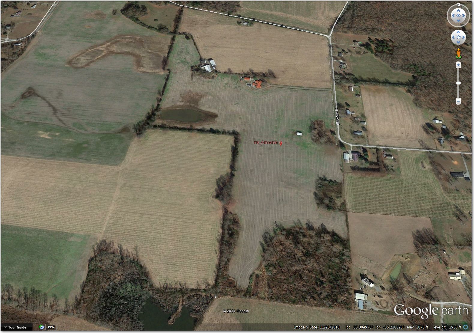
06 Amacher (35.3049, -86.2370): Doesn’t appear to exist anymore. I can see where an airstrip might have been at one time, but the field is clearly under cultivation as of November 2013
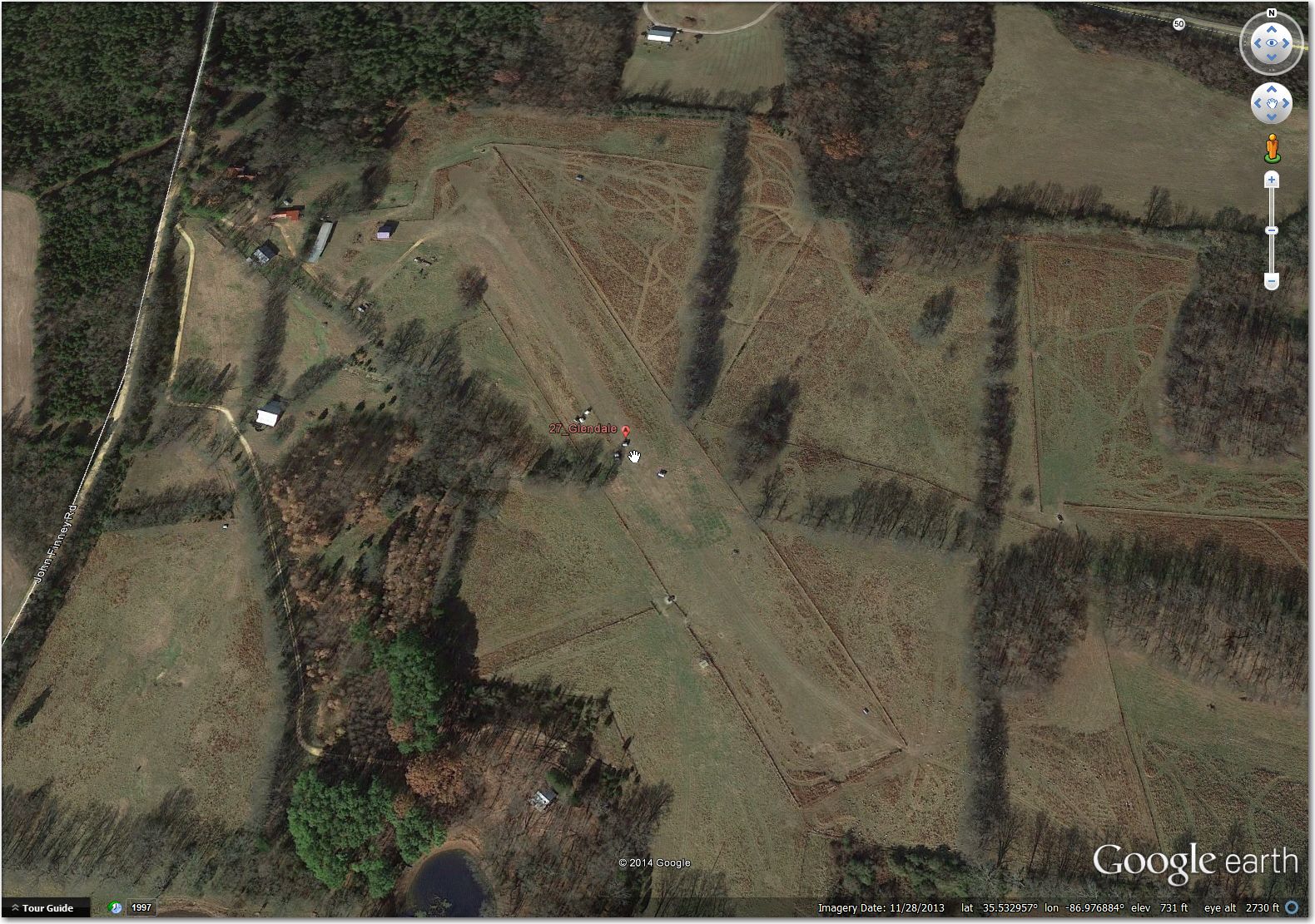
27 Glendale Airstrip (35.5330, -86.9769): This one has also clearly been abandoned in this November 2013 GE image. Note the structures (campers maybe?) arrayed artistically in the middle of the former airstip!
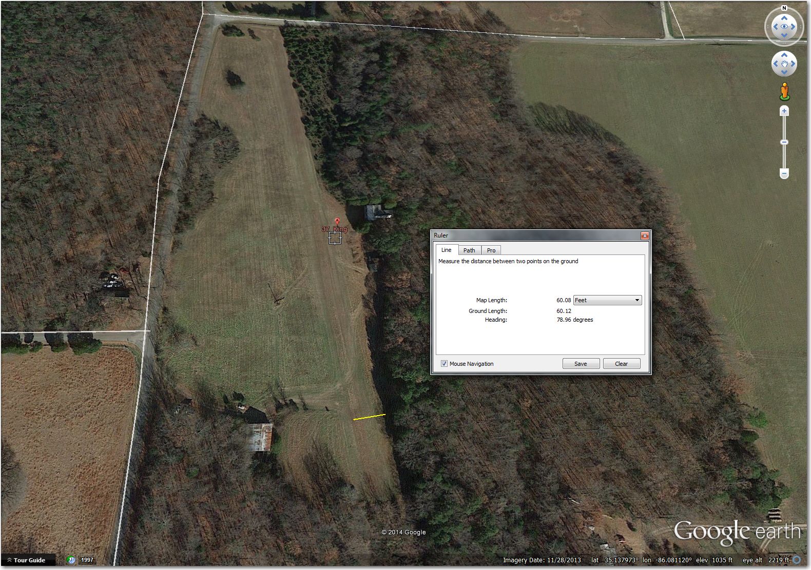
37 King Airstrip (35.1381, -86.0812): Probably OK for 15m, but a bit too narrow for my 18m wondership if the crops are high. Better off at Winchester, 3 miles NNE.

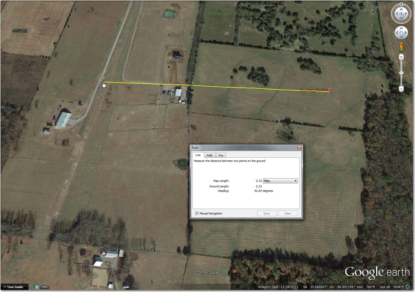
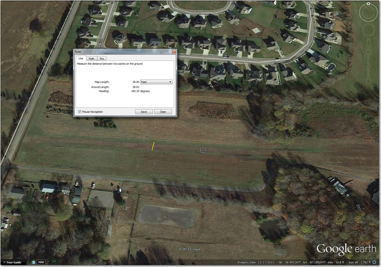
41 Long Meadow (35.6666, -86.4908): This airstrip has runway markers spaced about 63ft apart, and from the GE image it appears they might have some height to them. I think this is still OK for 18m, but you may have to do some maneuvering on rollout to deal with the markers. In addition, the waypoint symbol isn’t where it should be – rather it is displaced about 0.3 miles due east of the airport. Correct airstrip coordinates are (35.6666, -86.4908).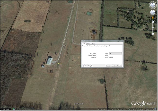
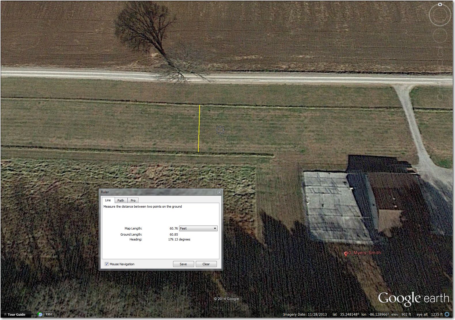
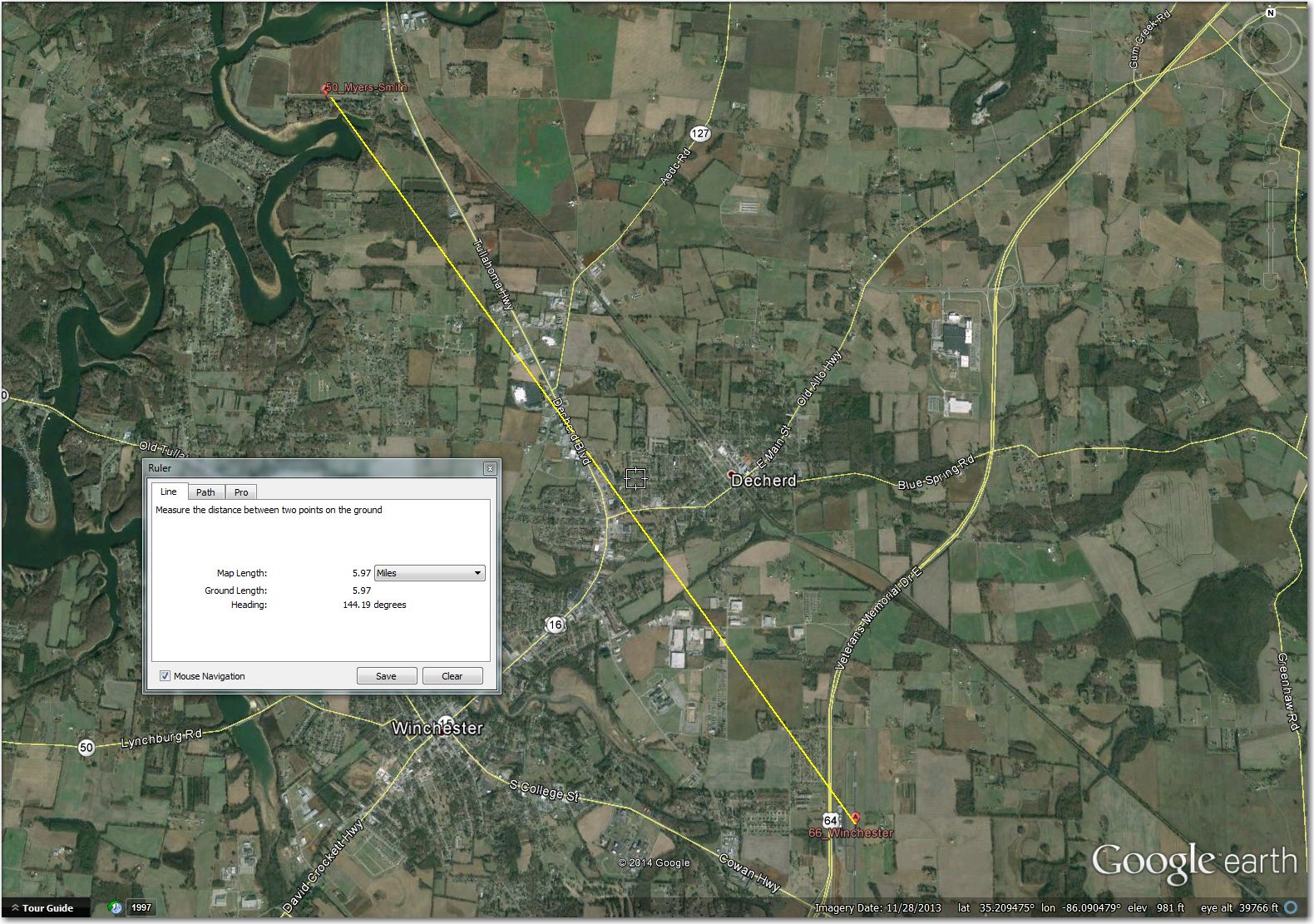
50 Myers-Smith (35.2481, -86.1287): A beautiful airstrip, but it appears to be bordered on both sides by hedges of some sort with some significant height (judging by the shadows). The hedge-to-hedge width is about 60ft, which ain’t gonna work with my 61ft glider, and would be tight even for a 15m ship (can you spell “ground loop on touchdown”?). This particular airstrip would benefit greatly from a physical visit to determine the makeup of the ‘hedges’, as it is possible (but sadly, not probable) that the ‘hedges’ aren’t really there or aren’t really a problem. Until then, this one will be deleted from my personal database, as I think I would be much better off at Winchester, 6 miles SE.
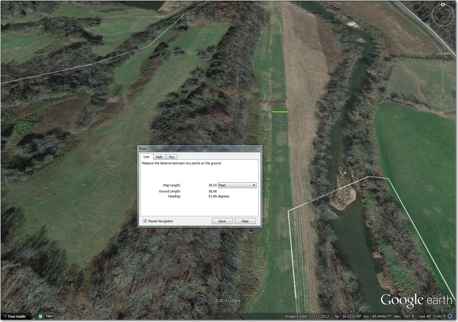
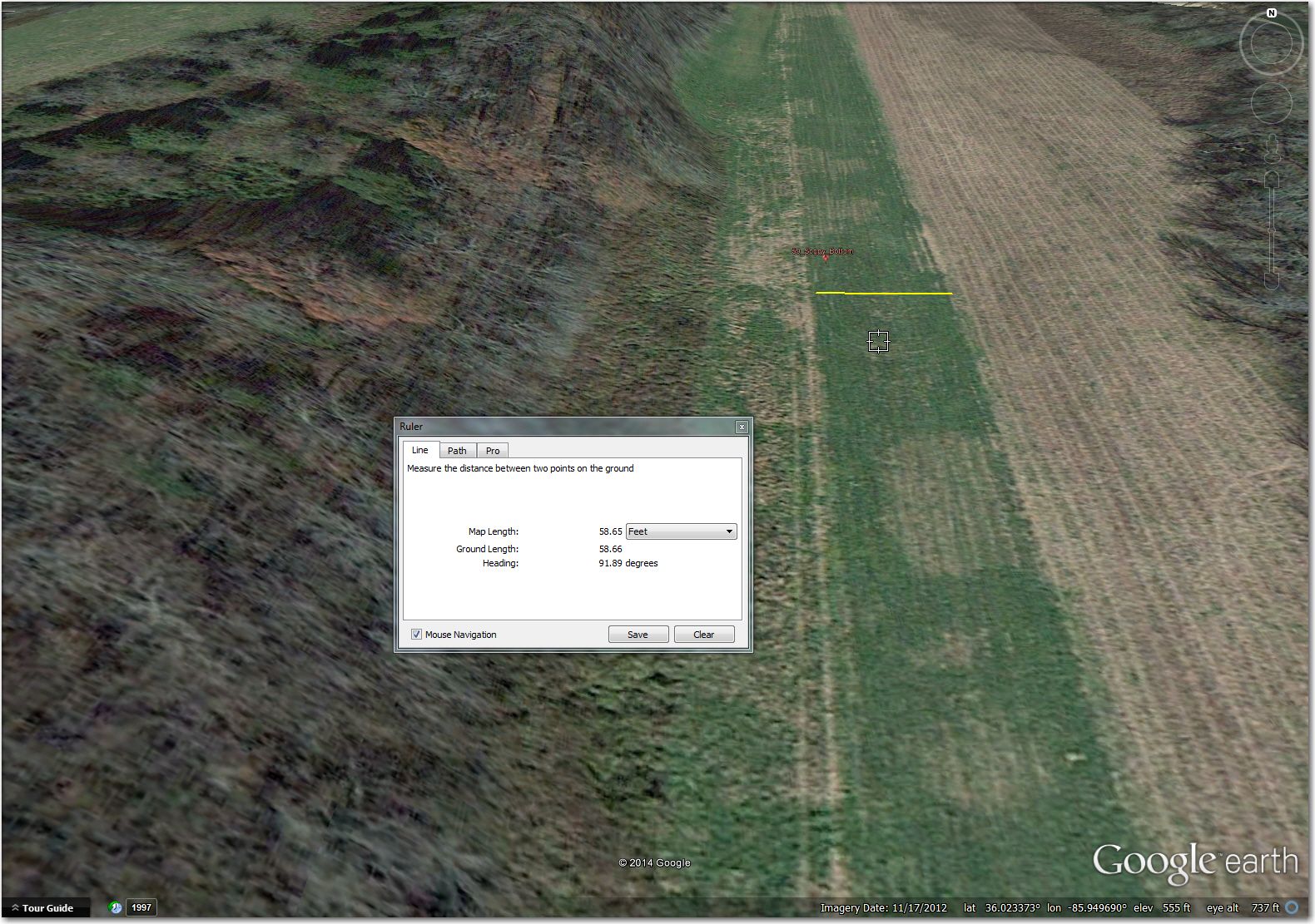
59 Soggy Bottom (36.0237, -85.9497): Another ‘problem child’. It’s not really wide enough for 18m, and pretty tight due to the steep slope on the west side. On the other hand, it may be that you could land off-center to the east side, and the downhill wing would simply pass over whatever crop is growing on that side (I did this once on a narrow hillside strip in the Harris Hill area, and it *did* work!). The other issue with this ‘problem child’ is that there really isn’t much else around; You may well be better off with a difficult landing on a potentially sideways-sloped runway than in any of the surrounding fields. 57 Smithville, 8 miles ESE is a nice, paved strip, but that 8 miles between the two is pretty unlandable. So, if you find yourself low at Soggy Bottom, you may not have enough altitude to risk running to Mitchell. I think I’m going to leave this one in my personal database, but change the coding to ‘TL’ (turnpoint, landable) vs ‘TA’ (turnpoint, airport). ‘L’ waypoints display on my ClearNav with a different symbol (square block vs airport icon) so it will hopefully clue me in to a potential problem.
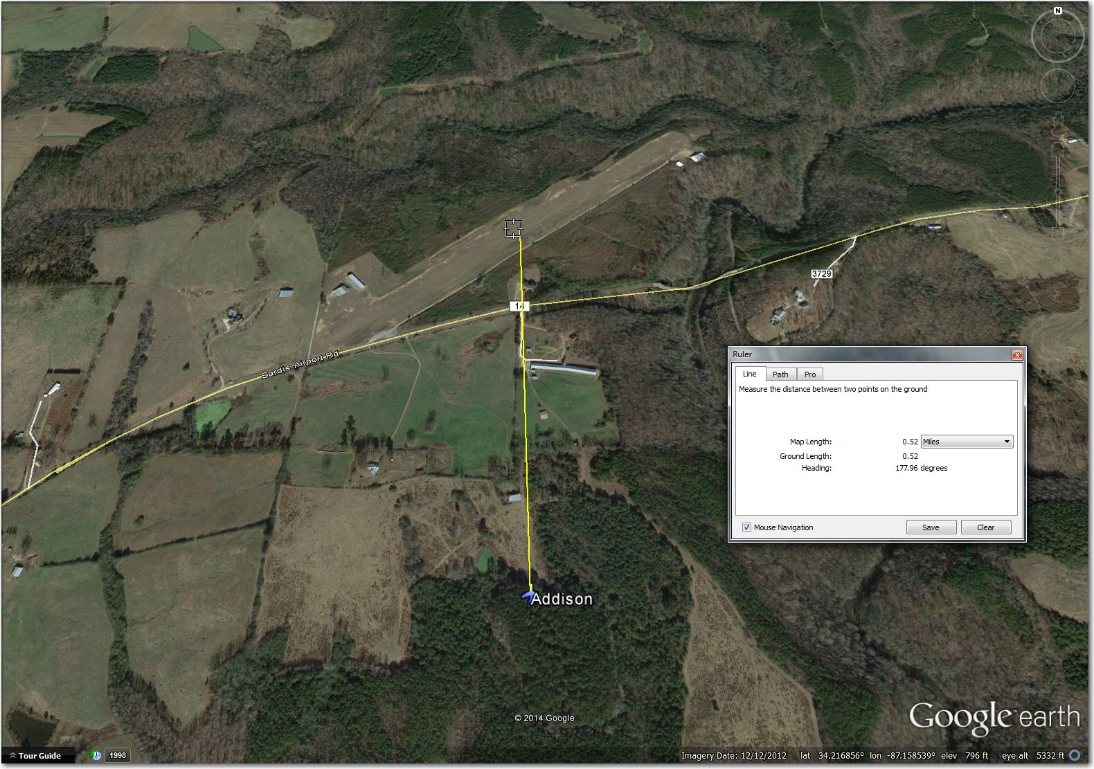
Addison Airstrip (34.2168, -87.1585): Nice strip, perfectly landable. The only thing wrong is that the waypoint symbol is about 0.5 miles off to the south. I suspect this is another FAA goof.
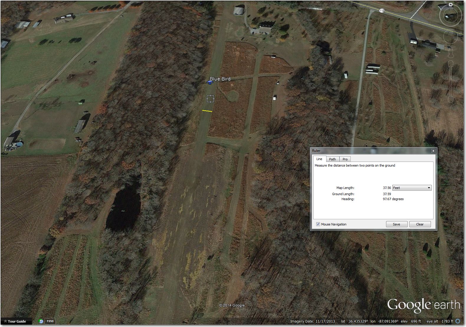
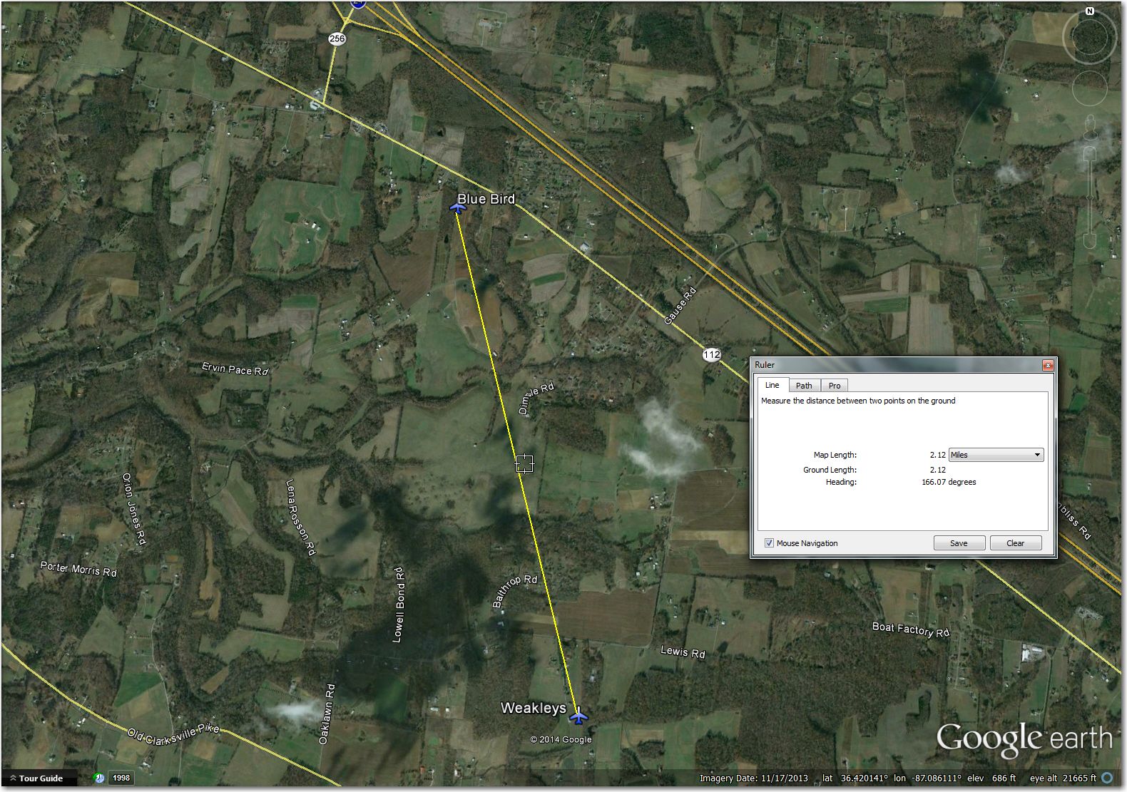
Blue Bird Airstrip (34.4357, -87.0914): Way too narrow for even a 15m ship, with what appears to be high brush on both sides. I suppose the brush could be low enough for a successful landing, but I’m not about to try it. Much better off at Weakley’s 3 miles south (although Weakley’s is not exactly O’hare either)
Carey Airstrip (36.0666, -86.1233): Waypoint symbol is about 0.7 miles to to the northeast. I suspect another FAA goof

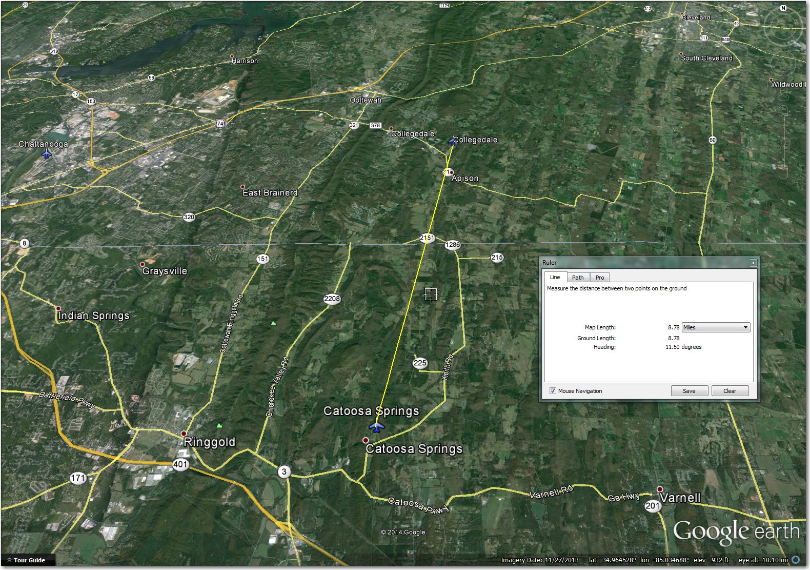
Catoosa Springs Airstrip (34.9184, -85.0524): This one is the poster girl for why I do these airport reviews. At 37ft wide and 990ft long, it is way too narrow and way too short for me. The best I have been able to do with my 18m ship is about 1000′ over a 50′ obstacle. I *might* be able to shoehorn my glider into this airstrip, but if I was that good, why would I be low here in the first place? ;-). Much better off at Collegedale, 9mi north

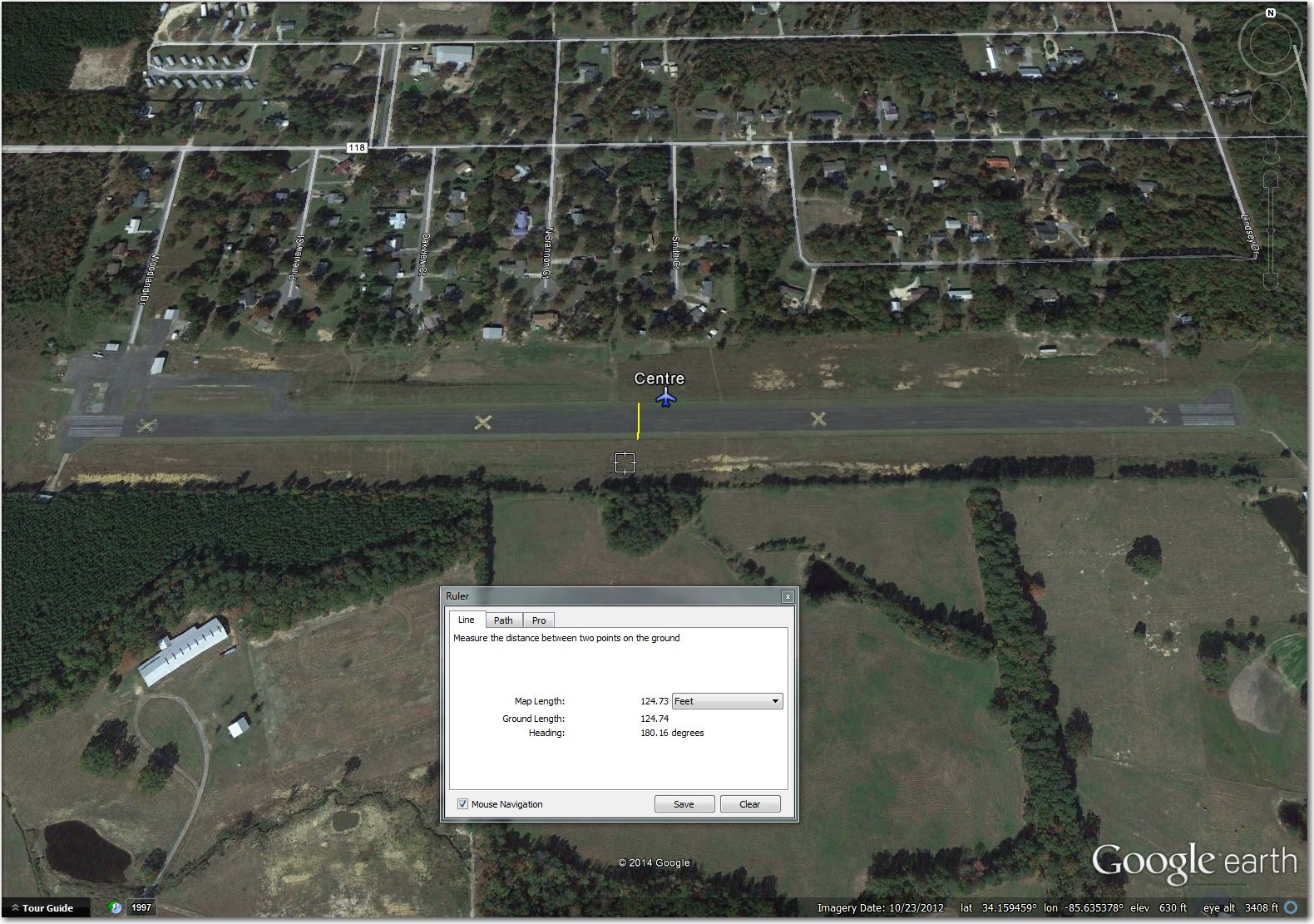
Centre Airstrip (34.1595, -85.6354): Nice looking paved strip, but the ‘X’s and the housing development in this October 2012 image are not a good sign, and things *never* get better with time for airports! Without some local knowledge input to the contrary, this one is right out. Better off at Centre-Piedmont 5mi south.

Cloudmont (34.5407, -85.5921): No problems with the strip itself, but the airport symbol is off about 0.5mi SE.

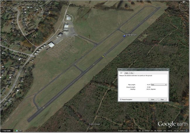
Cornelia Fort (36.1895, -86.7006): Good looking airport, but now completely inaccessible to contest traffic. This strip is only about 5mi north of Nashville International, and (as of May 2013) completely under the Nashville Class C cylinder and is permanently closed.
Ellis Airstrip (35.7803, -86.5854): This one is way too narrow for 18m, and very tight for 15m, and both runways are X’d out. Much better off at Gibson, 2mi SE.

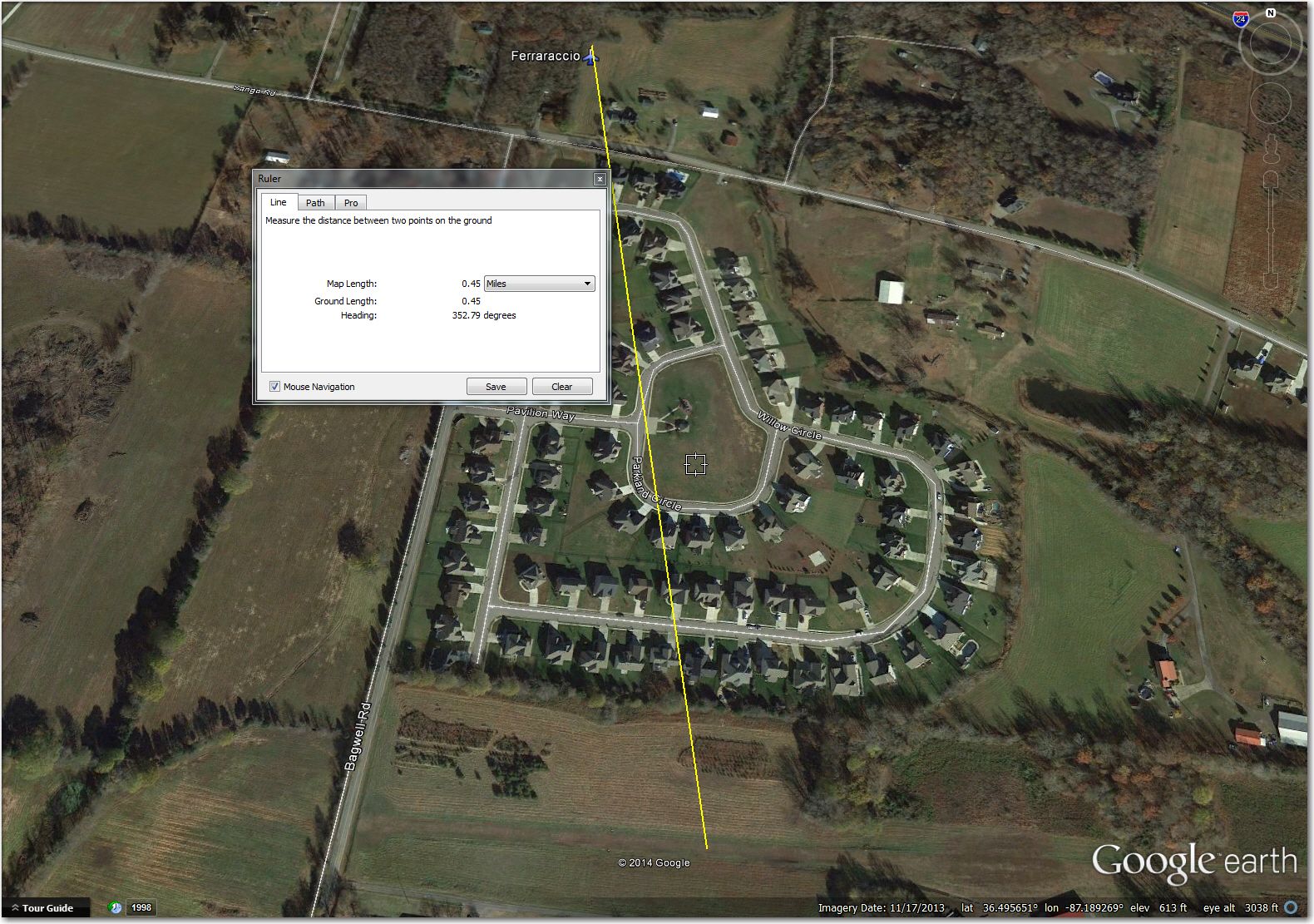
Ferraracio Airstrip (36.4932, -87.1892): Too narrow for even 15m ships, and the waypoint symbol is offset about 1/2mi to the north. Much better off at Weakleys, 9mi SE.

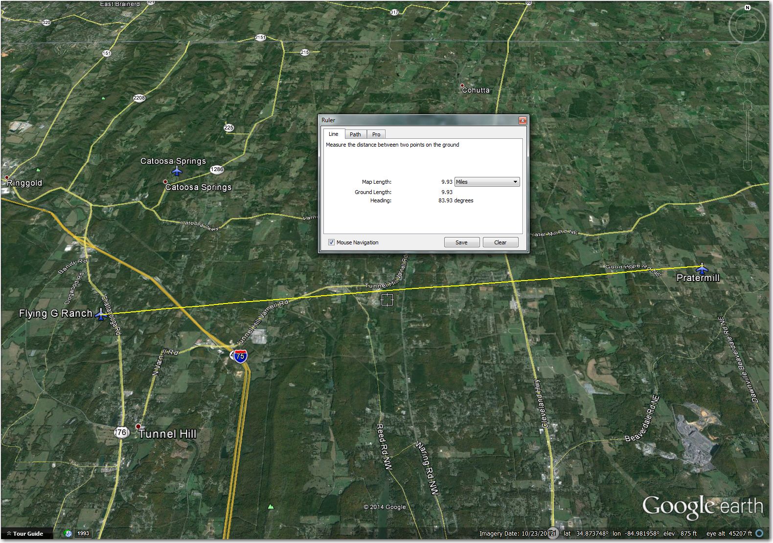
Flying G Ranch (34.8674, -85.0608): Too narrow for either 15m or 18m. Looks abandoned. Somewhat better off at Pratermill, 10mi east
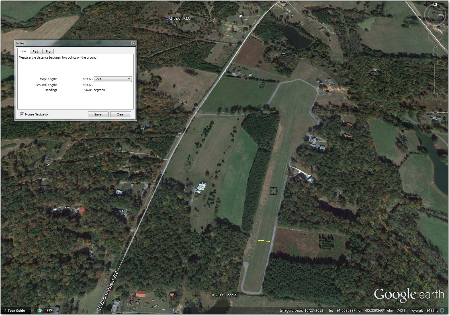
Gibson, GA Airstrip (34.6087, -85.3393): Perfectly usable airstrip, but the waypoint symbol is about 0.5mi NW of the actual airport

Headquarters (34,1057, -85.5657): Too narrow for 18m, may be too tight for 15m too. Much better off at Centre-Piedmont 3mi SW.

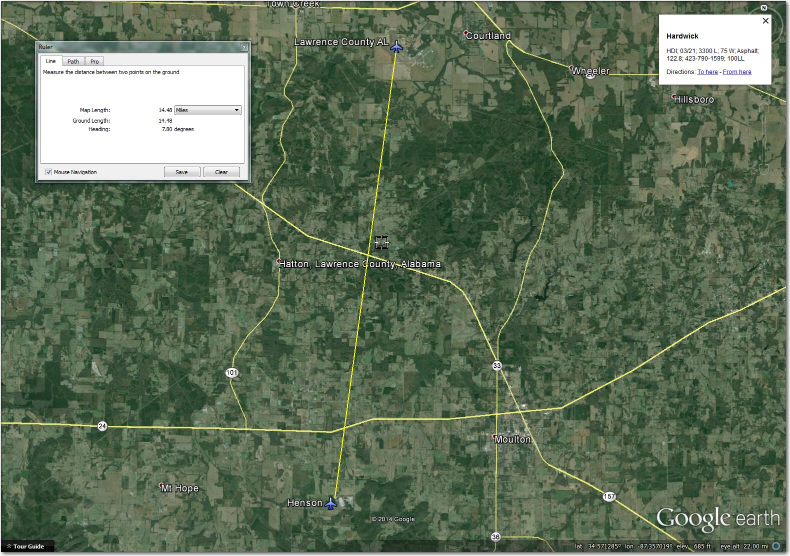
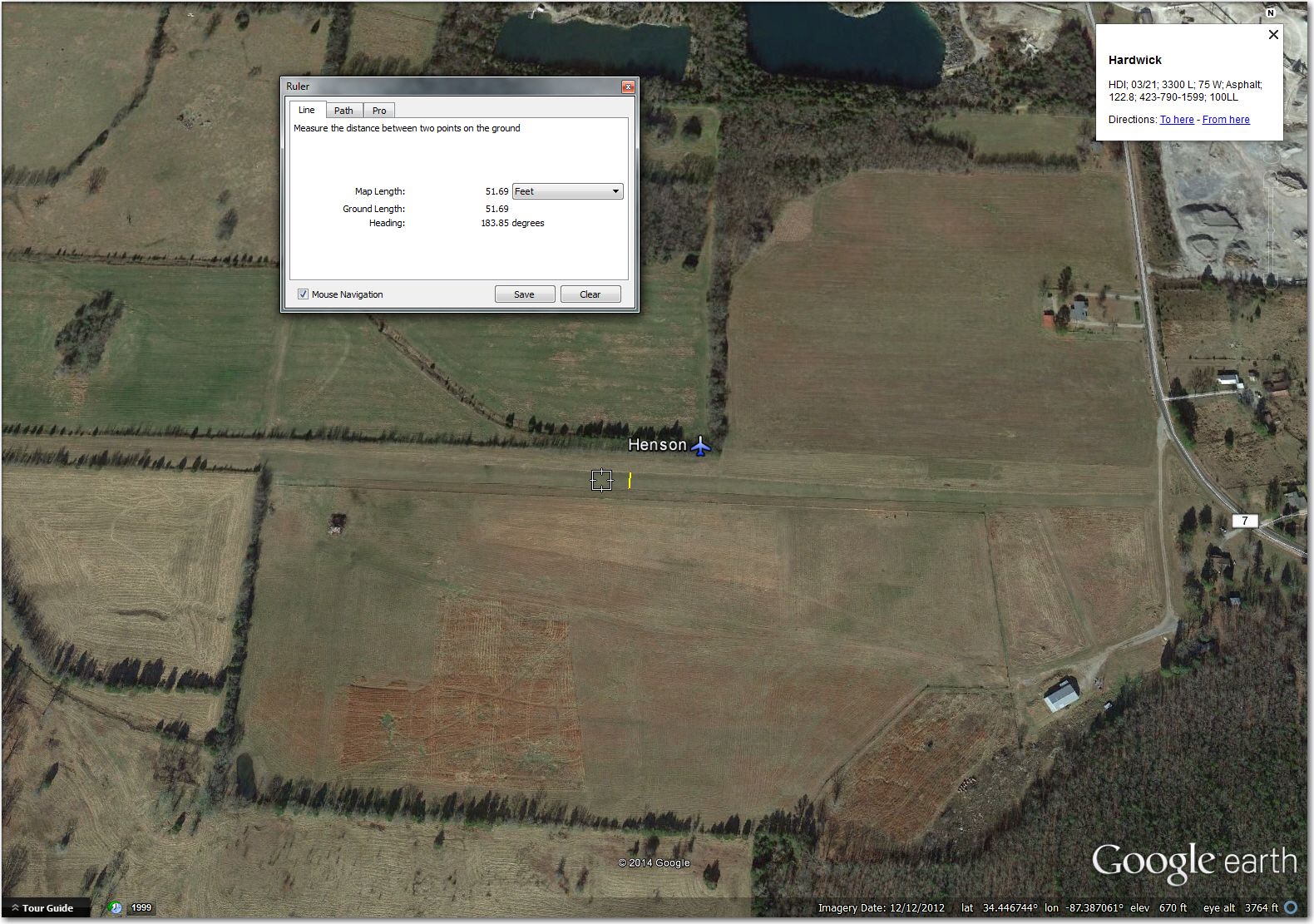
Henson Airstrip: (34.4467, -87.3870): Too narrow for 18m, tight but maybe do-able for 15m. Better off at Lawrence County 15mi north.
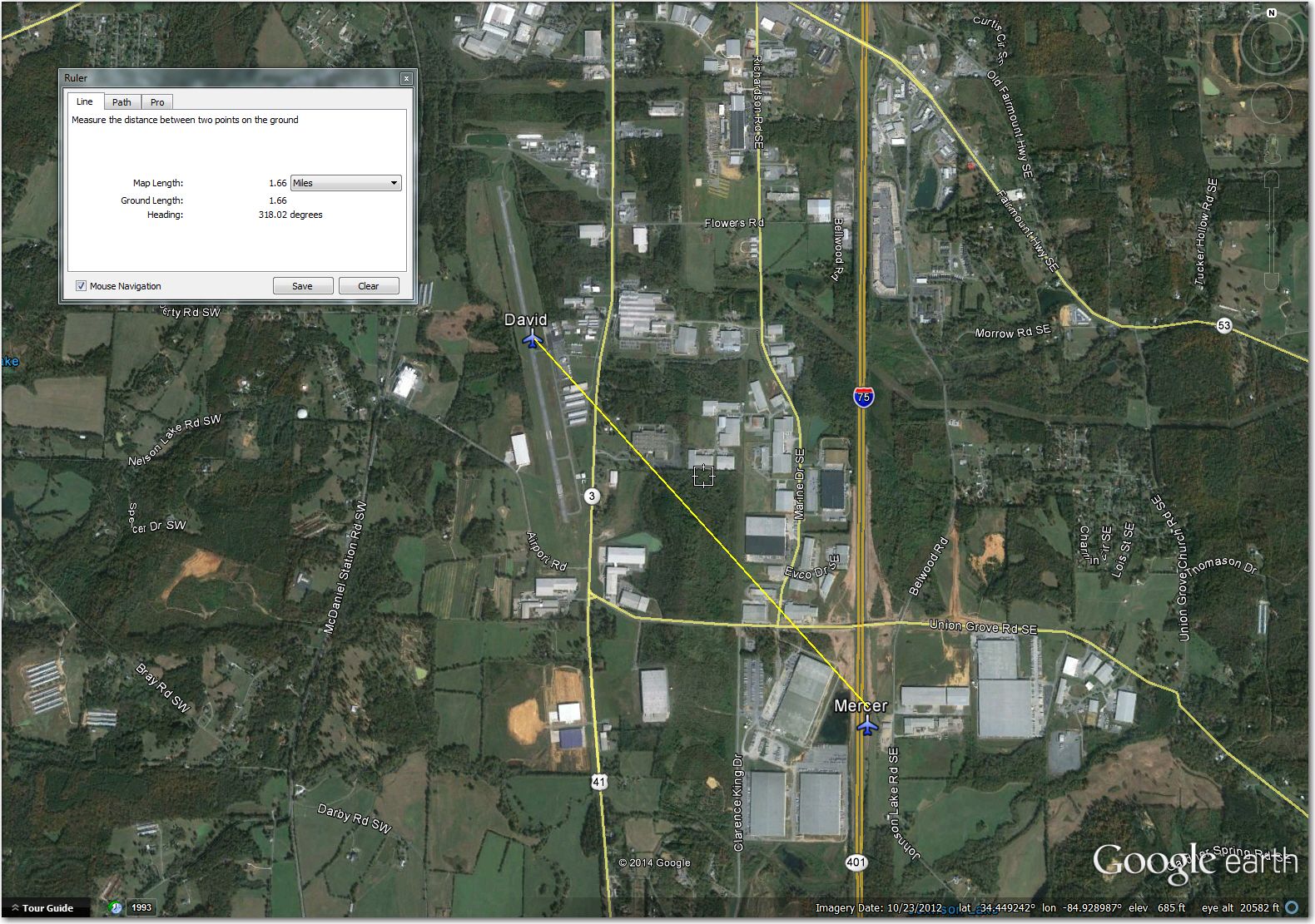
Mercer Airstrip (34.4371, -84.9193): Clearly abandoned, with hay bales visible in this October 2012 GE image. Much better off at David, just 2mi NW.
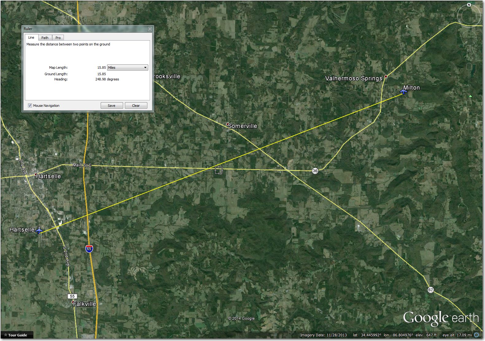
Milton Airstrip (34.4907, -86.6733): Too narrow for 18m, tight for 15m. Better off at Hartsell, 15m SW.
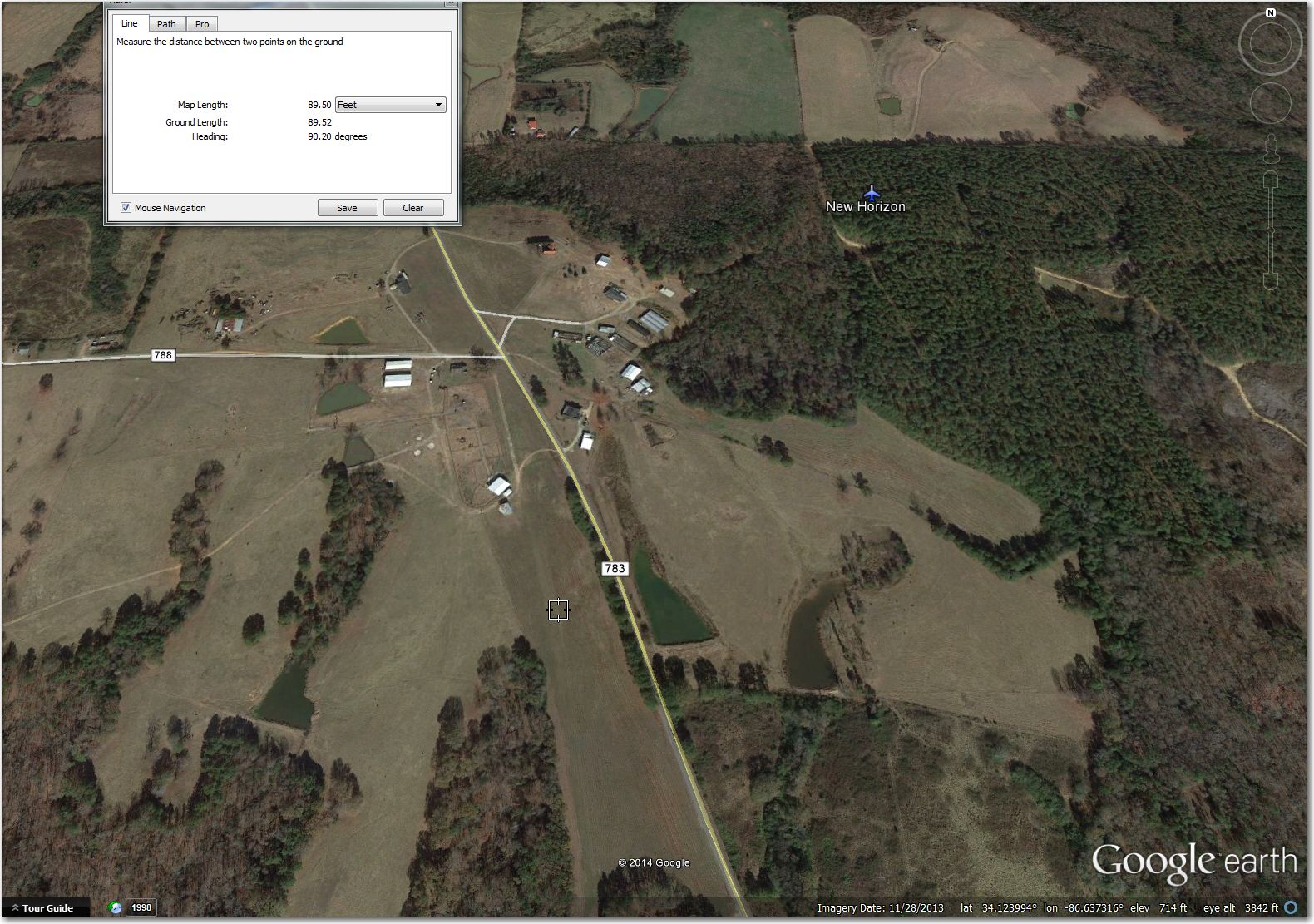
New Horizon Airstrip (34.1245, -86.6376): Nothing there anymore. There is something about 0.5mi SW of the airport symbol that looks like it might have been an airstrip at one time
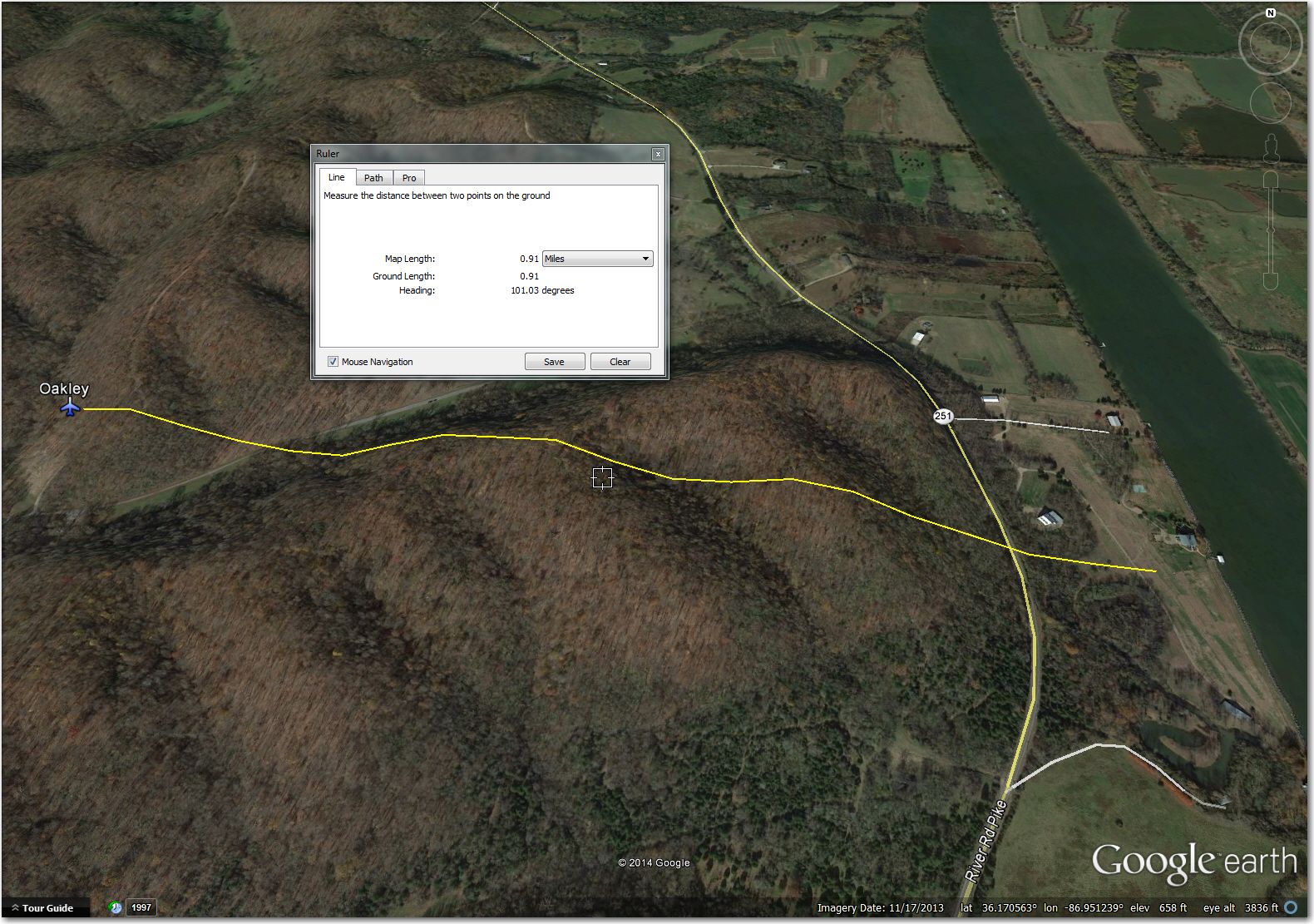
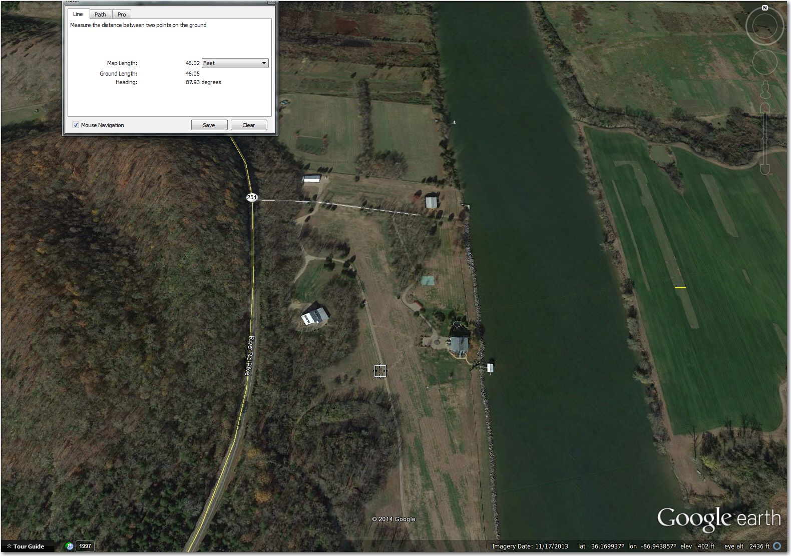
Oakley Airstrip (36.1700, -86.9437): Note the windsock (at the cursor location) and the two small helicopters captured in this November 2013 image. The waypoint symbol is offset almost a full mile to the NW.
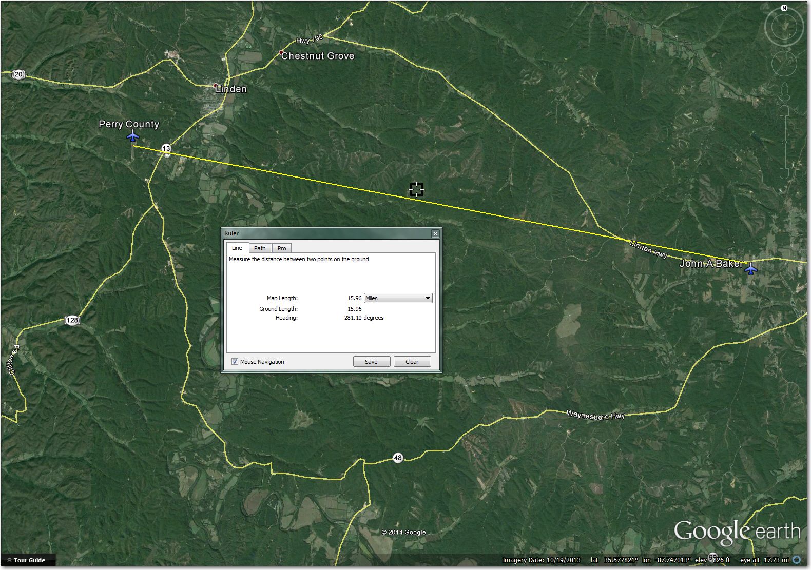
Perry County (35.5949, -87.8766): Great looking asphalt airstrip, with great big X’s on both ends – bummer. Better off at John Baker 16mi east.
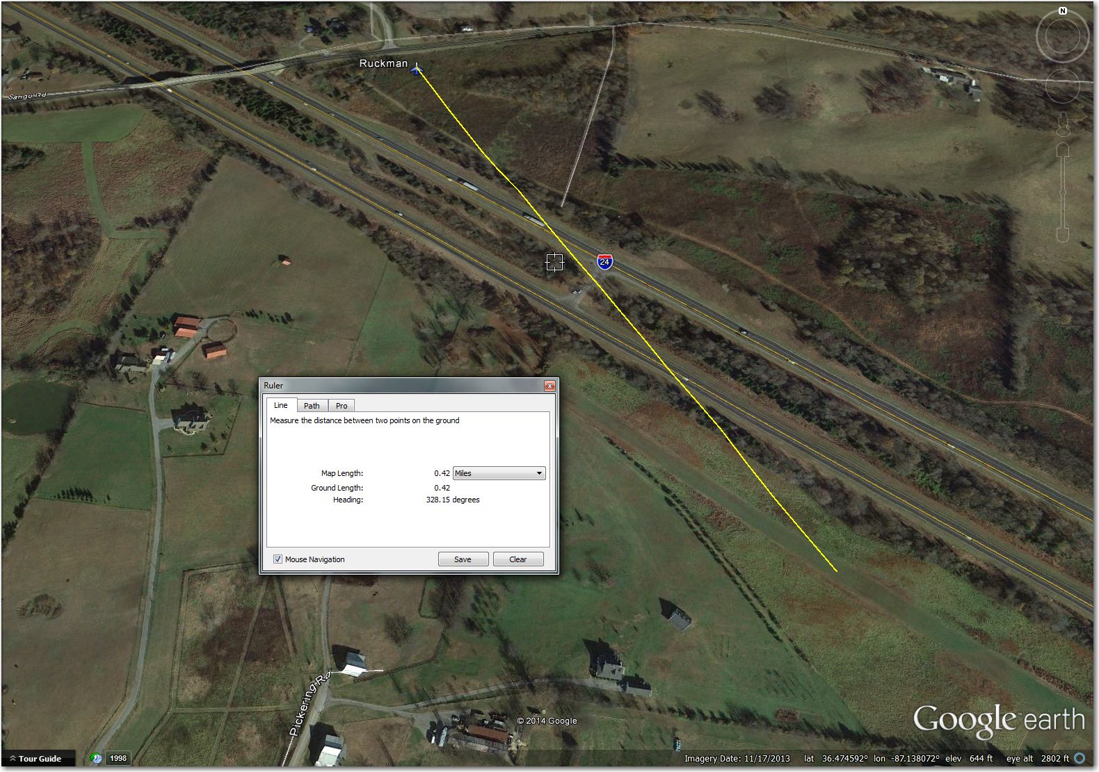
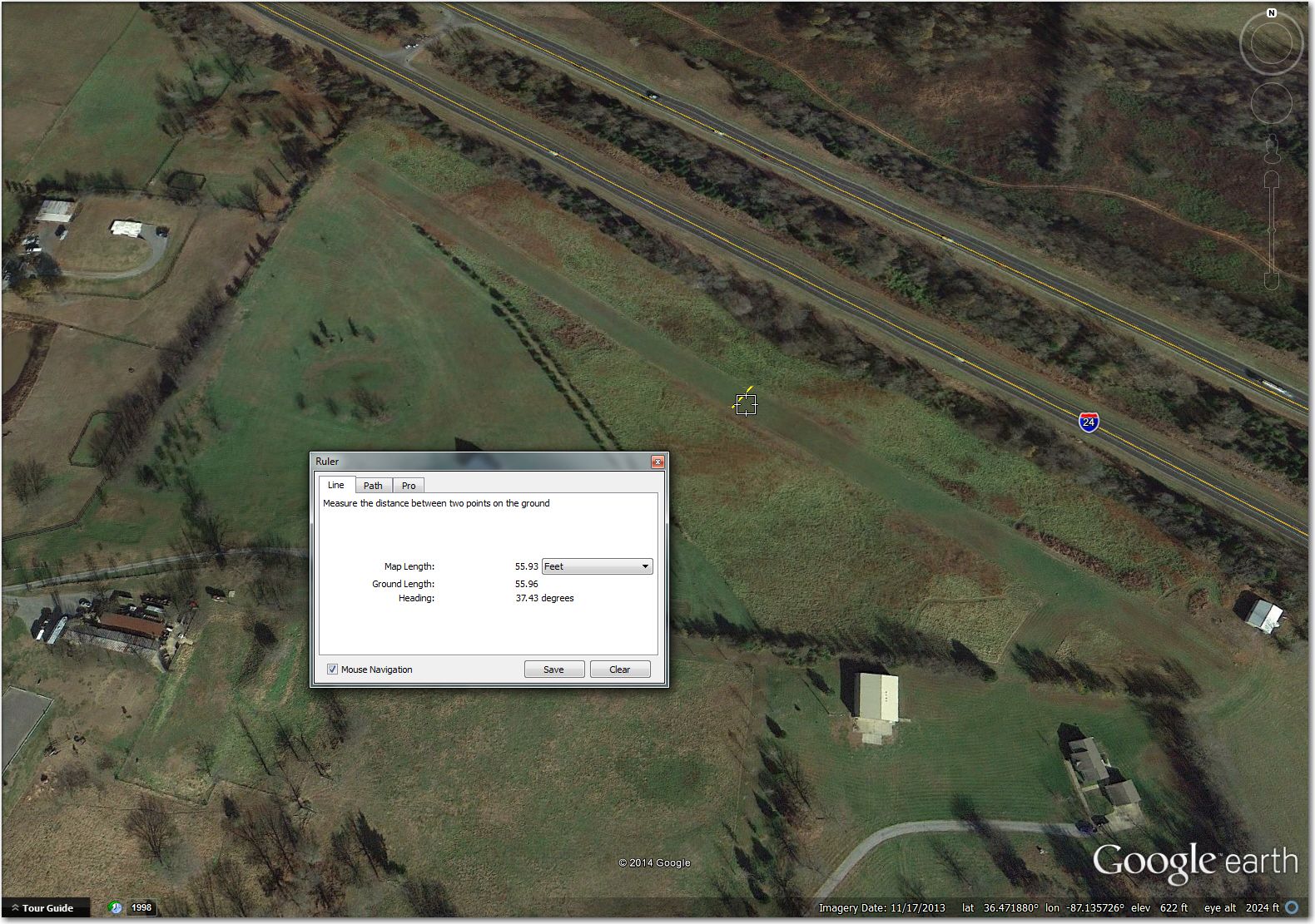
Ruckman Airstrip (36.4789, -87.1357): Too narrow for 18m and maybe too narrow for 15m. The runway itself is about 50′ wide, with brush of unknown height on both sides. In addition, the waypoint symbol is about 0.5mi NW.
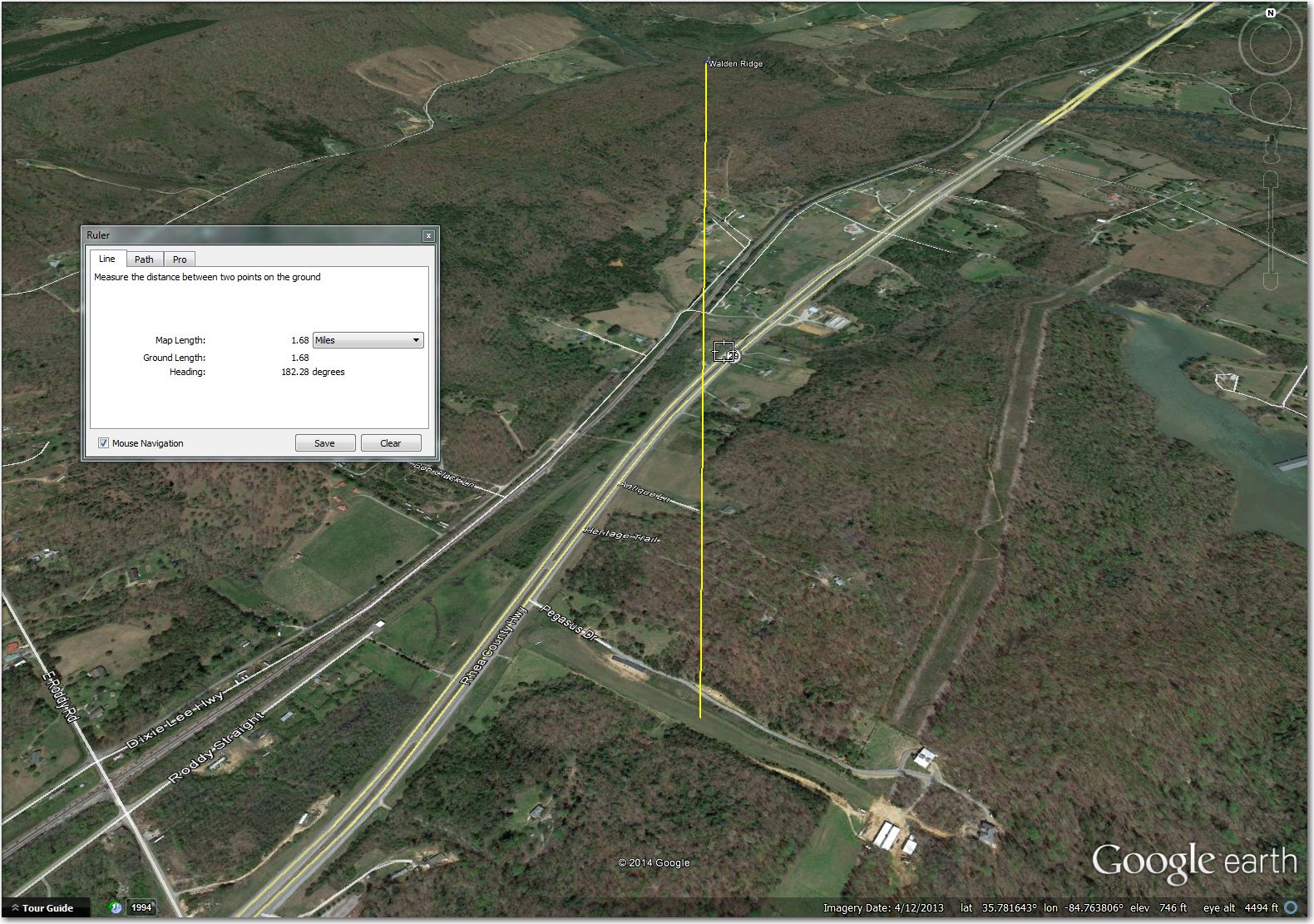
Walden Ridge Airstrip (35.7728, -84.7644): OK, but the waypoint symbol is more than a mile north of the actual airstrip.
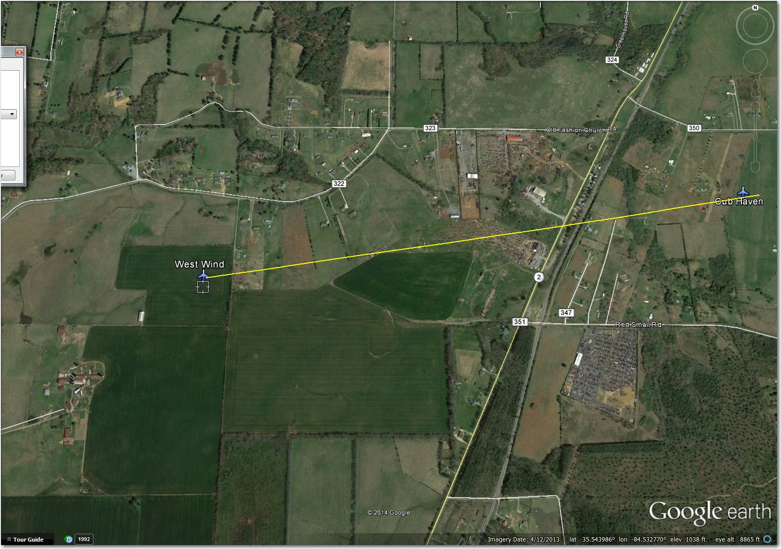
West Wind Airstrip(35.5445, -84.5326): Nothing there. Use Cub Haven just 1.4mi east.
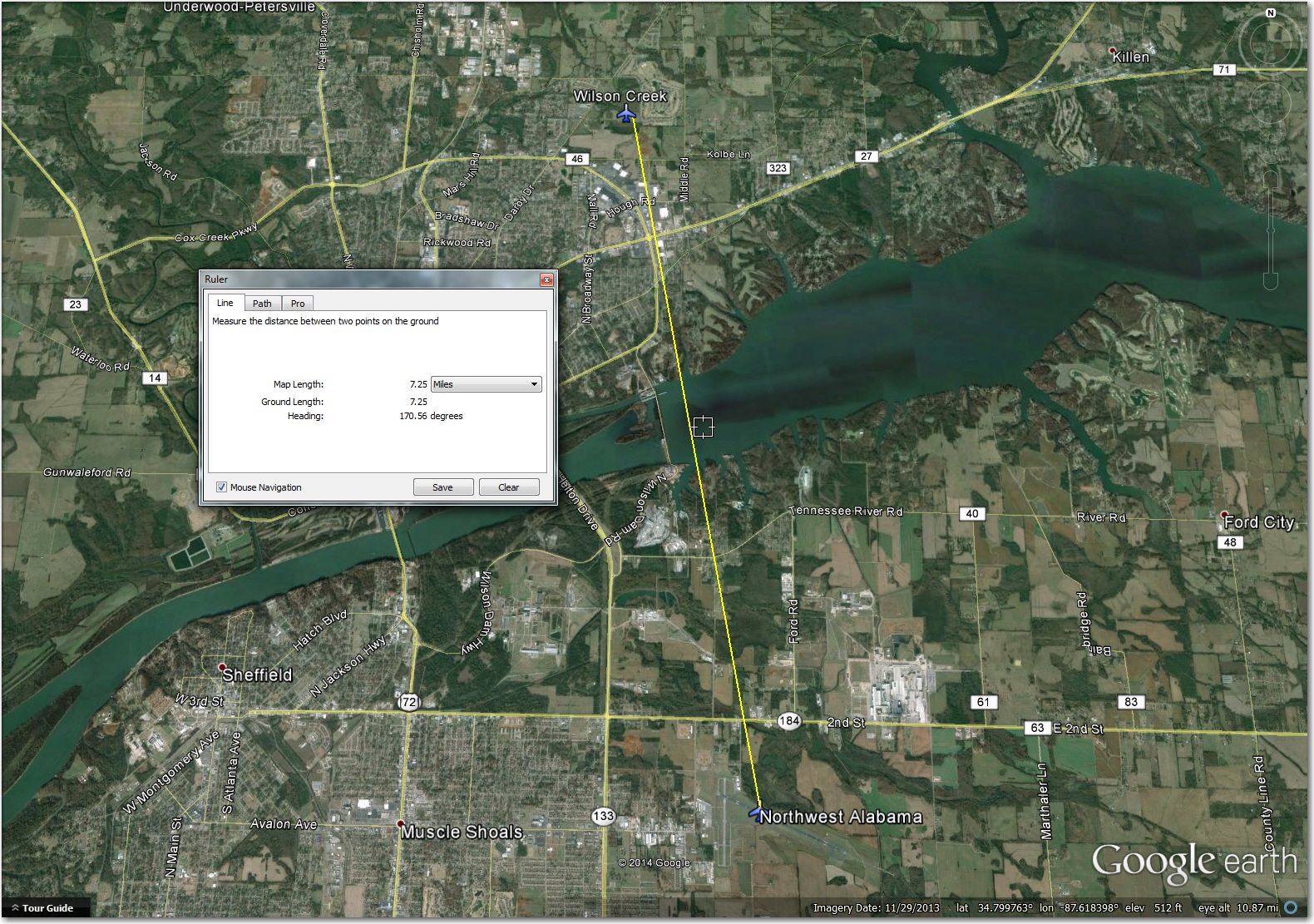
Wilson Creek Airstrip (34.8505, -87.6327): Way too narrow for 15m or 18m if crops are high. Better off at Northwest Alabama, 7mi south.
OK, that’s the lot. By my count, there are 150 waypoints in the Tullahoma waypoint database – ouch! Of those, 27 or about 18% have serious problems, so you have about a 1 in 6 chance of running to an issue, just on a random basis. Of the 27, 6 only require waypoint coordinate corrections, but the other 21 will be removed (or at least the ‘landable’ attribute will be removed) from my personal database.
As always, if anyone has first-hand knowledge of any of these waypoints that materially affects this analysis, please let me know. Email, phone, comments on this Soaring Cafe post – whatever.
Frank (TA)


1 comment for “Tullahoma, Tenn Contest Database Review”