In our last episode, we saw the melding of the Spartanburg and Perry airport/airstrip waypoints, the correction of old photo era turnpoint offsets, and other minor corrections. The result was a pretty complete and robust Perry waypoint database, which was then published in its various file formats as ‘Perry2014a’ on John Leibacher’s wonderful Worldwide Soaring Turnpoint Exchange (WSTX).
In this episode, we discover that all isn’t exactly perfect, resulting in the issue of a ‘Perry2014b’ just yesterday, and maybe even a ‘Perry2014c’ (and no, this is not an April Fool’s joke!). The cause of the Perry2014b release was the discovery that the HouseMovers airstrip (#25) magically regained its ‘Airport’ status, even though Al had wisely removed it from the list of landable sites due to its narrow runway and obstructions (tires along the runway, I am told) that make it unsuitable for even 15m gliders.
The reason I say there may well be a ‘Perry2014c’ edition is that I have also discovered that #26 Judge Will still retains its ‘L’ attribute, even though the airstrip has clearly been abandoned. I discovered this early in the process, but I got sidetracked by all the other problems with the Perry database, and forgot to include that change in the final information I sent off to John – oops!
OK, so now it is time to go through the entire Perry database again, but this time its for my own benefit as an 18m glider driver – the intent on this pass is to remove any airstrip that would be problematic for my new ride – a Ventus 2cx-18 (Sorry DB – no consideration being given here for 28m gliders – you guys don’t need airports anyways). From this review I will produce my own personal ‘Perry2014_minus’ for my ClearNav and SN10 units. Since most of the nav fomats used are in text form anyway (NDB for SN10, STX for ClearNav, and DAT for just about everything else), its easy to edit them in NotePad or in my favorite, TextPad.
Anyway, here we go. As usual, I look at every airstrip in the database using Google Earth (GE), but I only mention here the ones that I think would be problematic for an 18m ship and that I plan to edit out of my personal database.
Carolina Cow Country Airstrip (68 m NW) – WAY too narrow for 18m, and probably for 15m too. Much better off at Laurens Airport 4 mi SW. This strip should probably be removed completely from the database.
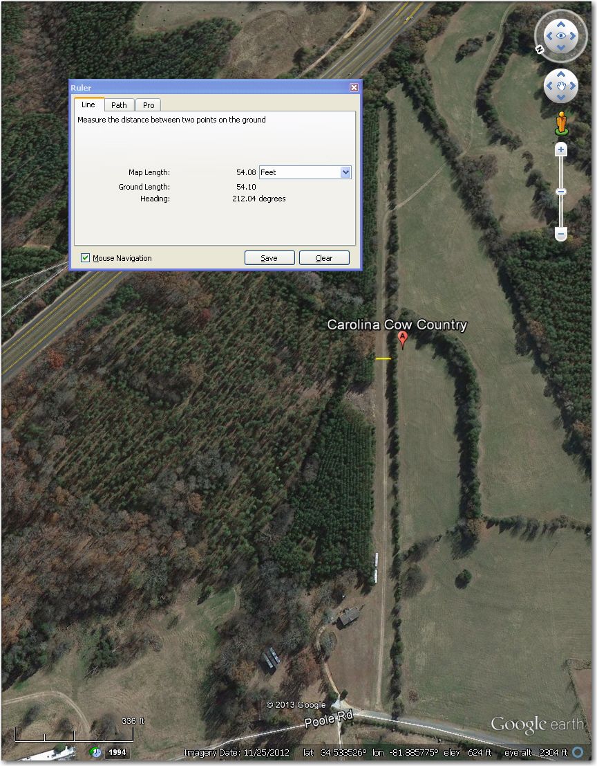
WAY too narrow for 18m, and probably for 15m too. Better off in a field.
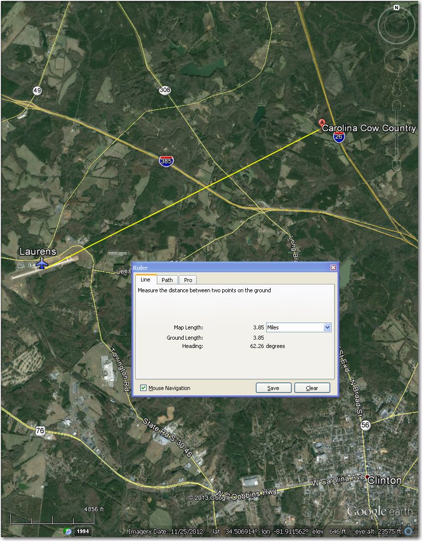
Laurens airport, 4 mi SW of Carolina Cow Country Airstrip.
Carpenter Airstrip (61 mi W) – looks abandoned and overgrown in this 3/2013 image. If you were desperate, you *might* be able to land in a relatively clear area in the middle of the strip (about 750′ available) – good luck! Much better off at Thompson-McDuffie Co Airport 8 mi west. This should probably be removed from the database.

Looks abandoned and overgrown in this 3/2013 image. Center 750′ or so *might* be landable.
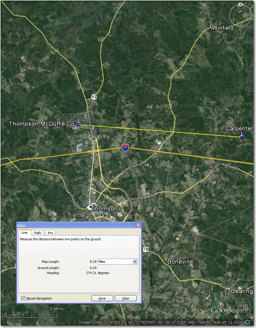
Thompson-McDuffie Airport 8 mi west of Carpenter airstrip.
Cox Airstrip (100 mi NW) – Too short (1,100′) with houses all around. Better off at Hartness 1.5 mi NNE.
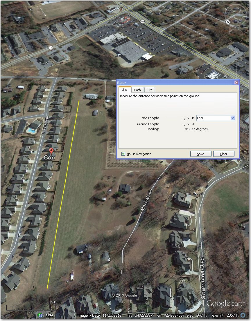
Way too short at 1,100′ with too many solid obstacles all around. Better off at Hartness 1.5 mi NNE
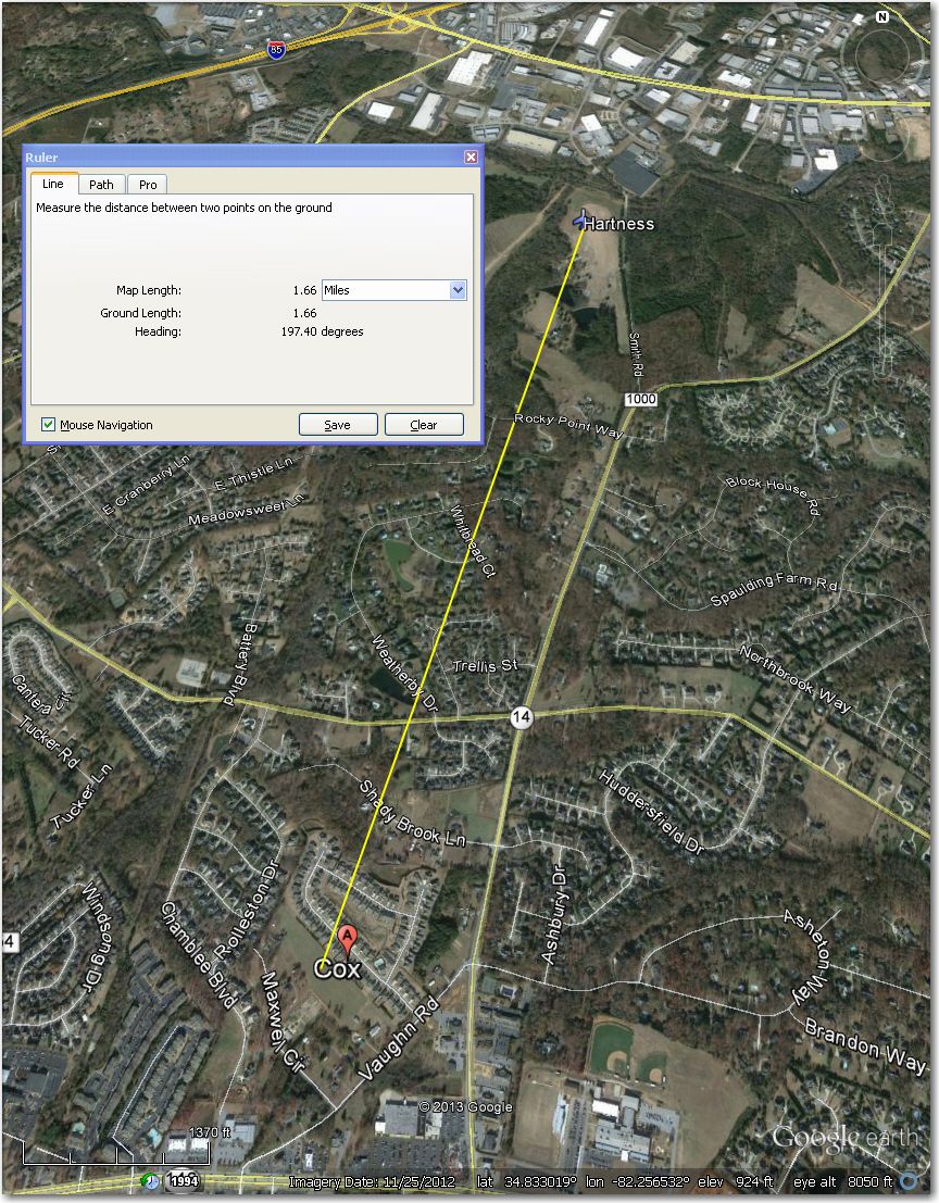
Hartness Airstrip – 1.5 mi NNE of Cox Airstrip
Darla’s Airstrip (94 mi SW) – Obviously abandoned and returned to crops (hay bales in field) in this 12/2009 image. This one should have been removed in Part II – rats!
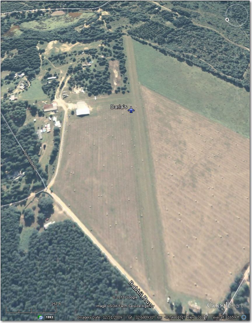
Clearly abandoned and returned to crops in this image.
Foxhunt Airstrip (41 mi NW) – Too narrow for 18m and probably for 15m too. Better off at Double Spring Airstrip 1.2 mi east. This should probably be removed from the database.
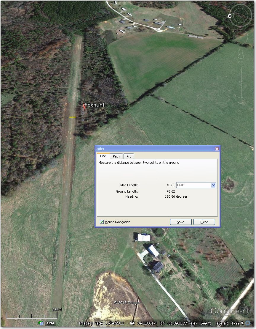
Too narrow for 18m and probably for 15 m too. Better off at Double Spring Airstrip 1.2 mi east
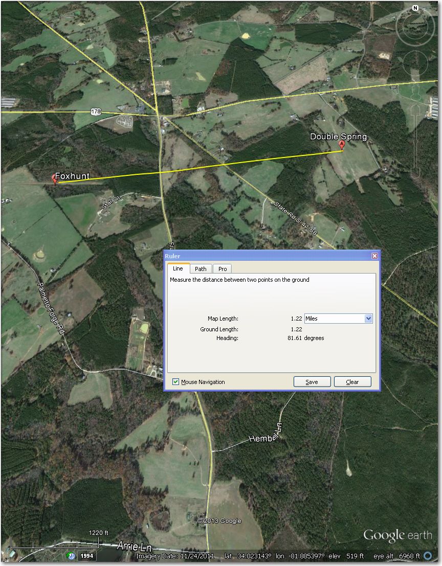
Double Spring Airstrip 1.2 mi east of Foxhunt
Hannah Rhea Airstrip (50 mi SE) – Looks abandoned and now a crop field in this 2012 image (missed the hay bales on my first pass!). Better off at Should be removed from the database.
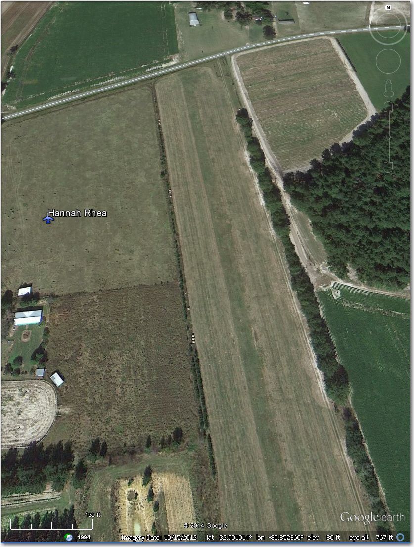
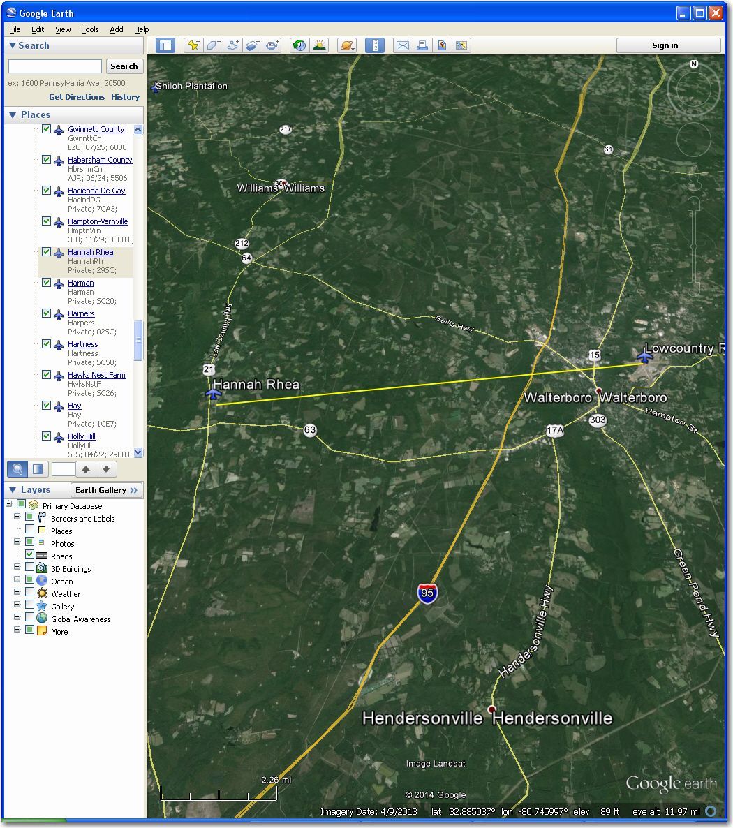
Looks abandoned (hay bales on field) in this 2012 image. Better off at Low Country Regional 12 mi east
Iva Airstrip (90 mi NW) – Looks like a high-wing only strip; the center strip is only about 45′ wide, with what looks like high bushes on both sides. Probably better off at Anderson 14 mi N or Hester Memorial 16 mi SSE. Should probably be removed from the database
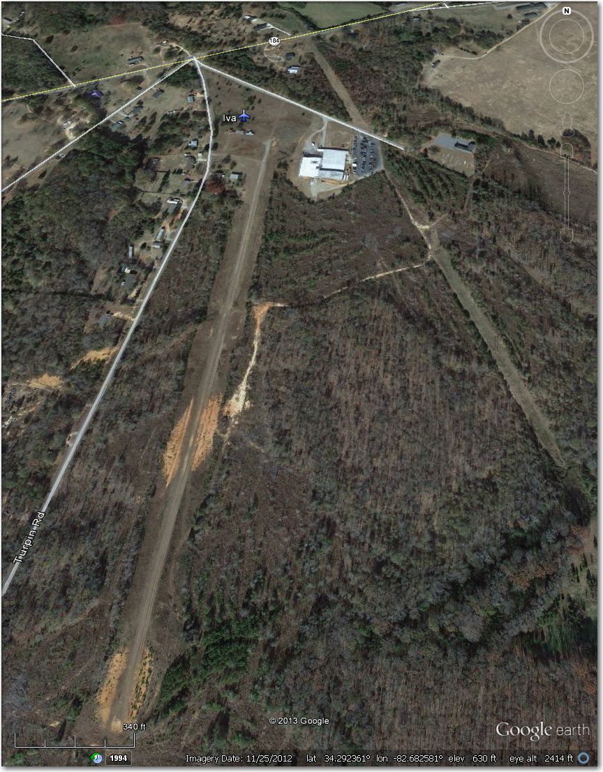
Looks like a high-wing only strip. The center cleared section is only about 45′ wide, with high bushes on both sides.
West Newberry Airstrip (50 mi NW) – Too narrow for 18m when the crops are high, and marginal for 15m. Better off at Newberry, 8 mi NE.
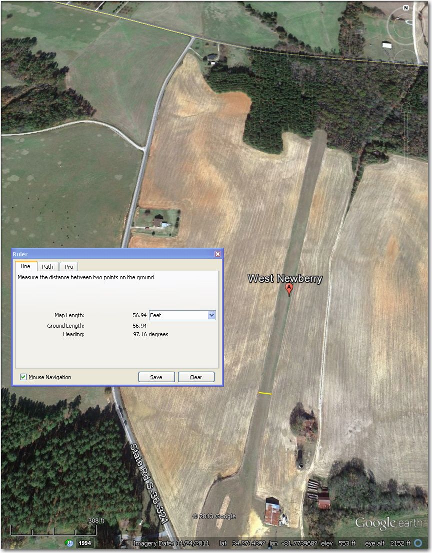
Too narrow for 18m when the crops are high, and marginal for 15m. Better off at Newberry, 8 mi NE
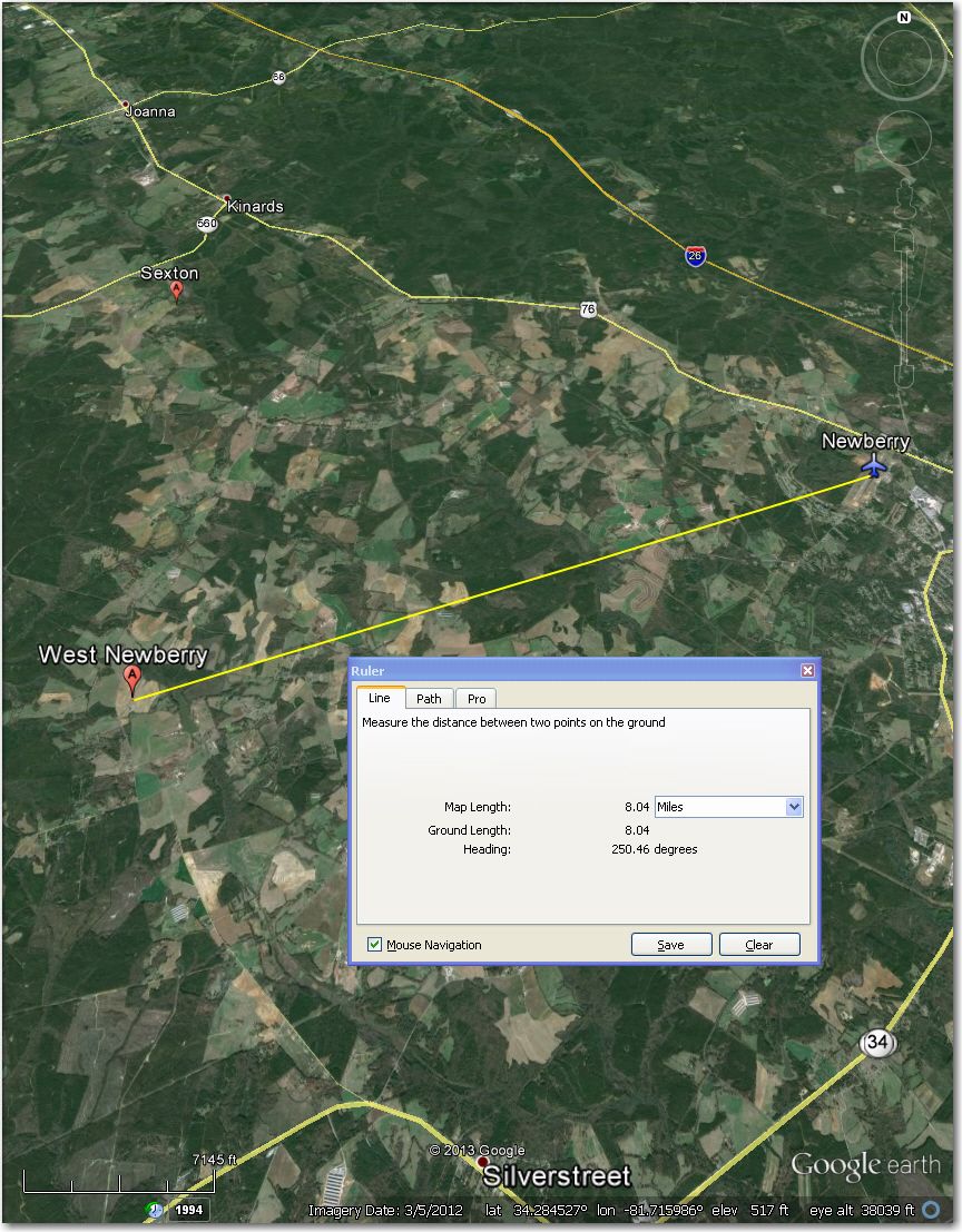
Newberry Airport, 8 mi NE of West Newberry Airstrip
So that’s it – we’re down to 8 ‘problematic’ airstrips in the Perry database. Of these 8, I plan to recommend that John Leibacher remove all but one from the database as being abandoned or too narrow for both 18m and 15m ships. The one exception is the West Newberry strip, which appears to be wide enough for 15m ships, but not 18. I’ll remove this one from my personal database, but it should probably stay in the ‘official’ one. With the above changes, the Perry waypoint database will be one of the very best around, with all but one airstrip suitable for 18m ships – nice!
IMPORTANT!!! All of this was done using Google Earth images, which can be several years out of date in places. In addition, airstrips pop into and out of existence with startling rapidity (e.g. Catos airstrip which was perfectly fine last year but is now a potato patch!). So, while it is generally true that an airstrip that looks too narrow or abandoned in a 2013 image will still be too narrow or abandoned in 2014, it isn’t a sure thing that an airstrip that looks OK in a 2013 image will still be OK when you arrive over it low. Never do a dead glide to an airport you haven’t at least looked at in Google Earth, and always arrive at least 1000′ above the airport to give yourself an opportunity to recover if the airstrip is now a trailer park!
Frank (TA)
4/2/2014 Post-script:
OK, John Leibacher already has ‘Perry2014c’ up on the WSTX, with the above changes included. John’s recent heroics have included working on this database numerous times in the last week or so, even though he was on vacation in Paris, France, and while travelling back from there via DFW. The last update was done while recovering from the effects of a 8-hour time zone change!


2 comments for “Perry (Wagener, SC) Airstrip Review, Part III”