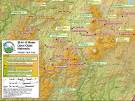
Cumulus popped around 10:50am CDT this morning on schedule (or slightly ahead) compared to yesterday. With a trigger temp of 90F we should see cloud thermals or cloud bases to 5500msl by noon. Pete Alexander “98”, who has been sniffing for us daily, will launch at 1150am. Today the big factor is a band of moisture and clouds on an east west line just to the north of Uvalde. It’s in a “deformation zone” or in the upper atmosphere and will help to develop Few to Scattered thunderstorms over the Hill Country beginning around 1-2pm. As a result, tasking will keep all classes to the south and west quadrants. The sea breeze front is not expected to reach too far inland and should not be a factor, but isolated thunderstorm cells will form along it also.
Besides basing the forecast on our analysis, the High Resolution Rapid Refresh (HRRR) model is confirming thunderstorm or convective development just to the north of Uvalde. Take a look at this gif animation of an echo top (in thousands feet) depicting the thunderstorm development from from 2pm to 7pm (hourly frames).
There is a chance of a gust front coming in from the north after 4-5pm at Uvalde as depicted by the HRRR model forecast. Note that this model is “not reality”… but just one possible solution. Nonetheless, tasking by John Good, the CD assistant, is expanding the f inish circle from 3km to 15km just in case the airport area is under the influence of a thunderstorm cell with brief gusts to 35KTs.
The radiometer profiler sounding confirms the increased moisture and the mid and high levels.
WGC Met Ops – Walt Rogers


