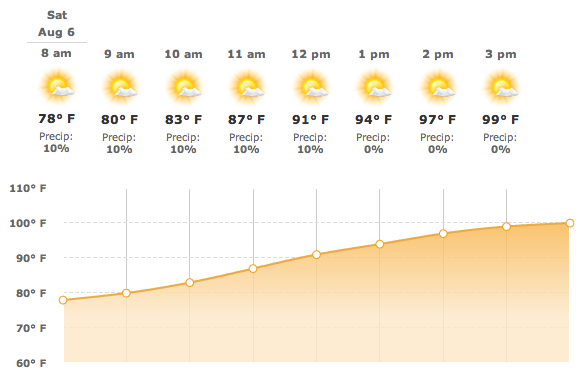
 Sunny and hot, with a high near 100. Southerly wind between 10 and 15 mph on the surface and easterly ~10 knots at cloudbase over most of the task area.
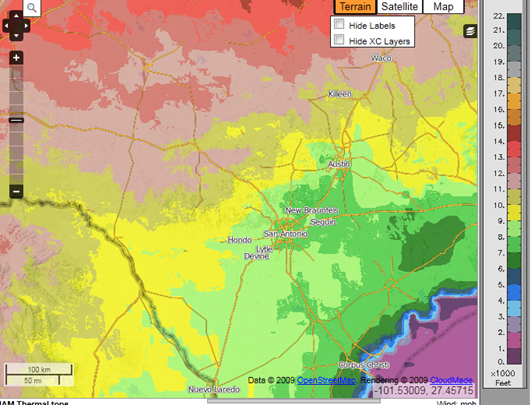
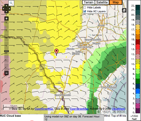
Expect clouds around Uvalde and to the north—8,000 ft bases rising to 9,000 ft later in the day and 10,000 ft and higher over the hill country. Similarly high bases should predominate in the southern part of the task area; however, there may be few to no clouds in a large swath extending from San Antonio SW through the middle of the task area south of Uvalde.
Dan Gudgel’s Official Morning Weather Briefing Presented at the Pilots’ Meeting
Hourly Forecast from www.weather.com
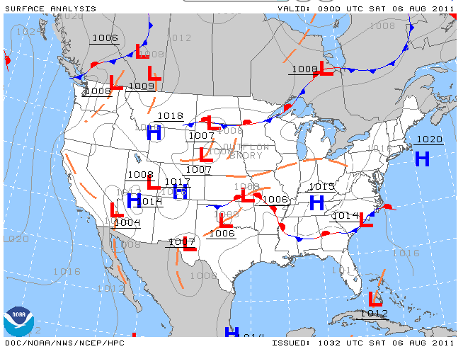
Surface Analysis Chart from www.aviationweather.gov/adds
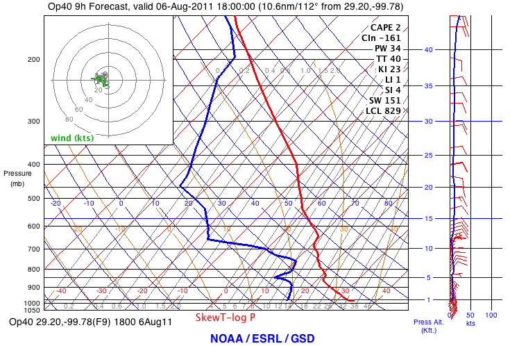
Skew-T from NOAA through XC-Skies
Thermal Tops XC Skies
Cloudbase from XC Skies
Dr. Alex Caldwell also provides a Uvalde RASP Forecast based on Dr. Jack’s data, but with 2.3 km spatial resolution.
Darryl Ramm has kindly created a simple iPhone RASP viewer that also works on the iPad and iPod Touch. Select ‘Uvalde, TX’ from the locations pull down menu. Thanks Darryl!
NATIONAL WEATHER SERVICE AUSTIN/SAN ANTONIO TX
628 AM CDT SAT AUG 6 2011

.DISCUSSION...
SEE AVIATION FOR THE 12Z TAF DISCUSSION.

.AVIATION...
THIS MORNING PATCHY STRATOCU HAS DEVELOPED GENERALLY EAST OF HIGHWAY
281 BRINGING INTERMITTENT MVFR CIGS TO KSAT AND KSSF. THE LOW CLOUDS
WILL MIX OUT WITH VFR CONDITIONS BY 14Z. HIGH BASED CU WILL FORM IN
THE AFTERNOON AOA 7K FT. THE 06Z NAM X-SECTIONS DEPICT STRONGER
SOUTHERLY FLOW BELOW 5K FT OVERNIGHT...SO MORE WIDESPREAD STRATUS
IS EXPECTED ALONG AND EAST OF HIGHWAY 281 WITH MVFR CIGS POSSIBLE
AT KSAT AND KSSF BY 10Z...KAUS BY 11Z. VFR CONDITIONS WILL PREVAIL
BY 14Z SUNDAY MORNING. SFC WINDS TODAY WILL BE SOUTHERLY AT 10 TO
15 KTS WITH GUSTS OF 20 KTS POSSIBLE FOR A FEW HOURS AFTER SUNSET.
