The OLC has established itself worldwide as a useful portal for displaying and analyzing cross-country flights. However, there is also criticism against the platform, especially in Germany. A group of ambitious developers has, therefore, started ‘Skylines“, a portal that comes pretty close to the OLC functionality and offers even more features.


Undoubtedly, the introduction of the OLC has given gliding an enormous boost worldwide, giving pilots the chance to compete and compare their performance. Its founder, Reiner Rose, had the right ideas at the right time, some 14 years ago.
But there are still some features a lot of pilots are missing, for example, being able to download more than ten files at once for research or to comment on flights. In addition, OLC’s organizational structure and how they are dealing with the pilots has been subject to criticism.
For all those who have been looking for an alternative to OLC, “Skylines“ seems to be the best so far. The main programmers of Skylines are no strangers to the gliding scene: Tobias Lohner, Tobias Bieniek and Max Kellermann have also contributed to XCSoar, one of the most sophisticated free glider computer programs for mobile devices running on Android and Windows Mobile. So it made sense to use the previously gained experience to create the new portal that is supposed to be a long-term alternative to OLC.
Max Kellermann makes no bones about his motives: “The platform is to be completely free, no download limits, compulsory logins and similar harassment. No ads, no censorship and suppression of critical opinions.” That means that all flights that have been uploaded to Skylines can be downloaded by any other user for personal or scientific evaluation. The latter was, for example, done by the Mountain Wave Project which led to the possibility to display popular wave entry points in Skylines.
In May, 2012 Skylines went online for the first time. Just one-and-a-half years later, it has become a remarkable platform, which is constantly being developed with the help of user feedback. By the end of 2013, the database contained more than 22,000 flights, which date back to 1993. 956 pilots are currently registered and have logged 81,000 flight hours and documented 5.3 million kilometers.
Contributing to this rapid success is the open source principle: The source code is publicly available at any time, allowing programmers to take part. Even without programming skills, pilots can help the development team by submitting error reports or suggestions for improvement or by just translating the website.
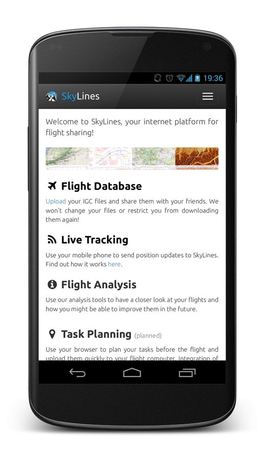
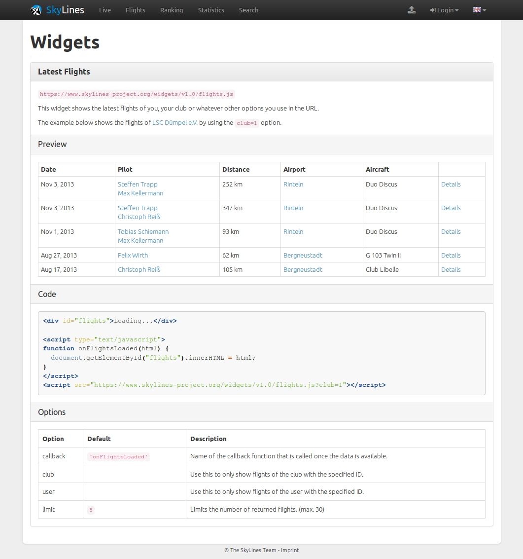
What started out as a pretty simple website to upload flights, calculating the distance flown and displaying the flight path on a map, has now become a complex matter. Still, creating a user account is simple, you just need your name, a password and an email address. Later, you can add your club to your profile – that’s about it.
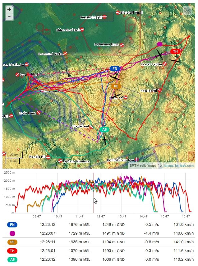
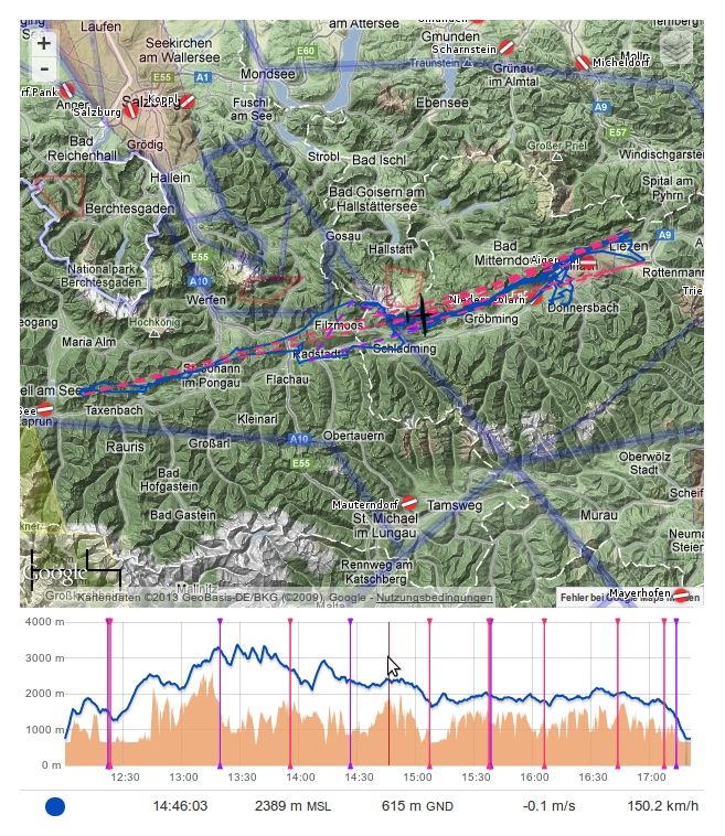
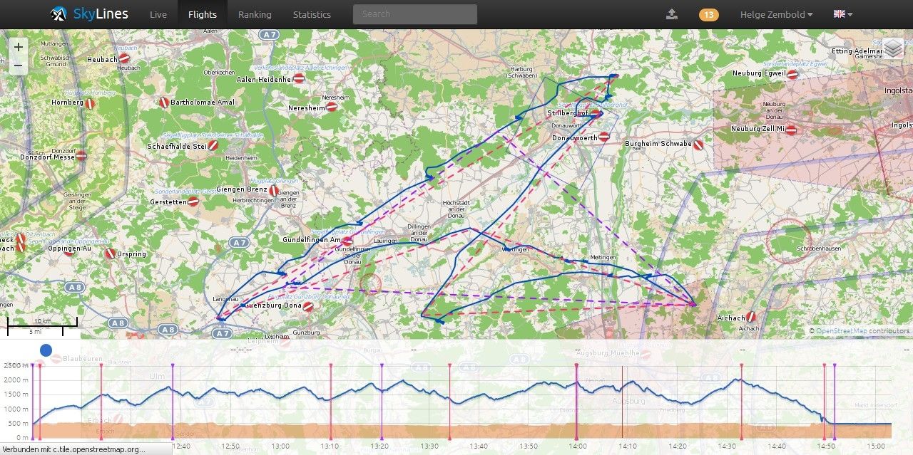
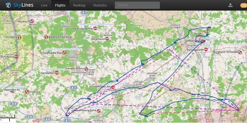
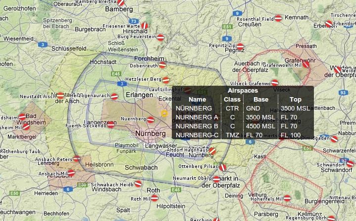
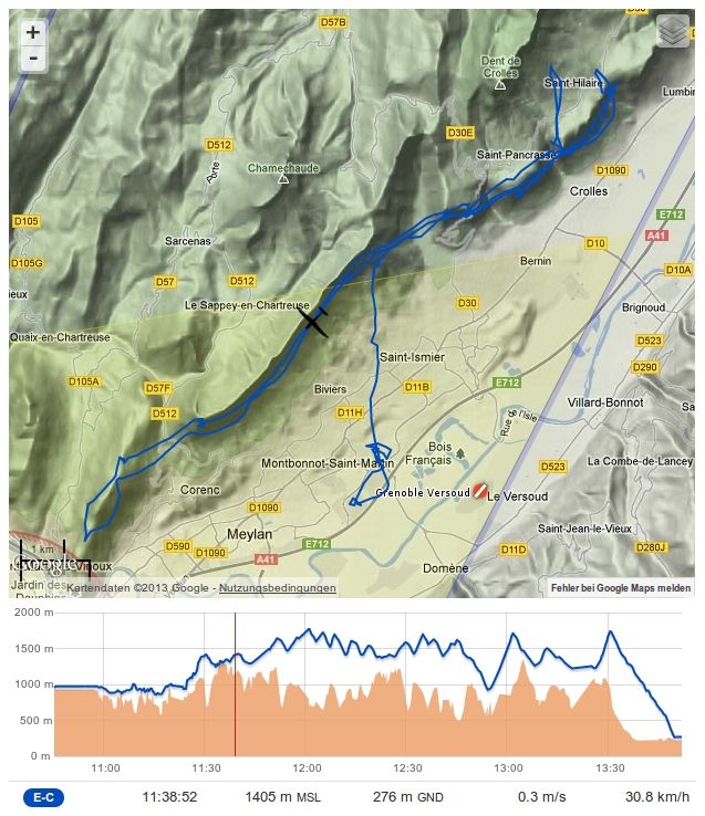
Uploading an IGC file is easy as well; just choose one or more files from your hard disk or smartphone and they are online seconds later. Skylines can even analyse ZIP files containing several IGC files. Distance, points, takeoff and landing times are calculated and duplicates detected automatically. Looking at a flight, you can, of course, view the flight path and choose between different zoomable map backgrounds, like a normal street map with airspace structure or a shaded relief map. In addition, the barogram is displayed and the flight can be followed at any point with the mouse pointer. Also listed is the usual basic flight data: pilot name, aircraft type and characteristics, takeoff and landing time, and mileage as well as straight and triangle flight. Scoring is done according to the OLC Plus rules.
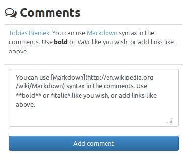
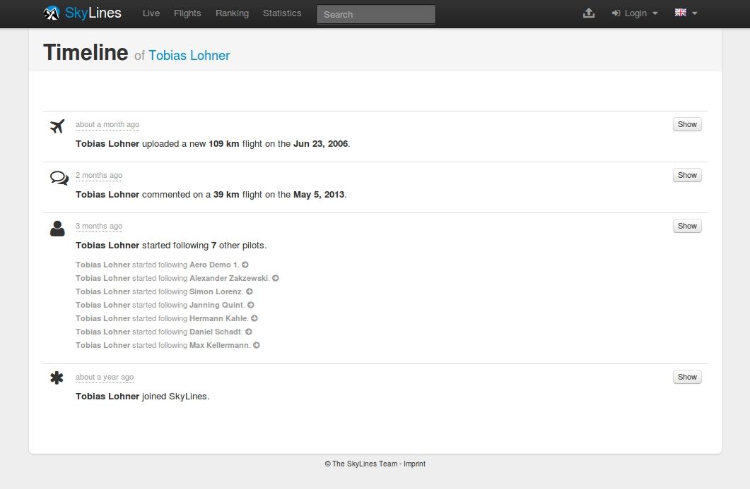
By clicking on “statistics,” circling and cruising performance is evaluated. The “comment” function not only allows the uploading pilots to make remarks about the flight; any other user can also post inquiries or start discussions about the flight. When clicking on a particular point of your route, you can load nearby flights to find out who you met enroute, provided that the other flight has also been uploaded to Skylines. One can also view several flights simultaneously by “pinning” them in the daily ranking.
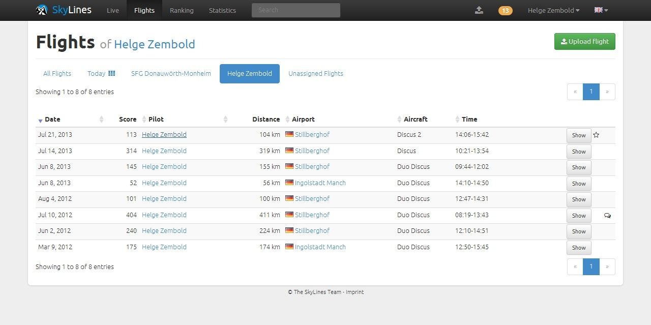
The personal statistics not only show the flights, hours and flown distance in the past twelve months, but also give an overview of certain achievements, such as the 500 kilometer flight. In addition, all previous start airfields are marked on a map. Rankings can be generated for airfields, clubs and pilots.
An interesting functionality is live tracking, which works with XCSoar, Gaggle and all LiveTrack24 clients. Using a personal tracking code generated by Skylines and entered into XCSoar, the position data, speed and altitude can be transferred via the data network to the website; observers on the ground can then track the flight. Moreover, other XCSoar users can have these flights displayed on their portable device in flight, just like FLARM targets!
Another feature of Skylines has recently been improved: now the co-pilot can also be assigned to any two-seater flight. Other things are still desirable, such as a ranking based on classes, specific gliders or other criteria. But there are also some interesting features coming up in 2014: Competitions may be organized using the Skylines tools, flight planning will be possible using the “Prosoar” feature and thermal maps will be integrated. Further features and ideas are presented on the developer’s blog.


4 comments for “Skylines: Flight Documentation and Analysis for Everyone”