99 Soaring Fans, This is Bravo Zulu I am reporting from Chilhowee Glider Port, home of Chilhowee Soaring Association, http://chilhowee.com/ Like others, I too doubted that the weather would hold good enough for a contest this past weekend, but I arrived Friday afternoon to prepare for the Region V contest and planned to stay over for…
Tag Archive for Condor
Day 8
by Bill Elliott •
At the conclusion of Day 7 I had gotten through the Terragen Topo Map video (http://www.vimeo.com/8584046) that showed how to render a particular Terragen terrain (.TER) file into a bitmap (.BMP) file. This was pretty cool and I felt real proud of myself until I realized that this procedure would have to be repeated for…
Day 7
by Bill Elliott •
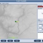
For the last couple of days, I’ve been busy keeping myself glued to the Hawk Tracking SPOT map, watching the Uvalde WGC unfold. Man is that addictive – just can’t stop watching the races, pulling for my teams (U.S. plus Canada plus Baud Litt plus Wiktor Kozlik). Also, I have been avoiding the Scenery Adventure…
Day 6
by Bill Elliott •
I have been stymied for a day or so now at Geoff’s ‘Terragen Topo Map’ video tutorial (video #9), and have been waiting anxiously for some help from the Condor Scenery forum folks. Last night I got a post from ‘Cadfael’, one of the original scenery designers, with a pointer to an earlier tutorial he…
Day 5
by Bill Elliott •
I’m actually starting this post on the same day as day 4, but who’s going to know? ;-). At the end of Day 4, I was able to fly around in my new (but very bland) scenery. Now, as the video instructor says, comes the hard part. The first step apparently is to export the…
Day 4
by Bill Elliott •
Well it has been a few days since I last played with the CCSC scenery project. I have been involved in supporting the SPOT tracking map for the Uvalde WGC, did some real-life soaring at CCSC, and even did some real honest-to-gosh paying work! Now, however, it’s back to Condor-land for more scenery design adventures.…
Day 3
by Bill Elliott •
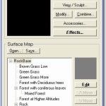
After Day 2 I had gone through file conversion to .TRN files (whatever the heck that is -I think maybe Terragon?). So now I’m off to see the wizard again for the next step (video tutorial #5), which appears to be opening the .TRN files in the Landscape editor. Following the video tutorial, I launched…
Day 2
by Bill Elliott •

Yesterday I was able to get the basic SRTM data displayed and converted to UTM data format. This morning I have been viewing more of the ‘3dem setup’ (second of a series) video tutorial, and reading the Scenery Toolkit ‘HowTo’ document. After the UTM coordinate transformation, the two start to diverge. The video tutorial continues…
Day 1
by Bill Elliott •
I’m going to try and create a Condor landscape (scenery) for my home soaring area (Caesar Creek Soaring Club, Waynesville, OH). There’s no real good reason to create the CCSC scenery, as it is pretty much flat as a board there, but I hope to learn some cool stuff in the process, and maybe get…
Condor: Training My Kids – Part 1
by Bill Elliott •

My children, who have been in an around aircraft, mostly gliders, from the beginning of their young lives sit at the dining table in early January. They want to fly! Outside it looks like we could actually go soaring, but it’s too cold, and the gliders are put away for the winter. So, what’s the next best thing to do? Condor!


