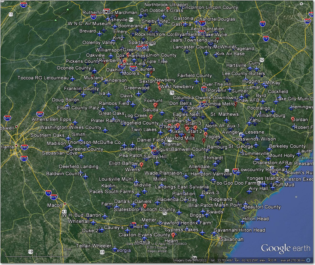
Perry Soaring Waypoint Database Geographical Distribution
Authors Preface: As many of you have already discovered, I password-protected this post so I could show it to Al Tyler and get his input before making the review public. This turned out to be an epic mistake, as Bill Elliott was apparently deluged with complaints and/or requests for access (sorry Bill!). So … I’m making it public, but be aware that this is a work in progress; Al Tyler, Sam Zimmerman, and I are working to pare the database down to something reasonable and pull out as much of the deadwood as we can. I hope to have a new, improved database up on Leibacher’s site by the time the contest rolls around, but that’s not at all assured. Whatever happens THERE WILL BE NO CHANGES TO CONTEST TURNPOINT NAMES OR NUMBERS so you can safely use the current Perry database from the Soaring Turnpoint Exchange. Ultimately my motivation for doing this review is so I can create my own personal database that excludes ‘problematic’ airports/airstrips (like The Bearwallow ‘airport’ – see below). Many of these problem airstrips are way outside the normal contest soaring area, and therefore won’t impact competitors at all. OTOH, you never know … ;-). So, here’s the review, but be aware it’s not anywhere near final – Frank (TA)
As part of my 12-step crash recovery program, I have taken a solemn vow to never go to another soaring site without first having done a thorough Google Earth review of all the airports/airstrips in that site’s waypoint database. Never again will I arrive at an ‘airstrip’ waypoint only to discover that it can’t be found or has been abandoned for years/decades!
This is my review of the Perry (Wagener, SC) waypoint database from John Leibacher’s wonderful Worldwide Soaring Turnpoint Exchange. As part of this great service, John provides a .KMZ file that displays all the waypoints in Google Earth. When I review a soaring site, I look at *all* waypoints with a ‘landable’ coding, but I only report the ones that I find missing, abandoned, or otherwise problematic (i.e. not wide enough for my 18-meter ship). If you don’t find a reference and/or image for a particular airstrip in this review, then you can safely assume that I didn’t find anything scary about it, and would be willing to land my glider there. Of course, this is all based on Google Earth images that can be as much as 2 years old, and on my not-so-sane view of the world, so your mileage may vary!
Note: When I first did this review, I discovered there were a *lot* of ‘problem’ airstrips in the Perry waypoint database. I attributed that to the unique circumstances surrounding ‘Perry International Airport’; Al Tyler is the only regular flyer out of Perry, and I’m sure he has long since memorized every usable airport/airstrip in his soaring area, and keeps track of airstrips as they go in and out of service. So, he has no real reason to maintain it, except for the contest turnpoints and other airstrips in the contest soaring area. Only us mere mortals need a well-reviewed database! ;-).
Frank Paynter (TA)
#10 Caraways Airstrip
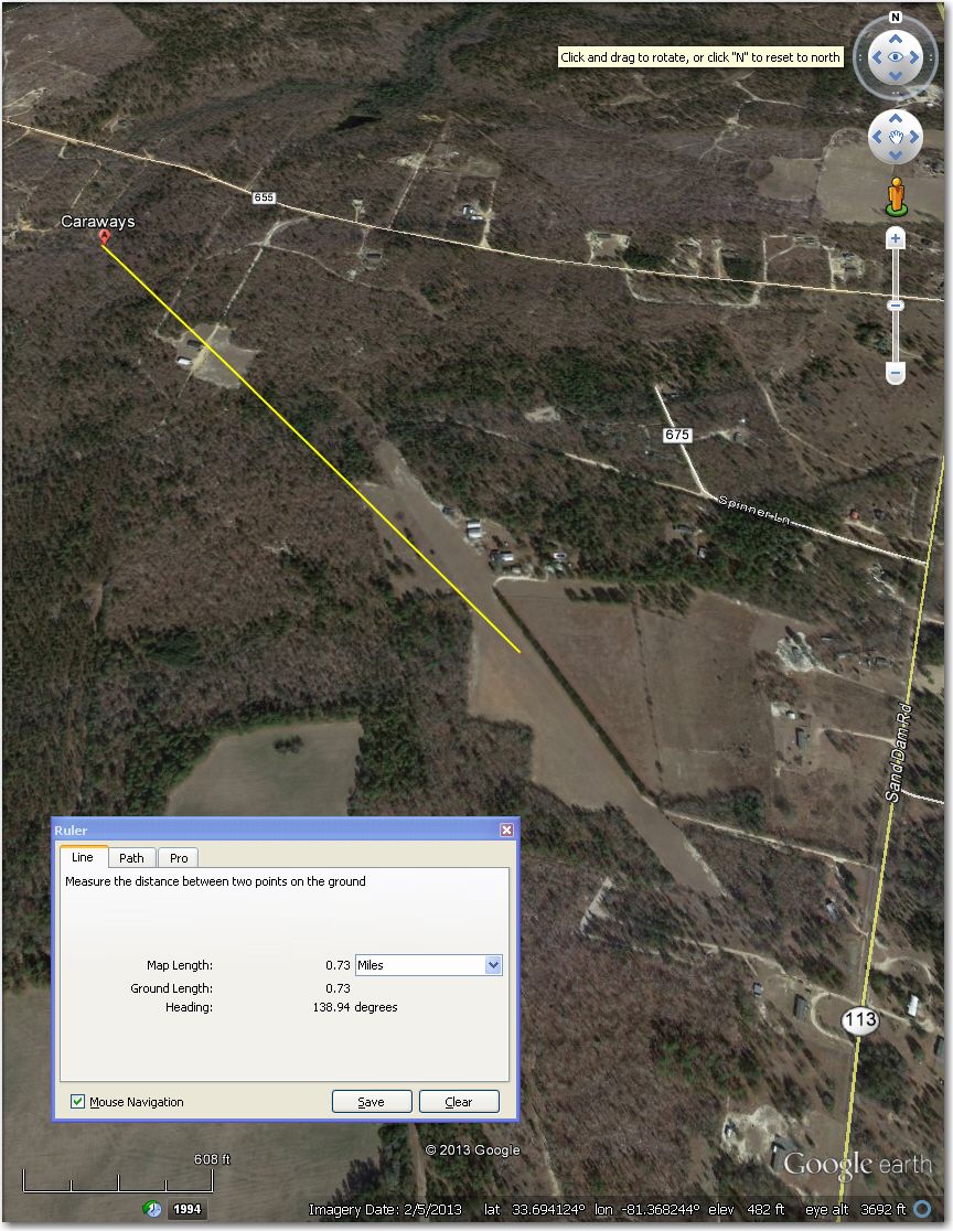
The Carraways symbol is almost a mile to the NNW of the airport. Correct airport coordinates are (33.693407, -81.367464)
#14 Do Little & Alan’s Airstrips
Nothing wrong with either of these airstrips, but I had to include it because you don’t often see two perfectly good airstrips side-by-side like this. There even appears to be a taxiway between them, maybe so Alan can taxi over to Dr. Dolittle’s place for a morning coffee? ;-).
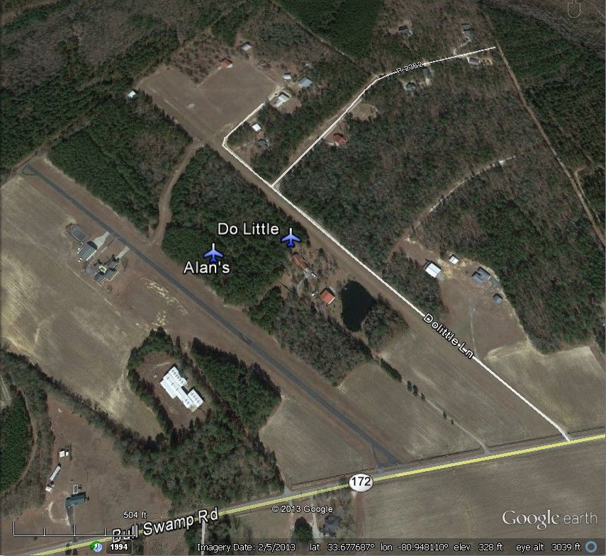
Don’t often see two perfectly good airstrips side-by-side like this!
#26 Judge Wil Airstrip – Clearly abandoned and returned to cropland. You can see the hangar and traces of the runway about 0.6 mi NNW of the waypoint symbol.
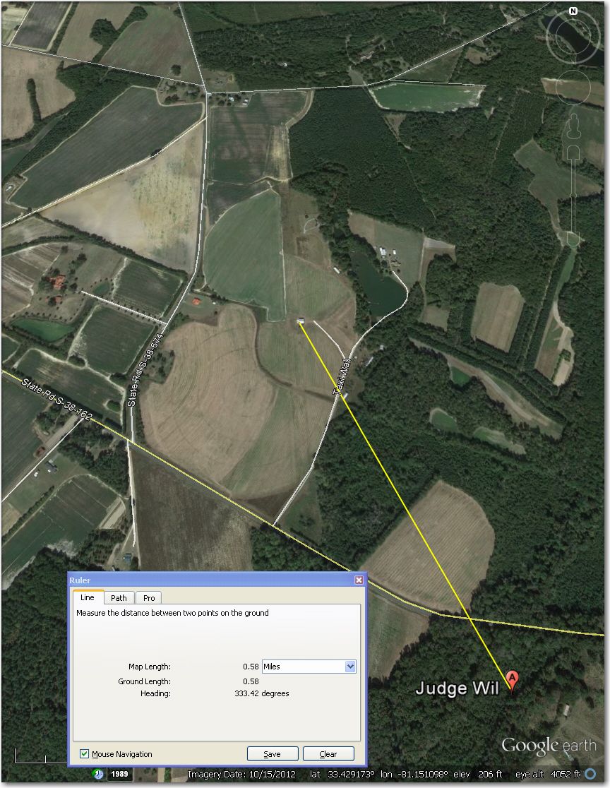
Clearly abandoned and returned to crops. You can still see the hangar, and traces of the runway
#41 West Wagener Airstrip – Waypoint symbol is displaced about 0.6 to the NW of the airstrip. Otherwise OK.
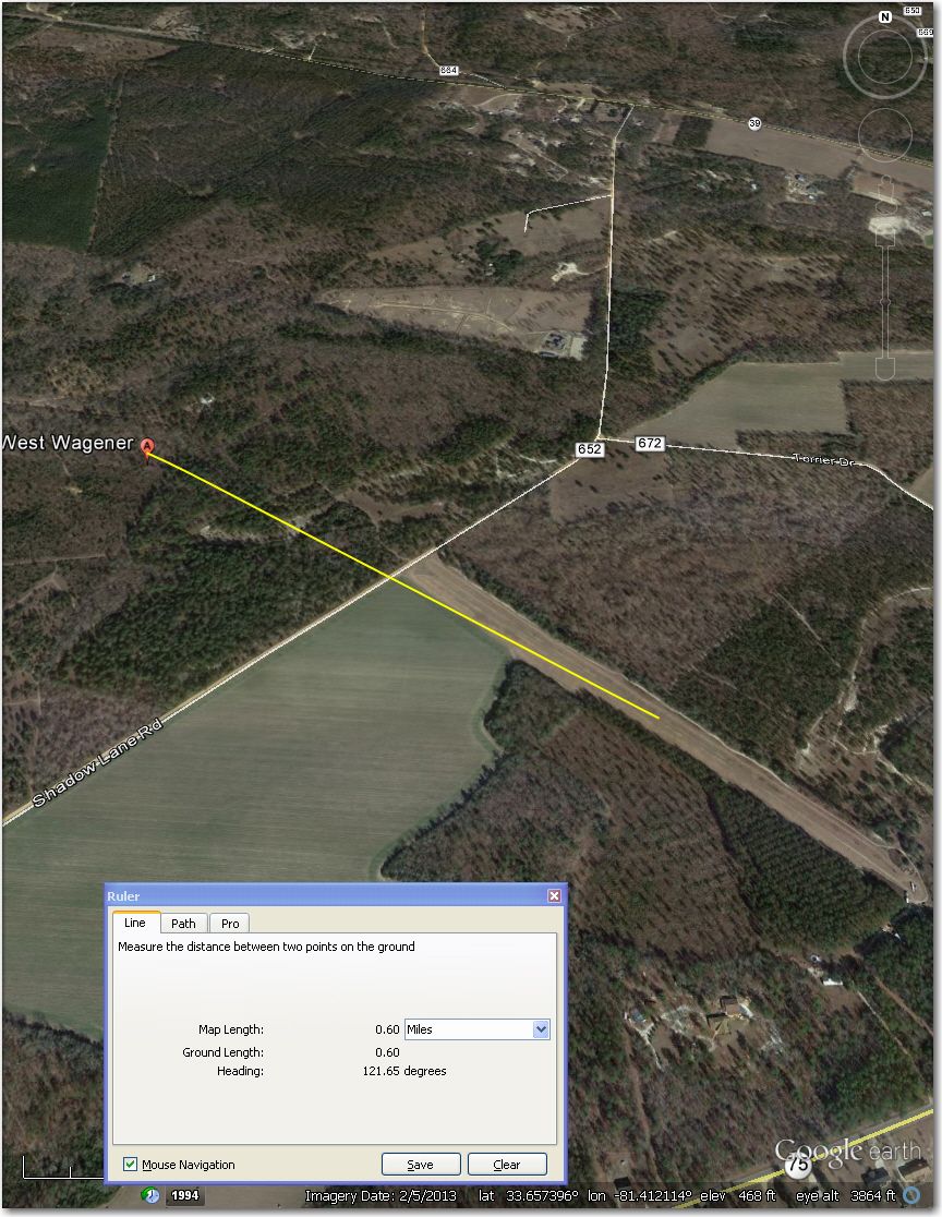
Waypoint symbol is displaced about 0.6 mi NW of the airstrip
Wexford Mills Airstrip – Waypoint symbol is displaced about 0.8 mi SW of airstrip.
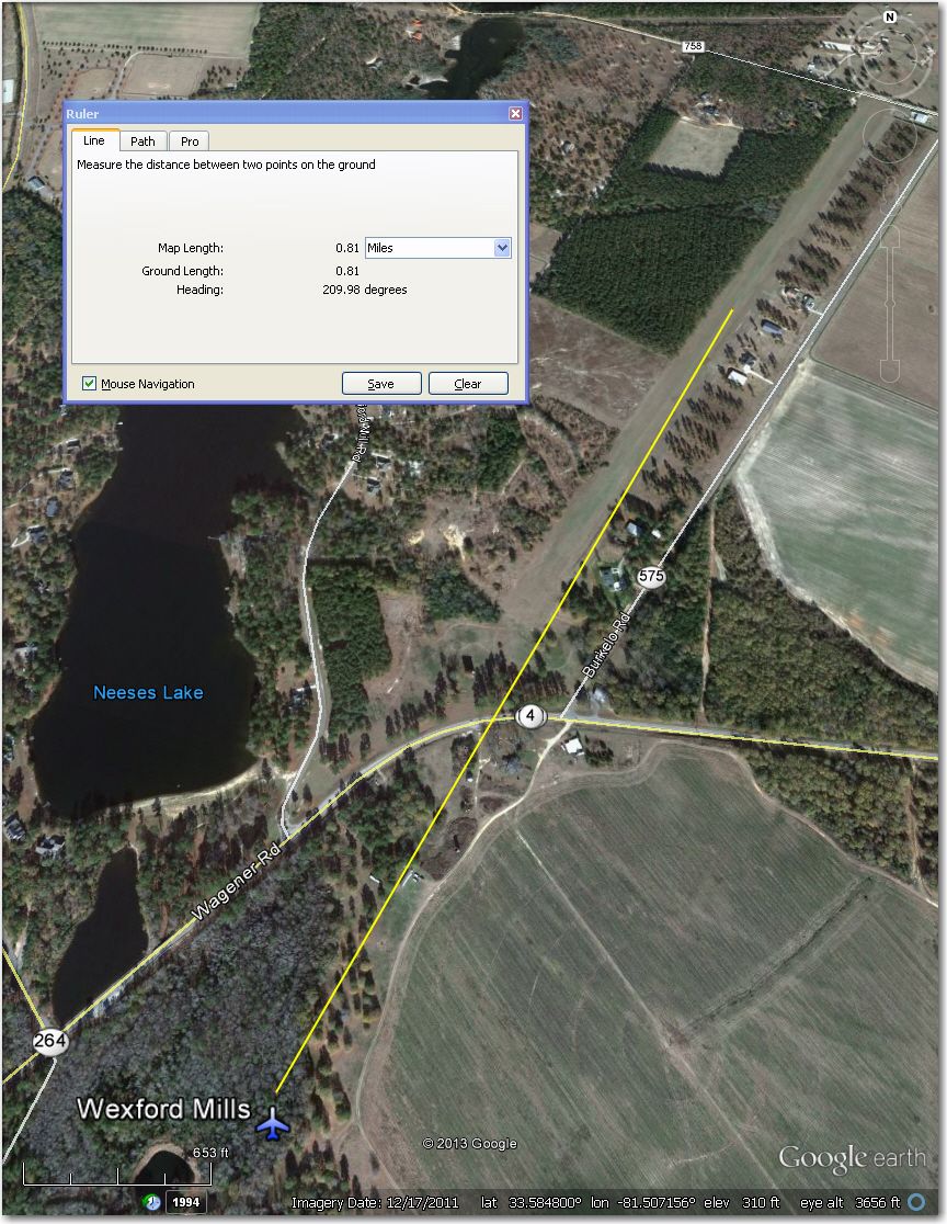
Waypoint symbol is displaced about 0.8 mi SW of airstrip.
Williston Airstrip – Waypoint symbol is displaced about 0.6 mi NW of the airstrip.
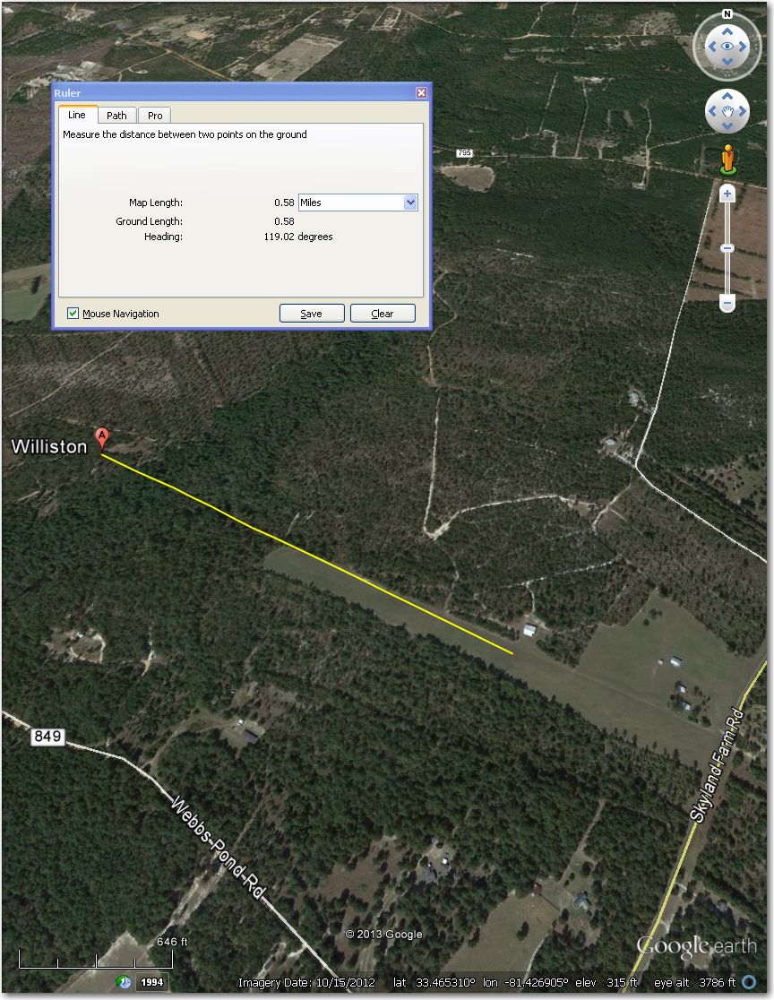
Waypoint symbol is displaced about 0.6 mi NW of the airstrip
29C Airstrip – Runway itself isn’t obvious, and looks suspiciously un-maintained in this 4/2011 image. Might be better off at Shelby, 4 mi SSE.
Not sure where the actual runway is, and it doesn’t look particularly well maintained
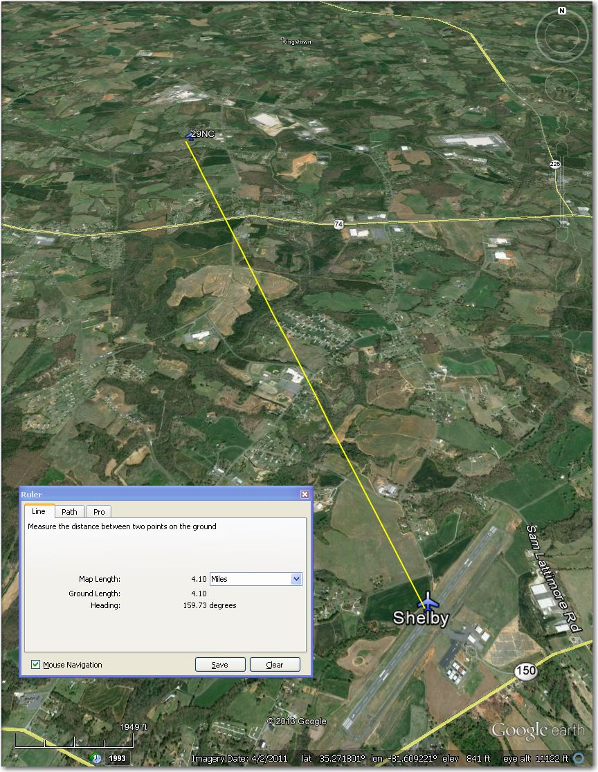
Might be better off at Shelby Airport, 4 mi SSE
Anna’s Airstrip – A bit short at around 1200′ usable, and not overly wide, either. Better be ‘on your game’ for this one!
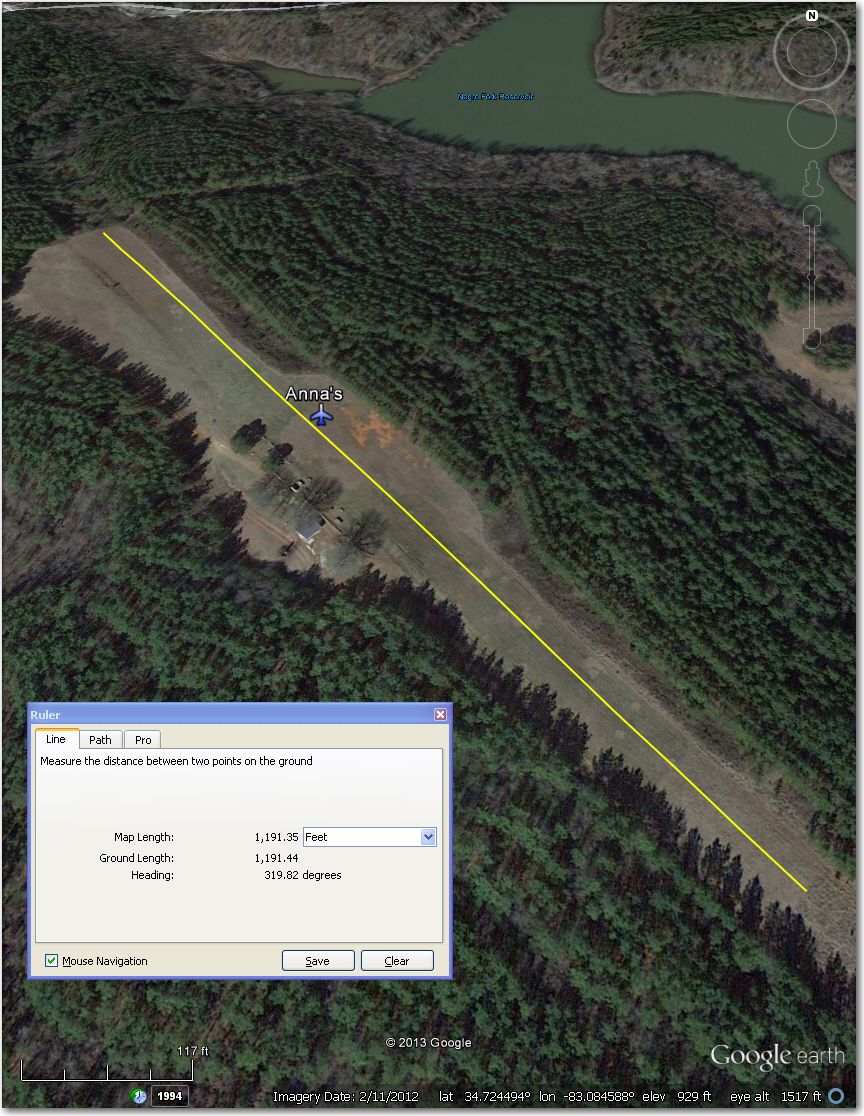
Short and not too wide, either – better be ‘on your game’.
Bearwallow Farm – If there’s an airstrip in this photo, I’ll eat my hat! This place is on the side of a pretty steep mountain at 3600′ msl—more like a ski resort than an airstrip! Fortunately, Six Oaks is a reasonable airstrip about 4.4 mi W.
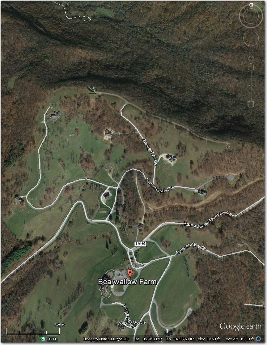
Maybe a ski resort, but definitely not an airstrip
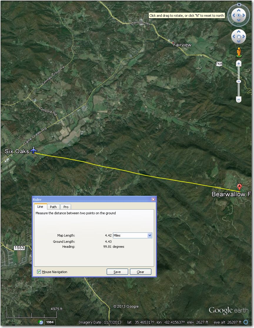
Six Oaks Airstrip is about 4.4 mi west of Bearwallow Farms
Bells Branch Airstrip – Obviously abandoned and overgrown
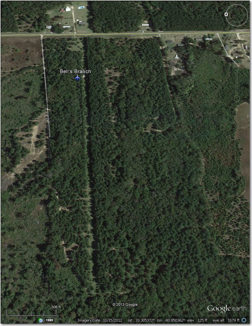
Obviously long-abandoned and now overgrown
Bethel Lake Wylie Airstrip – Abandoned and overgrown.
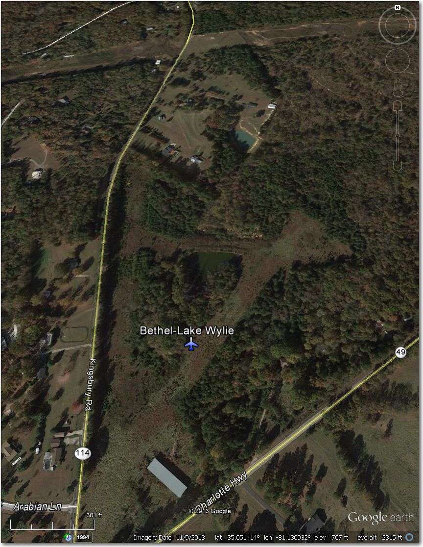
Bethel Lake Wylie – abandoned and overgrown
Carolina Cow Country Airstrip – WAY too narrow for 18m, and probably for 15m too. Much better off at Laurens Airport 4 mi SW.
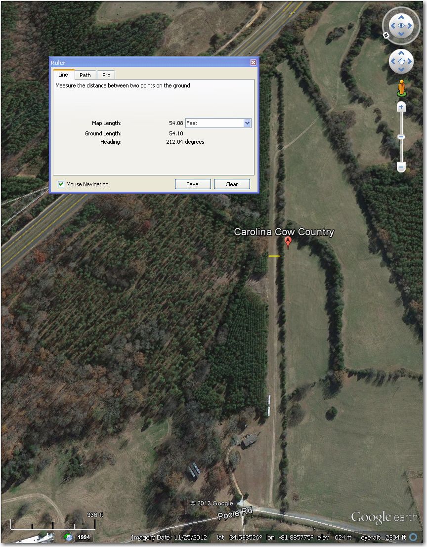
WAY too narrow for 18m, and probably for 15m too. Better off in a field.
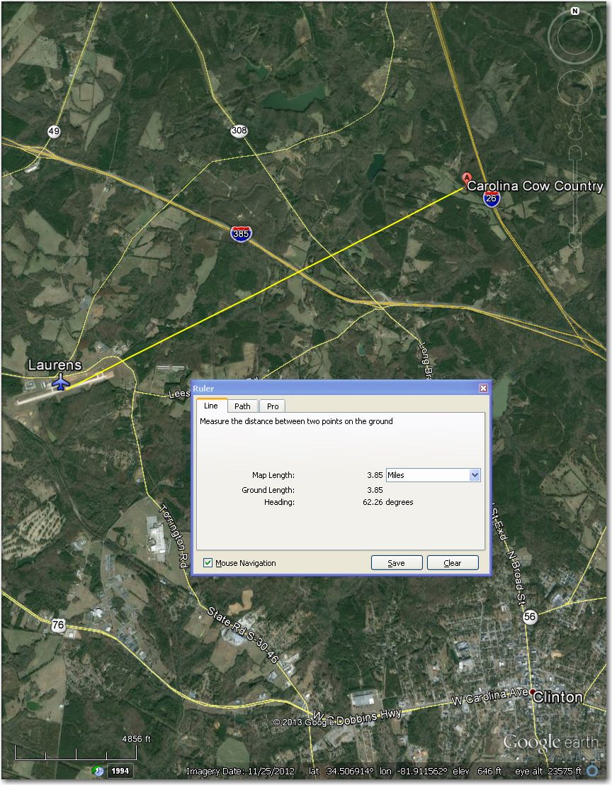
Laurens airport, 4 mi SW of Carolina Cow Country Airstrip.
Carpenter Airstrip – looks abandoned and overgrown in this 3/2013 image. If you were desperate, you *might* be able to land in a relatively clear area in the middle of the strip (about 750′ available) – good luck! Much better off at Thompson-McDuffie Co Airport 8 mi west.

Looks abandoned and overgrown in this 3/2013 image. Center 750′ or so *might* be landable.
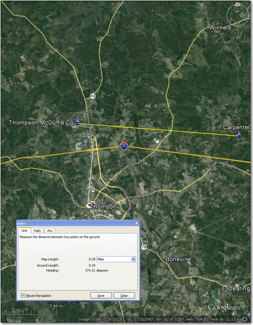
Thompson-McDuffie Airport 8 mi west of Carpenter airstrip.
Clute’s Hilltop Airstrip – clearly abandoned and overgrown in this 4/2011 image. Better off at Rutherford Co-Marchman 5 mi west
Clute’s Hilltop Airstrip – clearly abandoned/overgrown in this 4/2011 image.
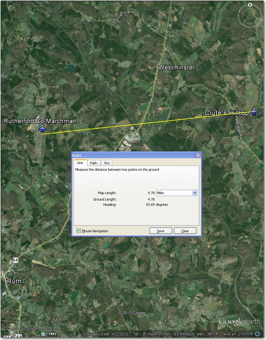
Rutherford Co-Marchman Airport 5 mi west of Clute’s Hilltop airstrip
Clyde Valley Airstrip – Too narrow for 18m, and probably too narrow for 15m too. Better off at Silver Creek Airstrip 3 mi NNW.
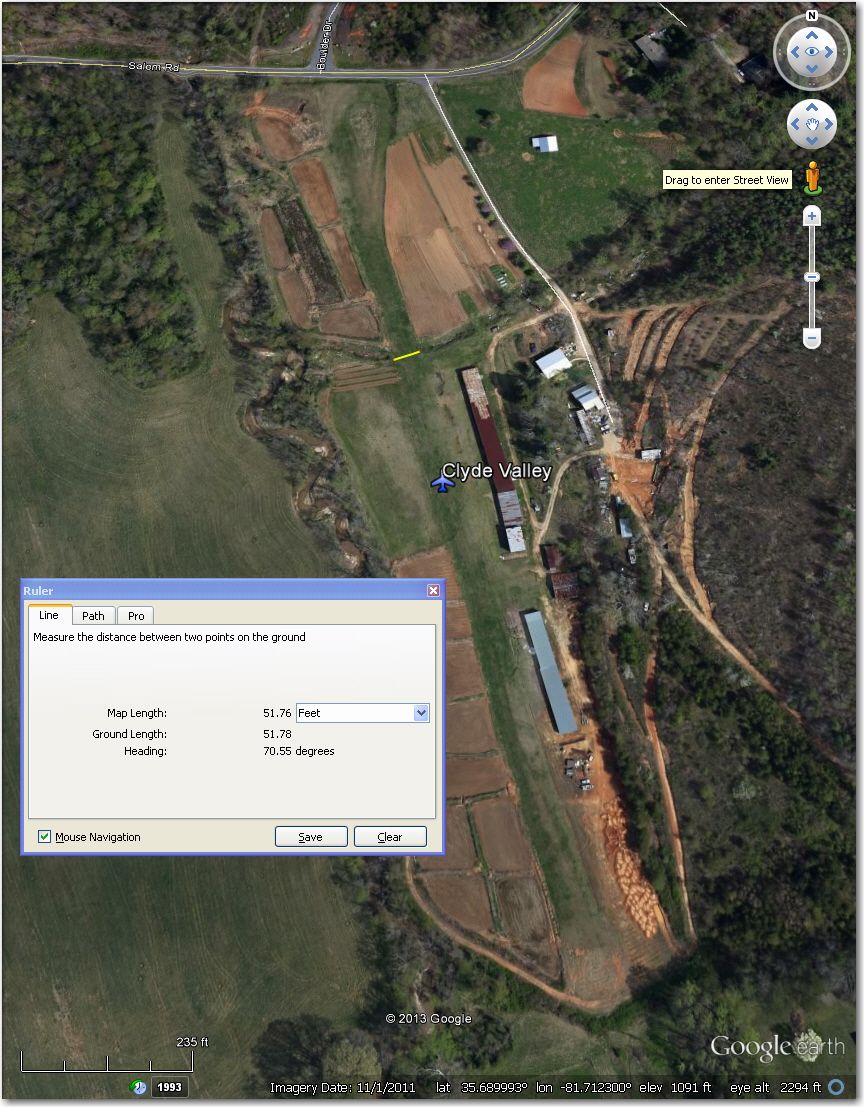
Too narrow for 18m and probably for 15m too. Better off at Silver Creek airstrip 3 mi NNW
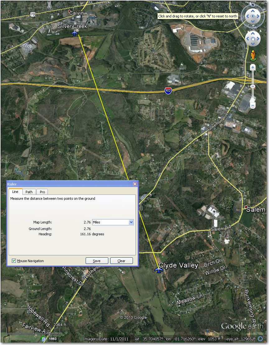
Silver Creek Airstrip 3 mi NNW of Clyde Valley.
Cox Airstrip – Too short (1,100′) with houses all around. Better off at Hartness 1.5 mi NNE.
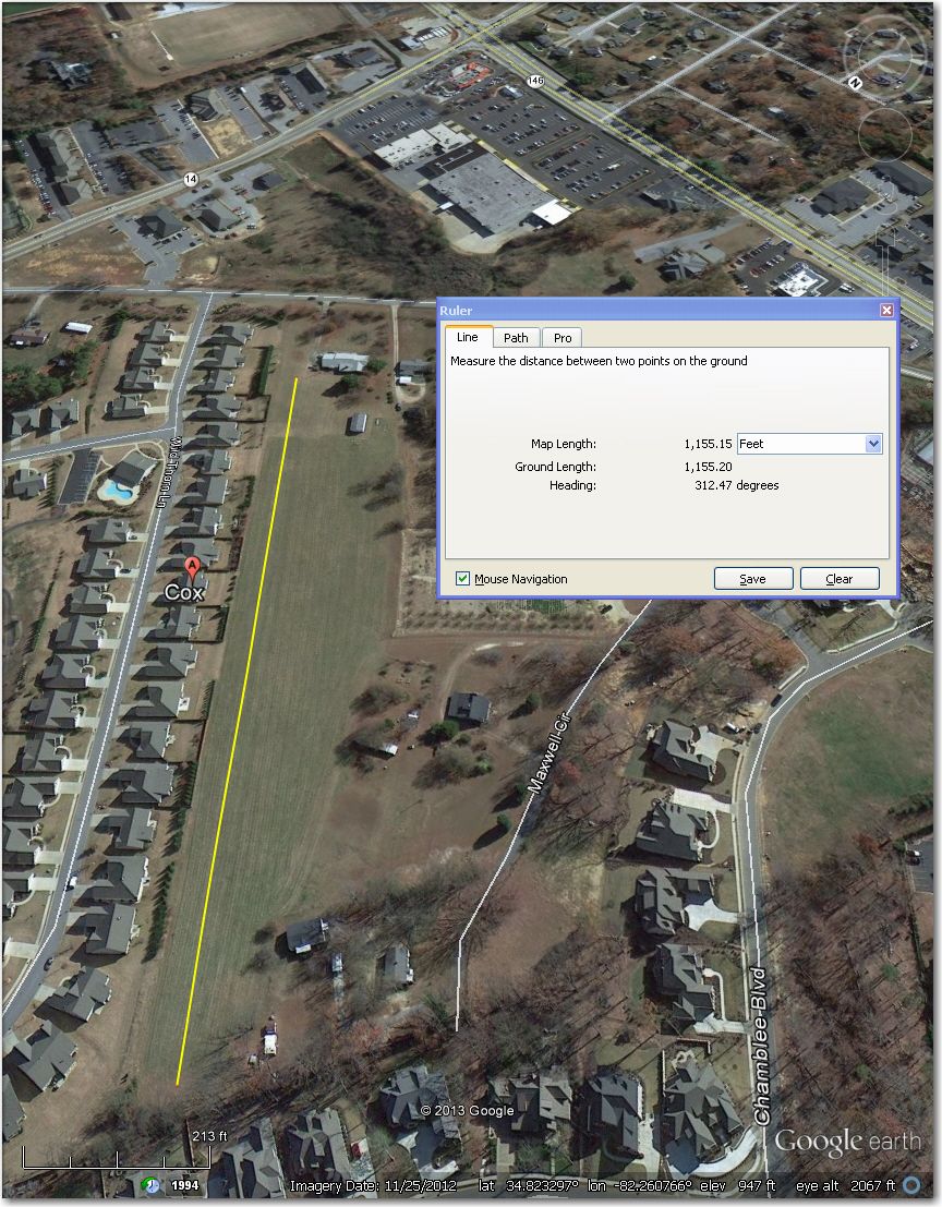
Way too short at 1,100′ with too many solid obstacles all around. Better off at Hartness 1.5 mi NNE
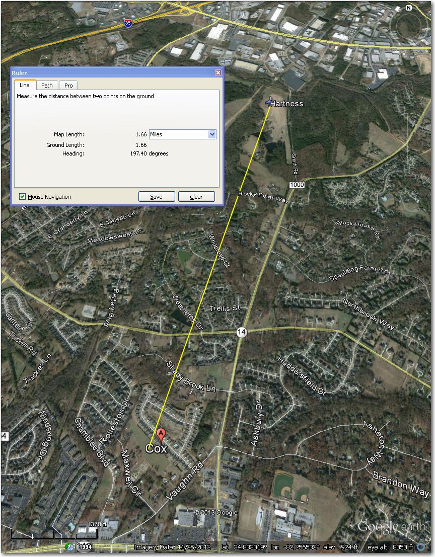
Hartness Airstrip – 1.5 mi NNE of Cox Airstrip
Crawford Hendrix Farm – Nothing there in this 3/2013 image.
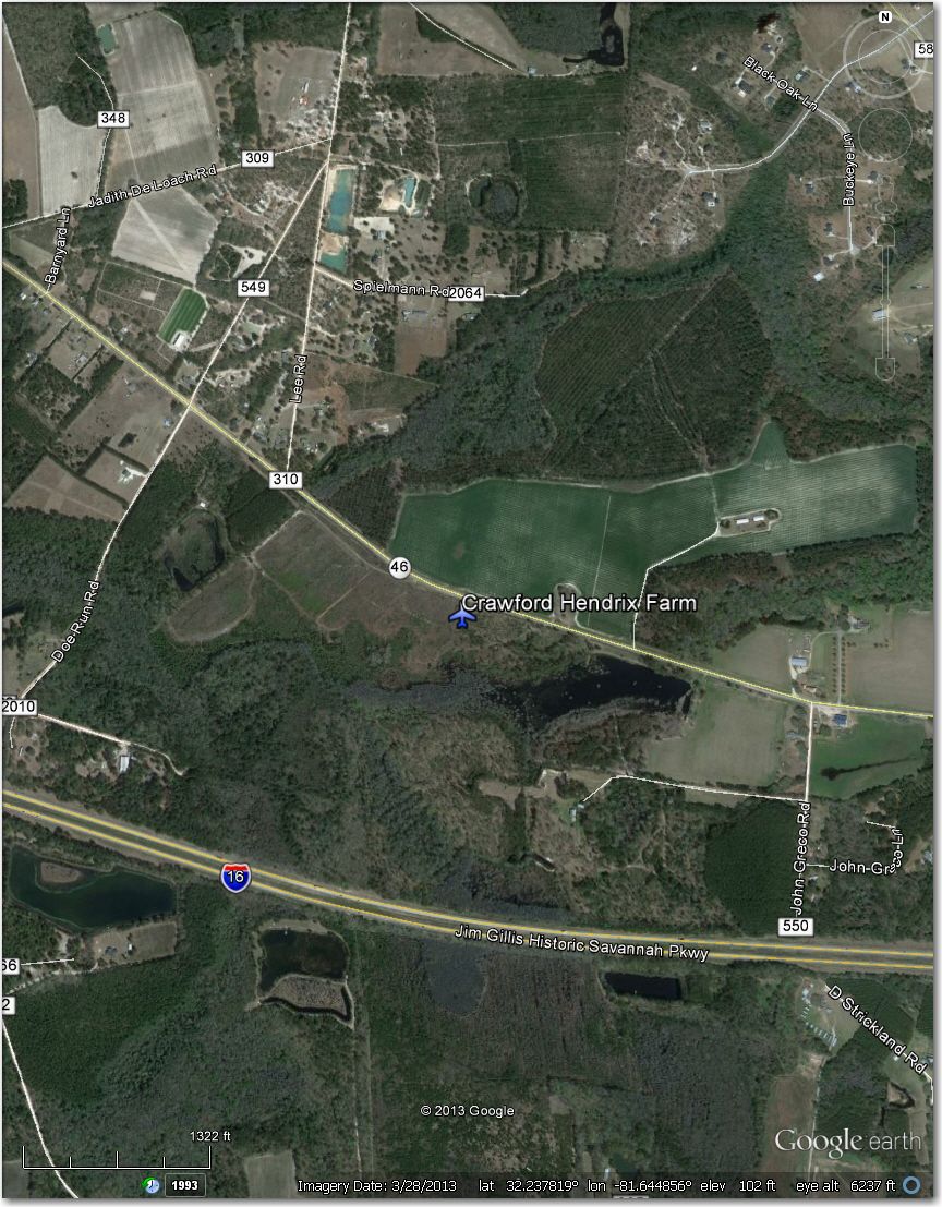
Nothing there in this 3/2013 image
Creech Aviation Facility – Nothing there in this 11/2013 image.
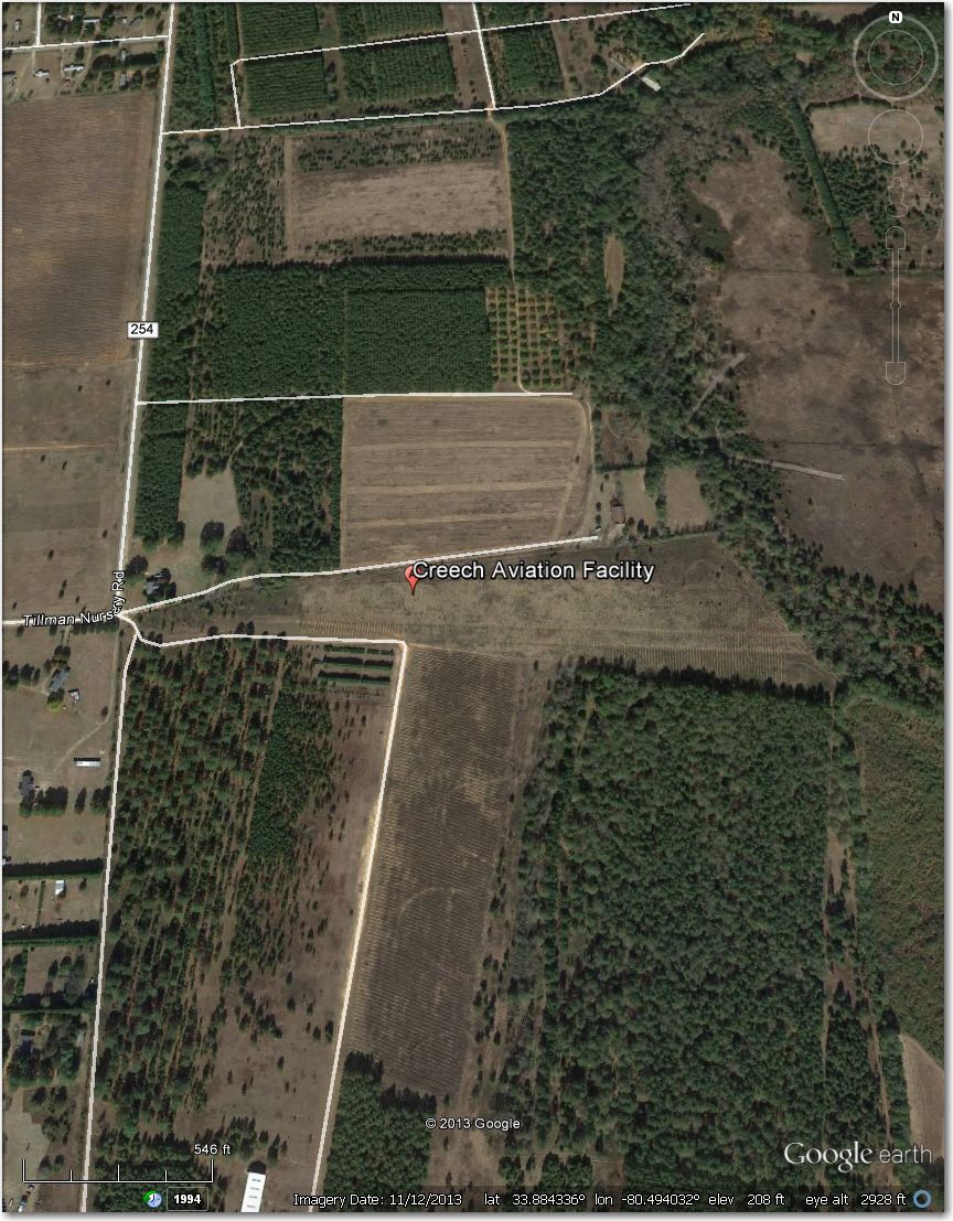
Nothing there in this 11/2013 image
Curry Airstrip – Nothing there in this 3/2012 image
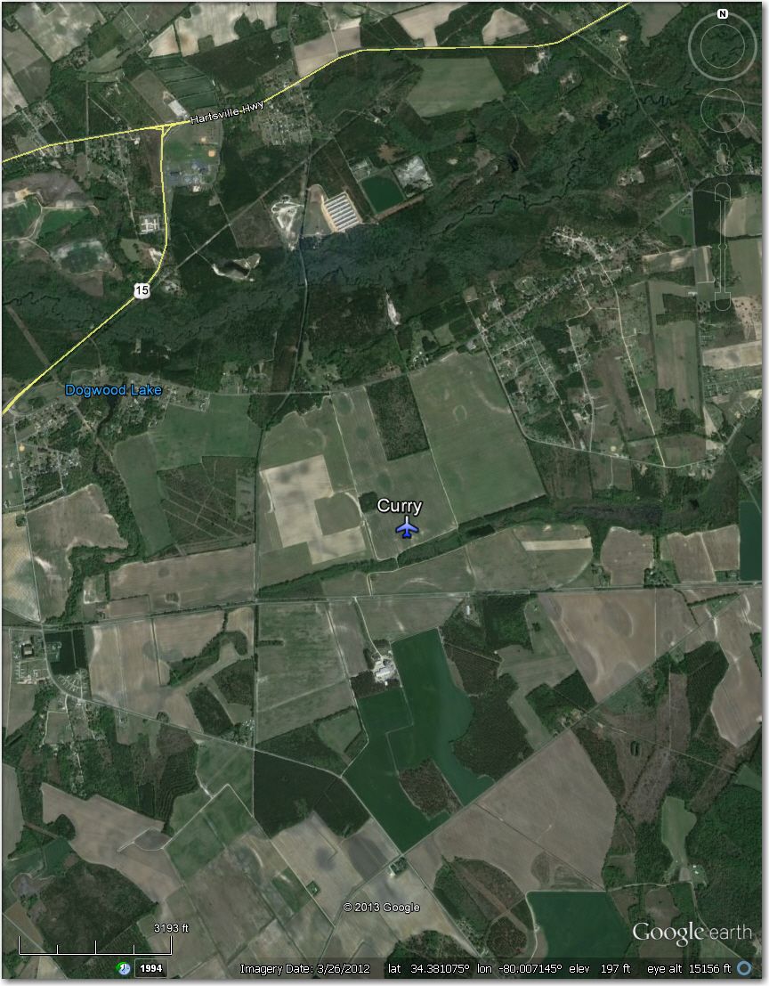
Nothing there in this 3/2012 image.
Daniels Airstrip – Nothing there in this 11/2012 image.
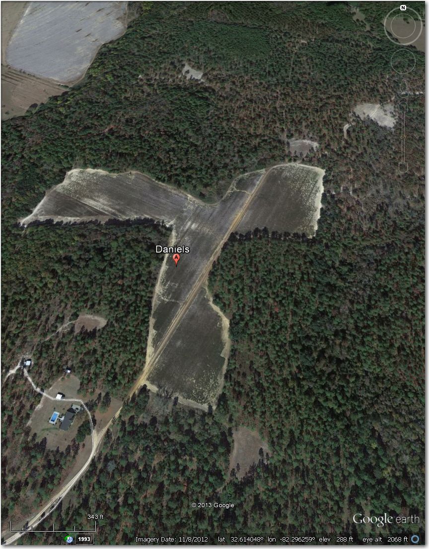
Nothing there in this 11/2012 image
Danville Airstrip – Obviously abandoned and overgrown. Better off at Whitehall, 7.6 mi SE.
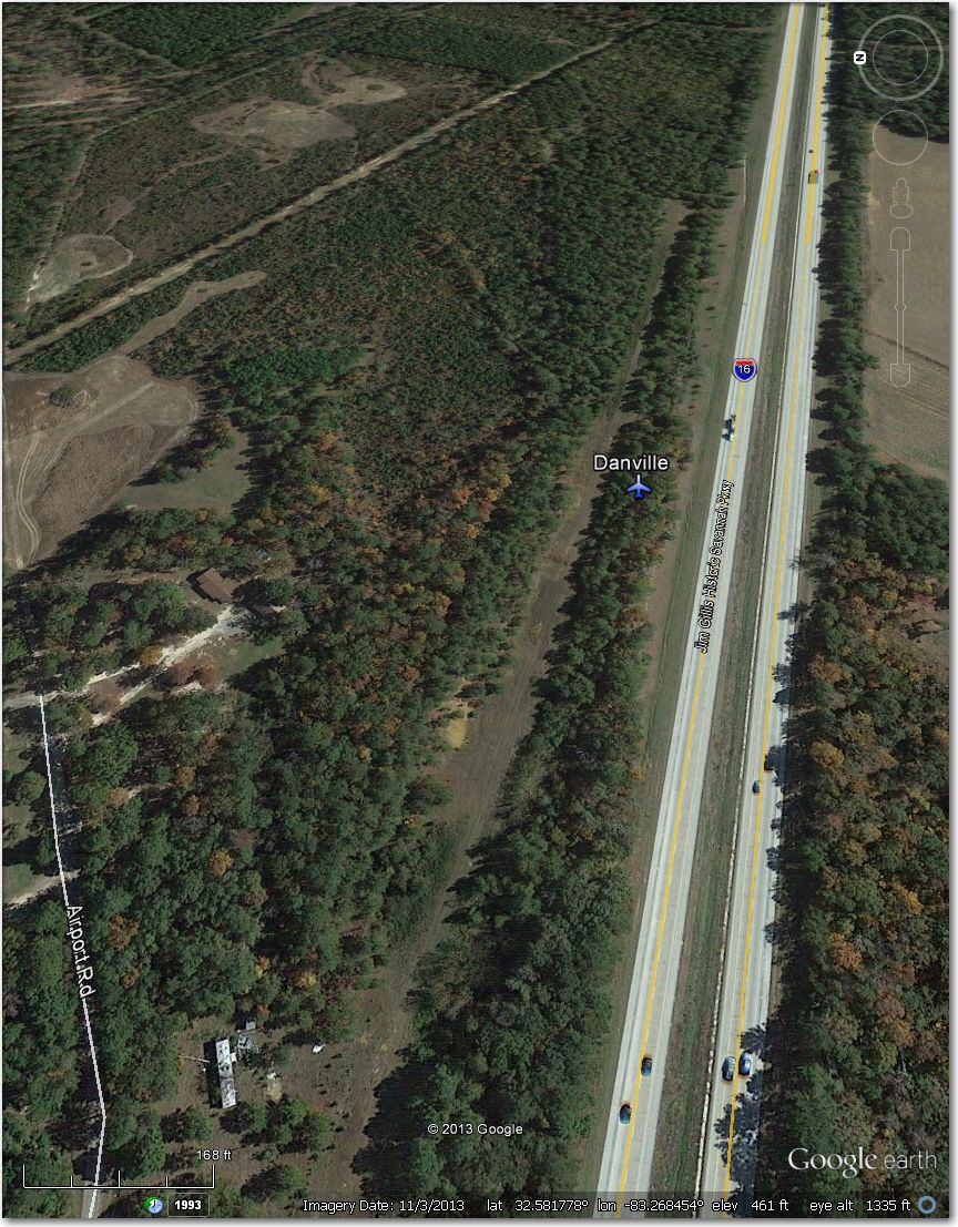
Danville Airstrip – Abandoned and overgrown. Better off at Whitehall 7.6 me SE
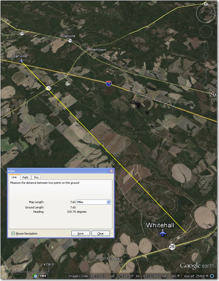
Whitehall Airstrip – 7.6 mi SE of Danville
Darla’s Airstrip – Obviously abandoned and returned to crops (hay bales in field) in this 12/2009 image.
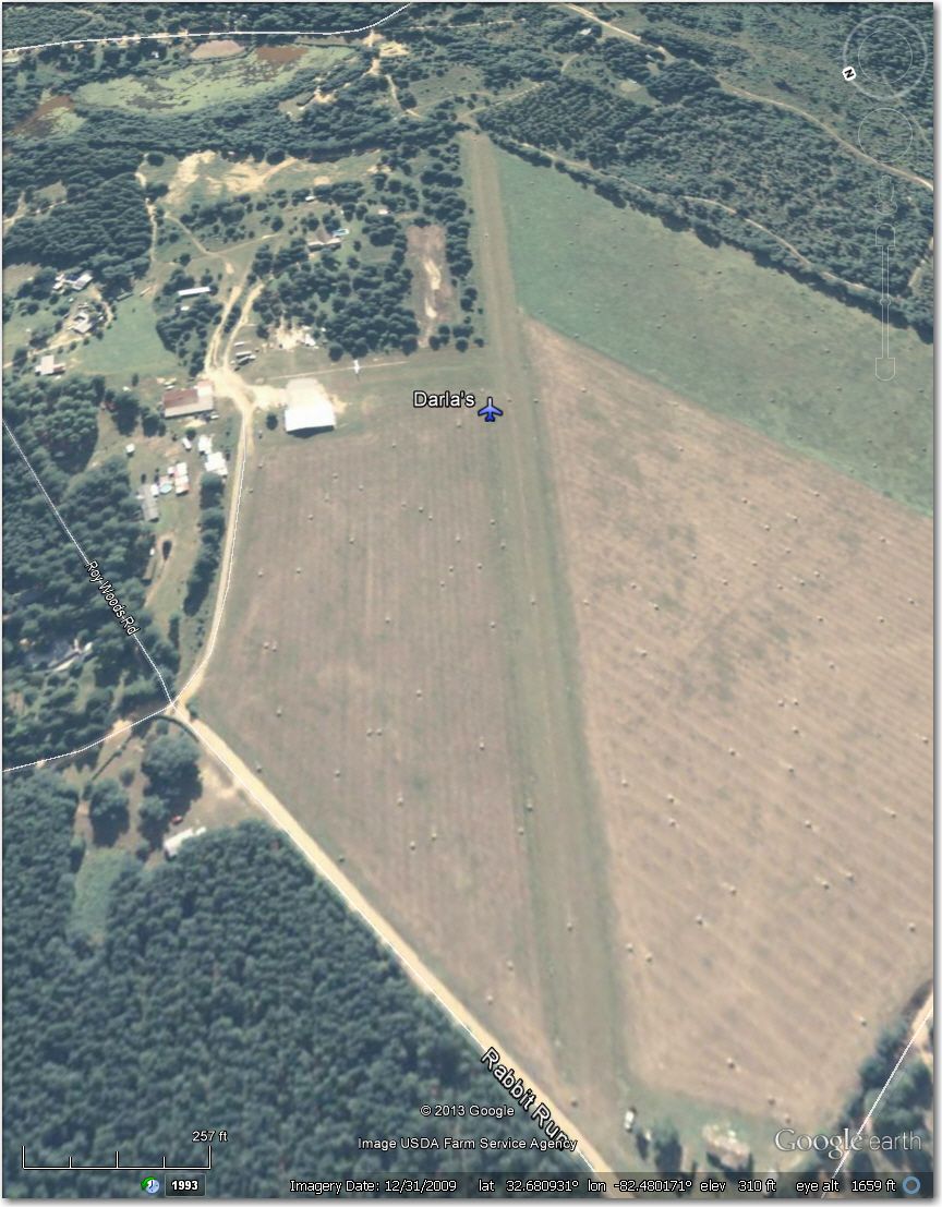
Clearly abandoned and returned to crops in this 12/2009 image.
Davis 2 Airstrip – Nothing there in this 3/2012 image.
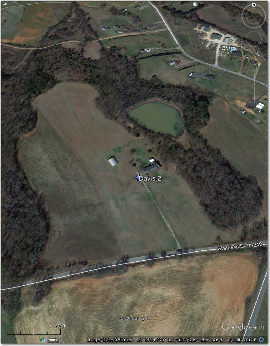
Nothing there in this 3/2012 image
Davis 4 Airstrip – Nothing there in this 11/2012 image.
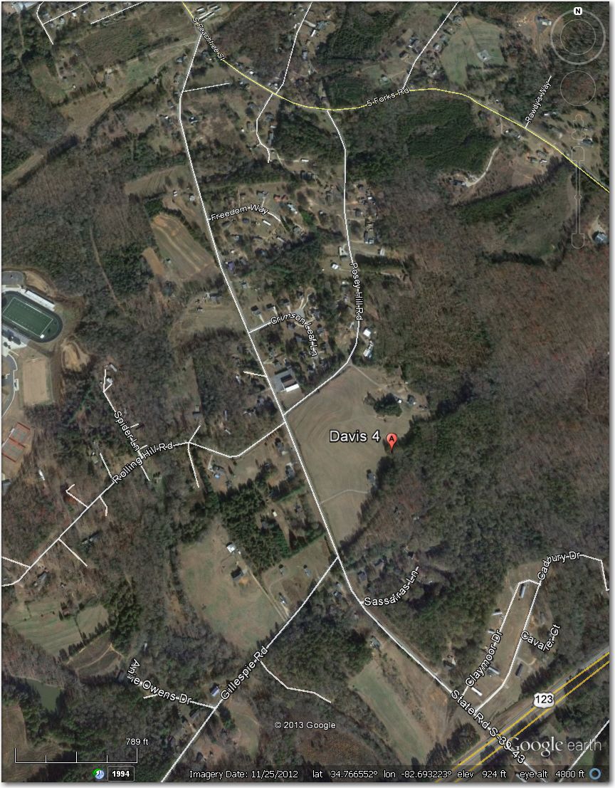
Nothing there in this 11/2012 image
Dream Team Airstrip – Nothing there in this 11/2013 image.
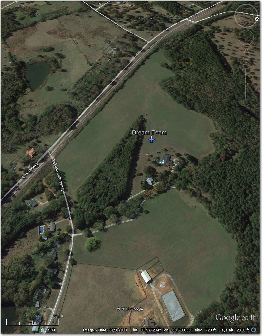
Nothing there in this 11/2013 image
Eliot Barrow Airstrip – Waypoint symbol is offset approximately 0.5 mi NE of actual airstrip.
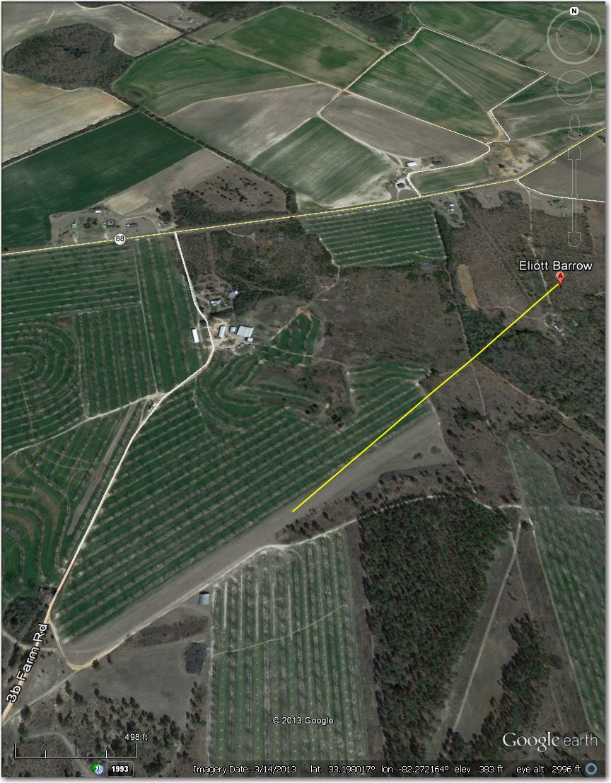
Waypoint symbol is offset approximately .5 mi NE of airstrip
Foxhunt Airstrip – Too narrow for 18m and probably for 15m too. Better off at Double Spring Airstrip 1.2 mi east.
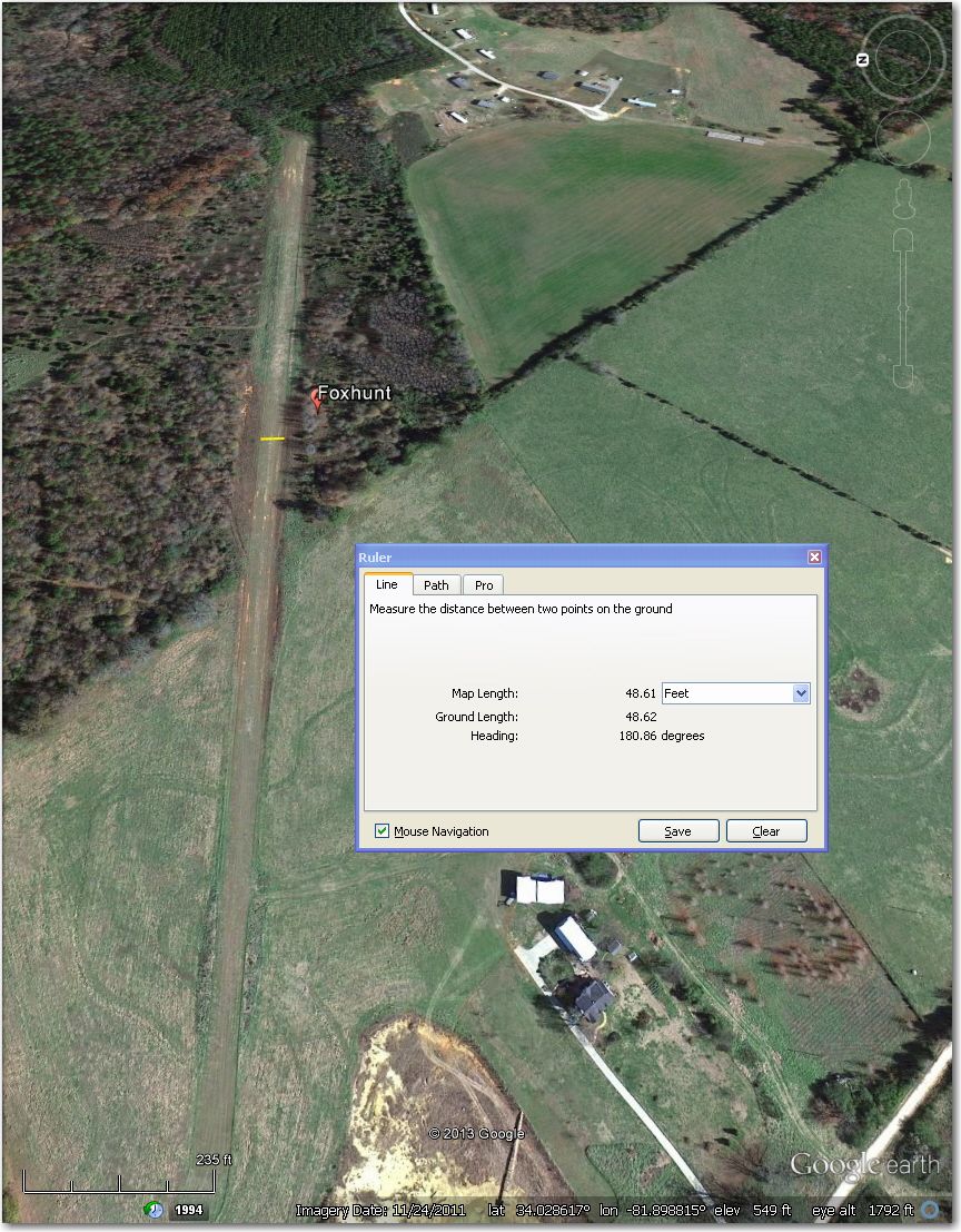
Too narrow for 18m and probably for 15 m too. Better off at Double Spring Airstrip 1.2 mi east
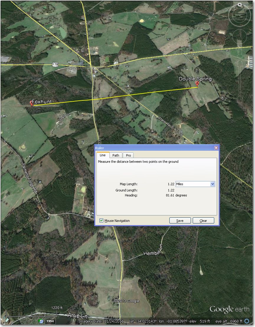
Double Spring Airstrip 1.2 mi east of Foxhunt
Great Oaks Airstrip – Abandoned (note the big ‘X’ in the middle of the runway)
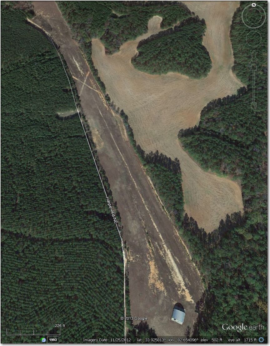
Abandoned (note the big ‘X’ in the middle of the runway).
Green Pond Airstrip – Waypoint symbol is about 0.7 mi NW of actual airstrip.
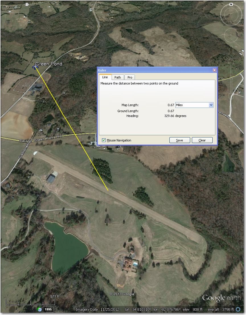
Waypoint symbol is about 0.7 mi NW of actual airstrip
Hawks Meadow Airstrip – Too narrow for 18m and probably 15m too. Better off at Jaars-Townsend Airport 2.1 mi north.
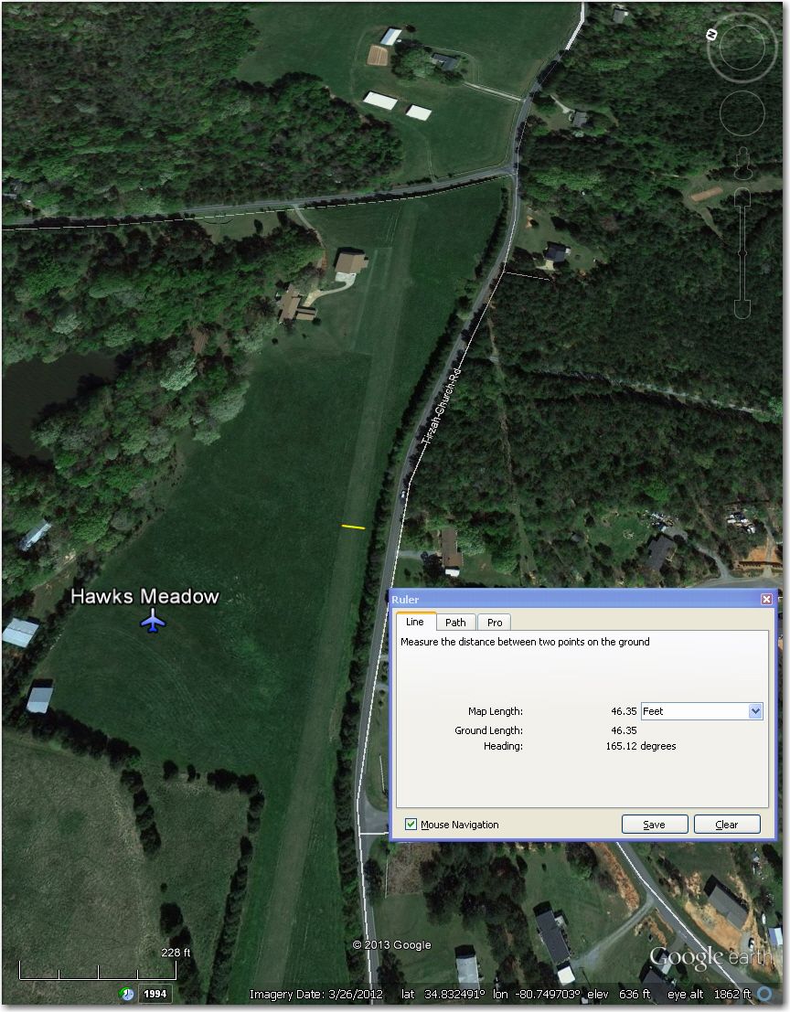
Too narrow for 18m and probably for 15m too. Better off at Jaars-Townsend 2.1 mi north
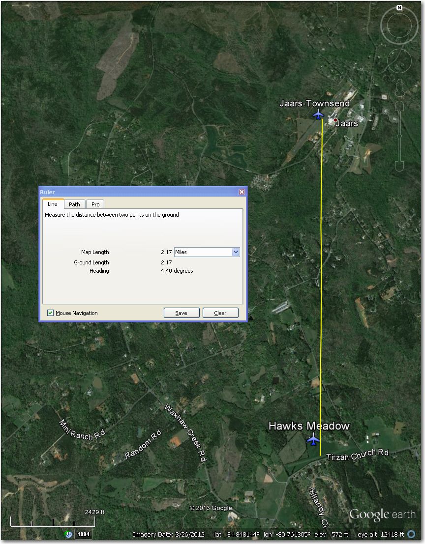
Jaars-Townsend airport 2.1 mi north of Hawks Meadow
Hearn Airstrip – Nothing there in this 3/2013 image. The long open area to the west is a high-tension powerline.
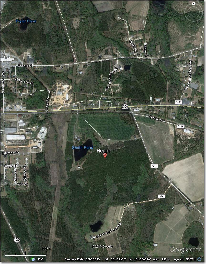
Nothing there in this 3/2013 image. The long open field to the west is a high-tension power line
Holt Airstrip – Waypoint symbol is approximately 1 mi east of actual airport
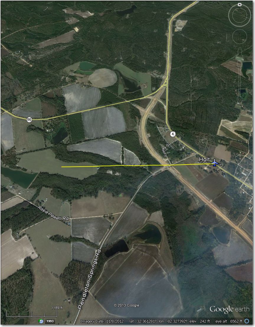
Waypoint symbol is about 1 mi east of actual airstrip
Iva Airstrip – Looks like a high-wing only strip; the center strip is only about 45′ wide, with what looks like high bushes on both sides. Probably better off at Anderson 14 mi N or Hester Memorial 16 mi SSE.
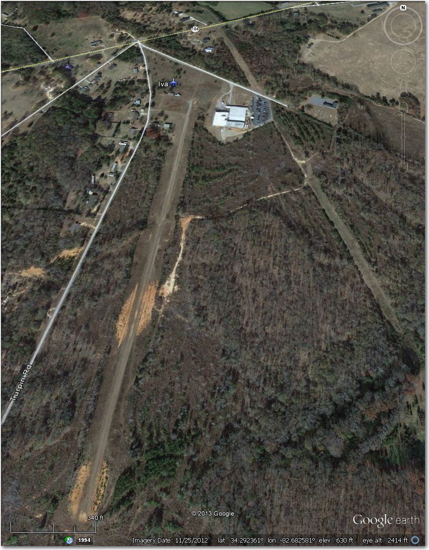
Looks like a high-wing only strip. The center cleared section is only about 45′ wide, with high bushes on both sides.
Jordan Airstrip – Looks abandoned in this 11/2013 image.
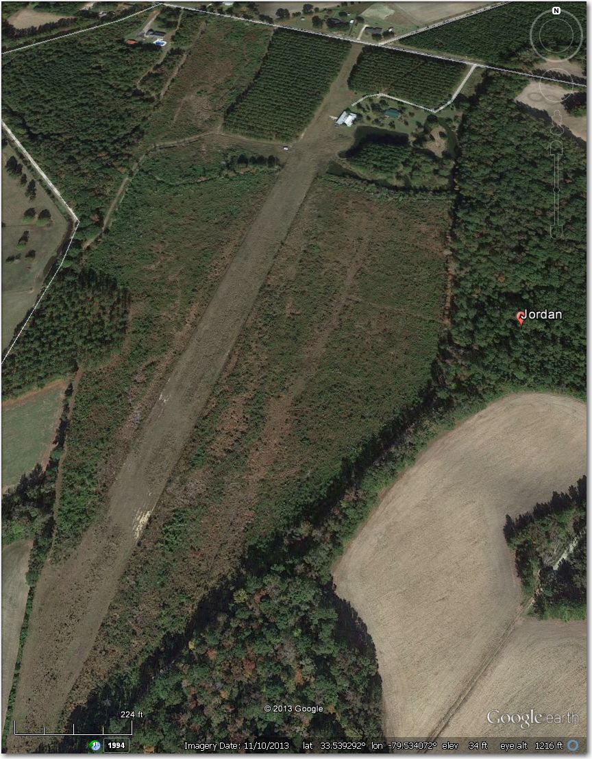
Looks abandoned in this 11/2013 image
Lamar Airstrip – Nothing there in this 11/2013 image
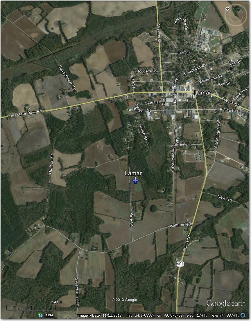
Nothing there in this 11/2013 image
Lathan Airstrip – Nothing there in this 11/2013 image
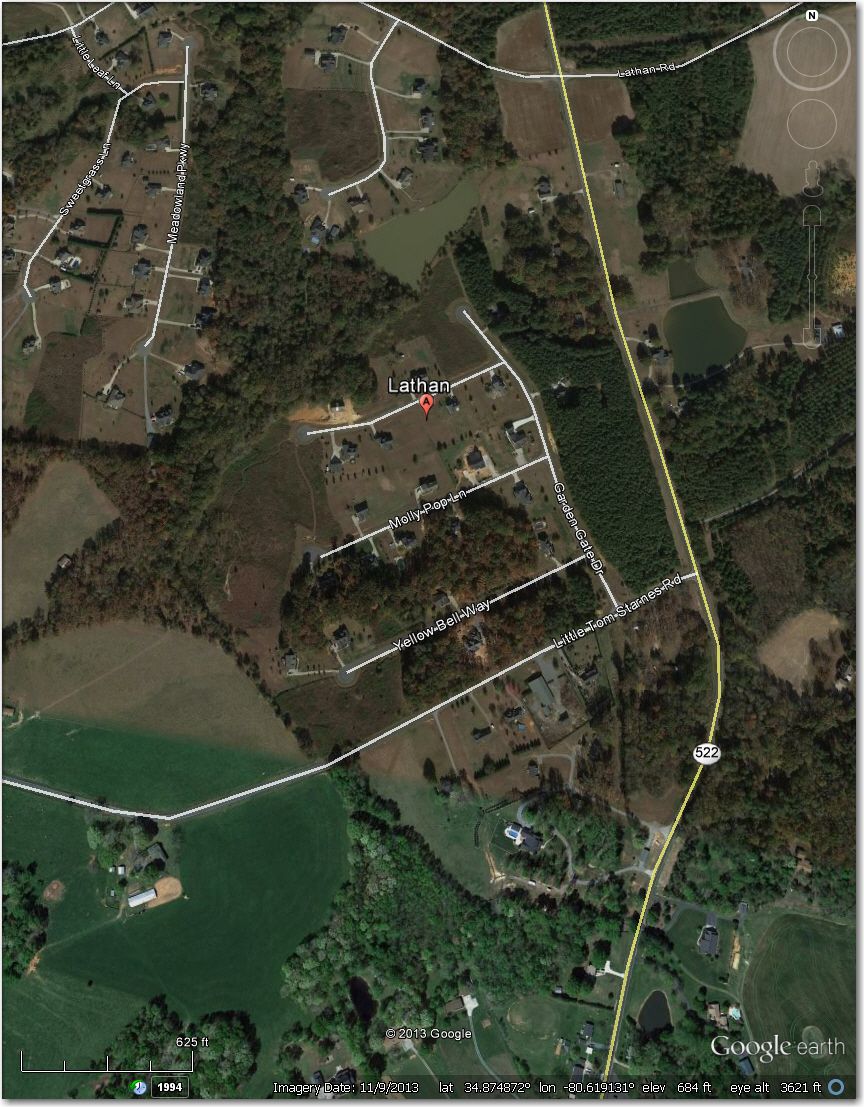
Nothing there in this 11/2013 image
Lesesne Airstrip – Nothing there in this 2/2013 image
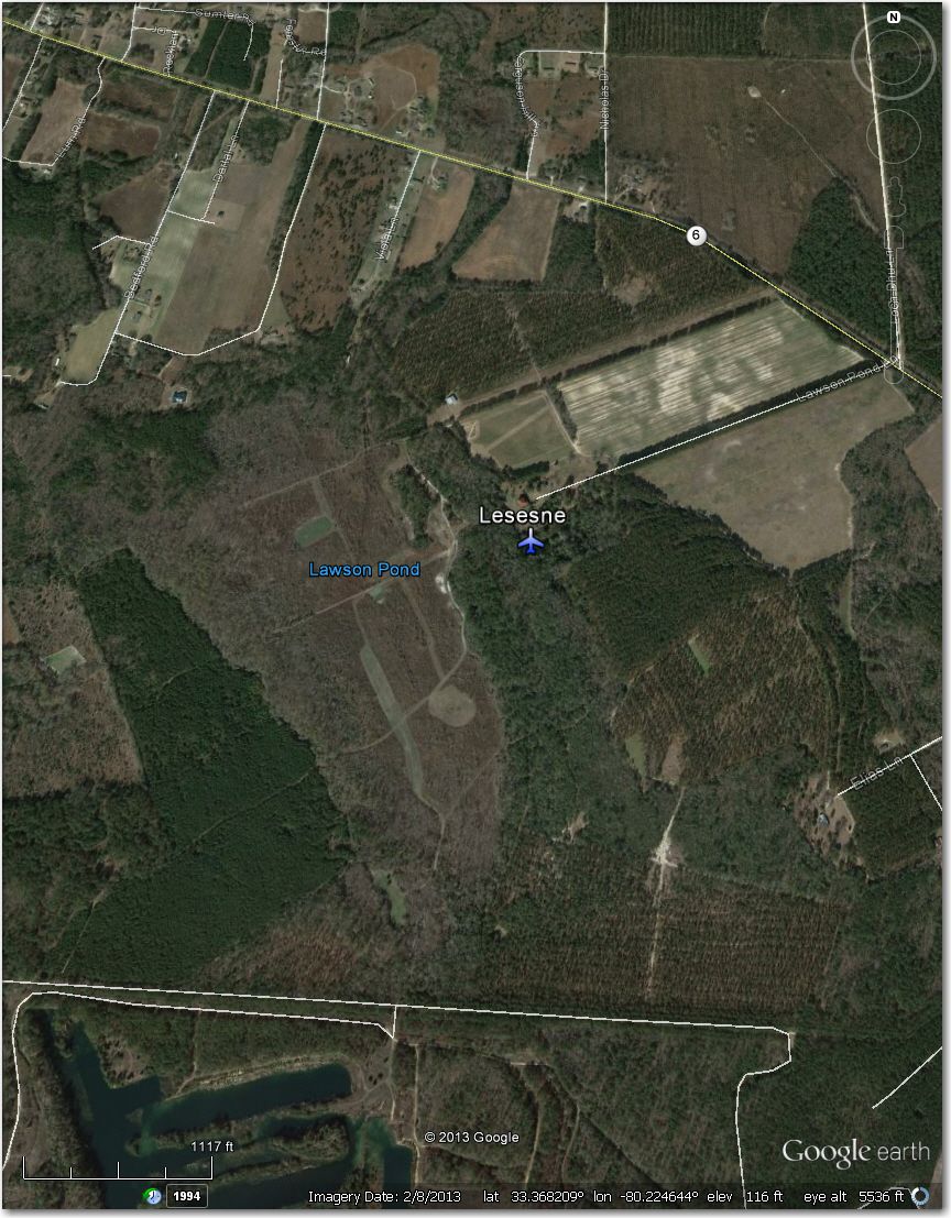
Nothing there in this 2/2013 image
LT Landing – Nothing there in this 12/2009 image
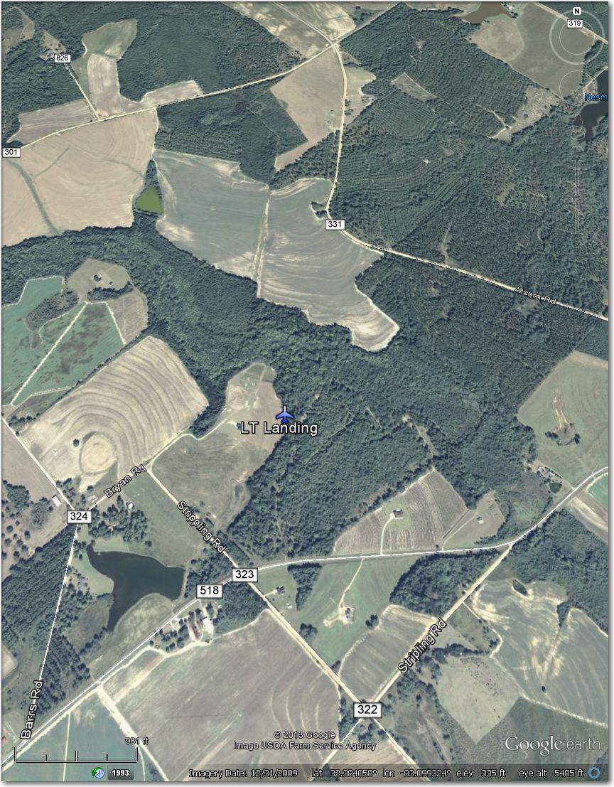
Nothing there in this 12/2009 image
Marsh Point Airstrip – An honest-to-god island airstrip! Way too narrow for even a 15m ship – better off at Beaufort County, 4 mi SW
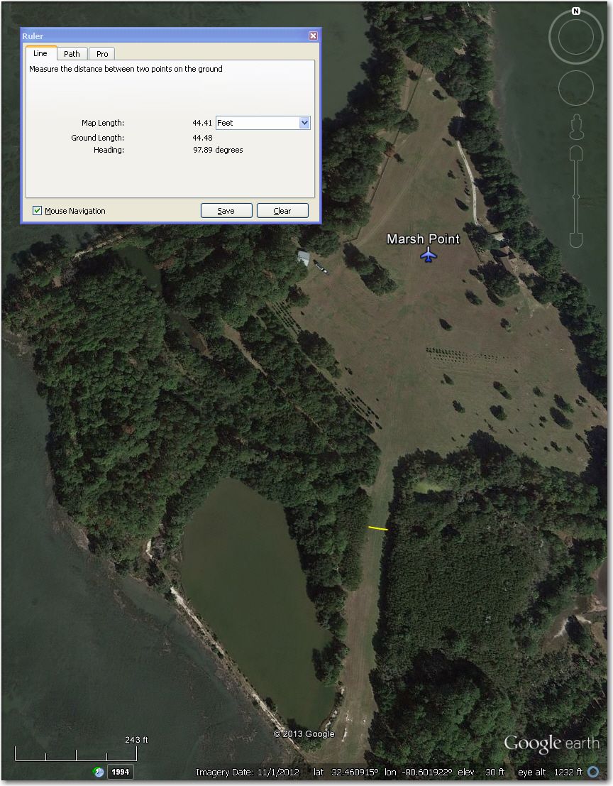
An honest-to-go island airstrip! Better off at Beaufort County, 4 mi SW
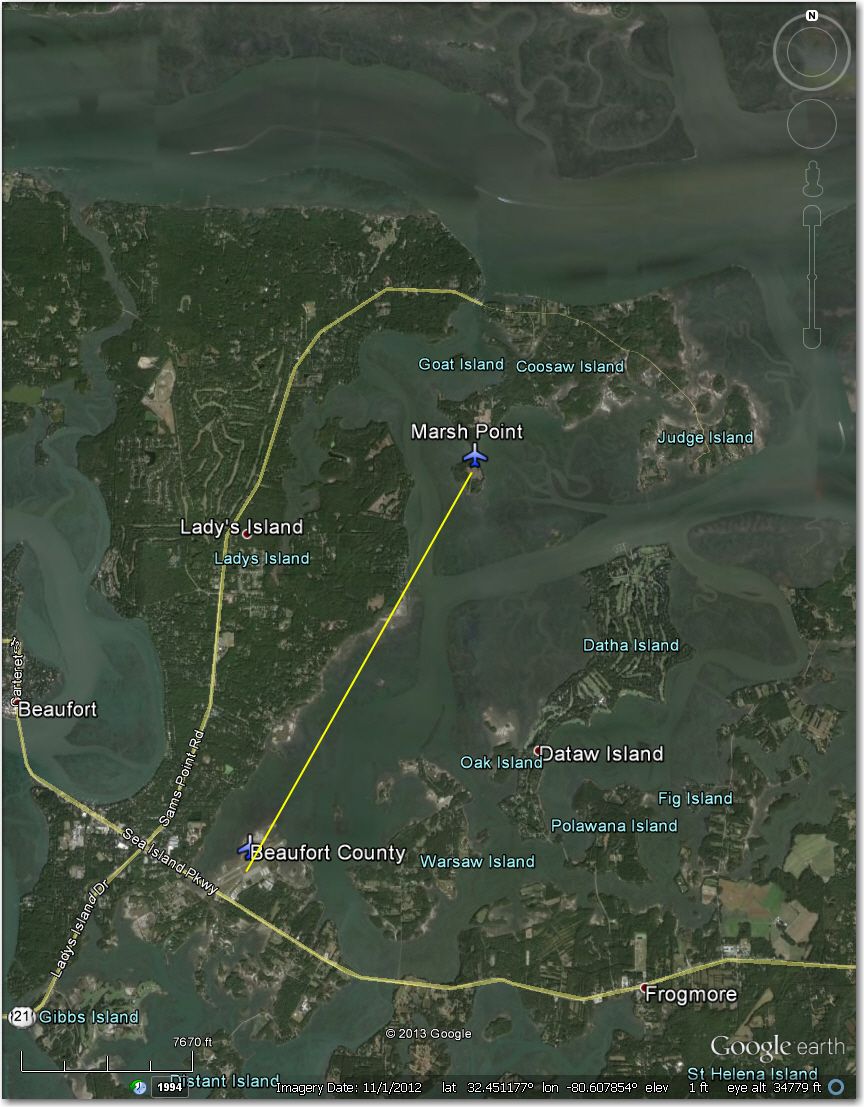
Beaufort County Airport 4 mi SW of Marsh Point Airstrip
McKay Airstrip – Long ago abandoned and turned into a housing development, as shown in this 5/2013 image.
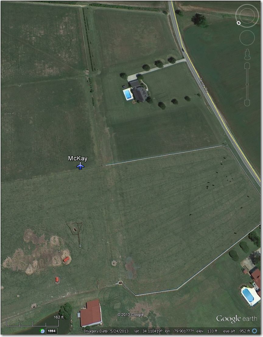
McKay Airstrip – long ago abandoned.
Northbrook Ultraport – Way too narrow and short for anything but maybe a PW5.
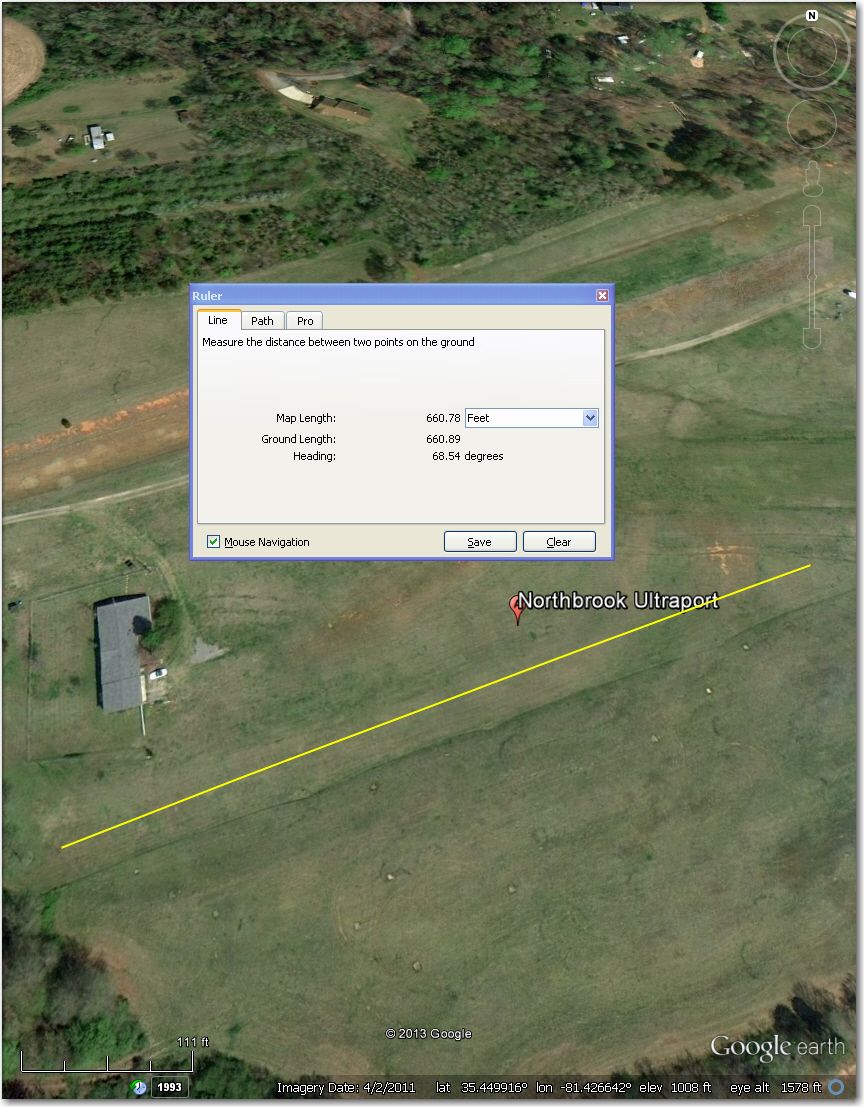
Way too narrow and short for gliders
Riverbend Airstrip – Looks abandoned, and way too narrow/short for gliders. Donaldson Center 2.7 mi NW is a much better bet.
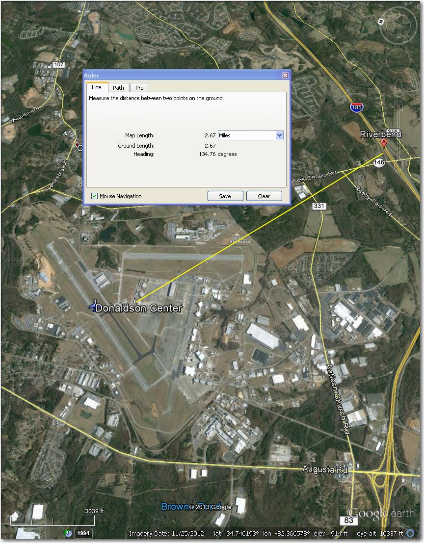
Looks abandoned, and is way too narrow/short for gliders. Donaldson Center, 2.7 mi NW is a better bet
Sexton Airstrip – Waypoint symbol is approximately 1.3 mi ESE of the actual airstrip.
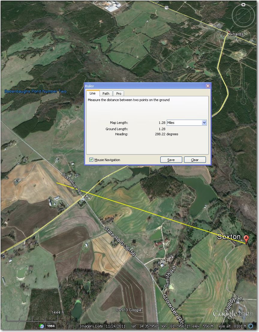
Waypoint symbol is about 1.3 mi ESE of the actual airstrip
State Line Ultraport – More a pasture than anything else. Note the cattle grazing in this 3/2012 image.
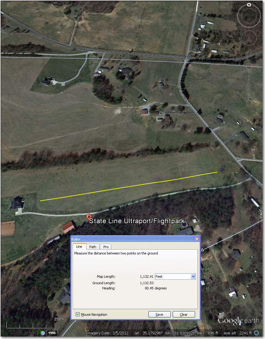
State Line Ultraport – More a pasture than anything else. Note the cattle grazing in this 3/2012 image
Sugar Hill Airstrip – Nothing there in this 10/2012 image.
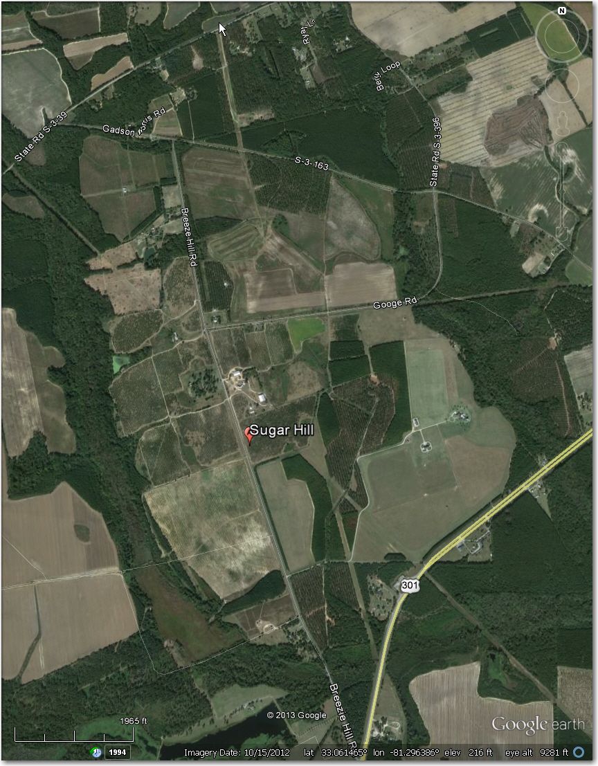
Nothing there in this 10/2012 image
West Newberry Airstrip – Too narrow for 18m when the crops are high, and marginal for 15m. Better off at Newberry, 8 mi NE.
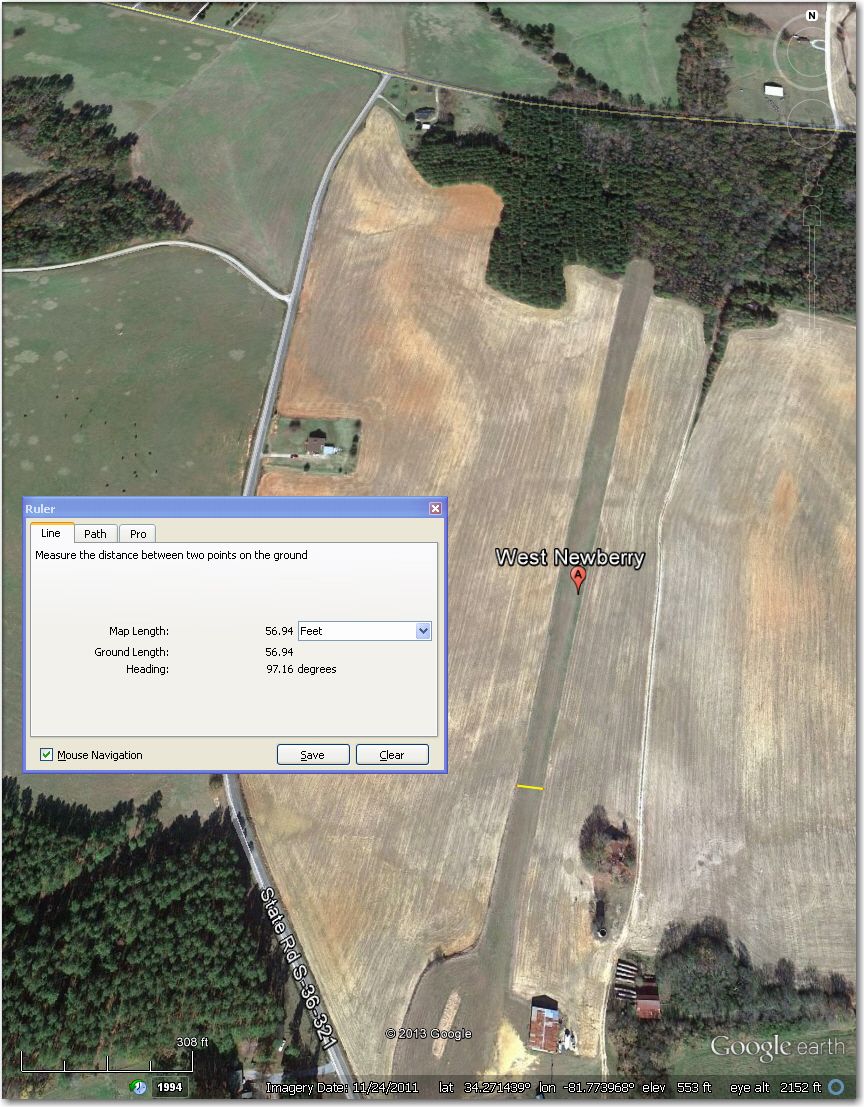
Too narrow for 18m when the crops are high, and marginal for 15m. Better off at Newberry, 8 mi NE
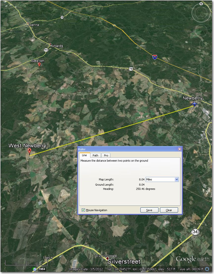
Newberry Airport, 8 mi NE of West Newberry Airstrip
White Plains Airpark – A tight squeeze for 18m (note the distance from the centerline to the windsock!). Don Bells 4.5 mi SW is a better bet.
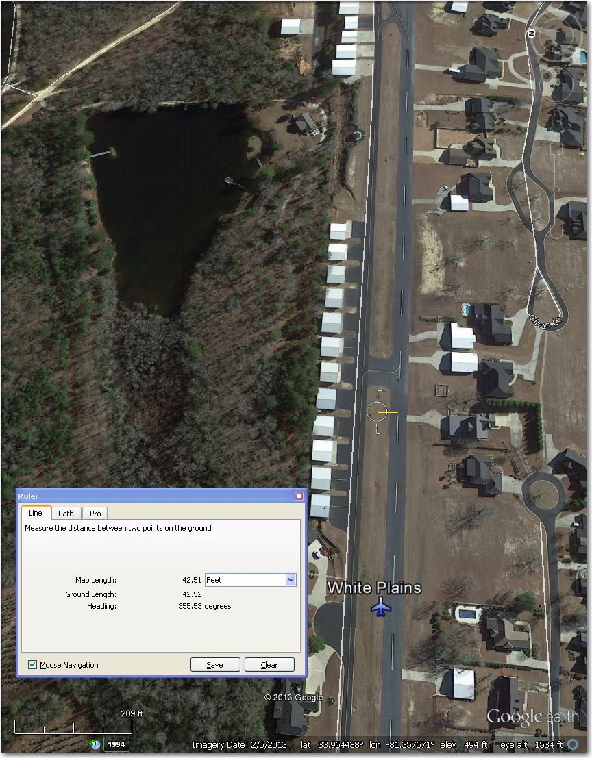
A tight sqeeze for 18m. Don Bells 4.5 mi SW might be a better bet
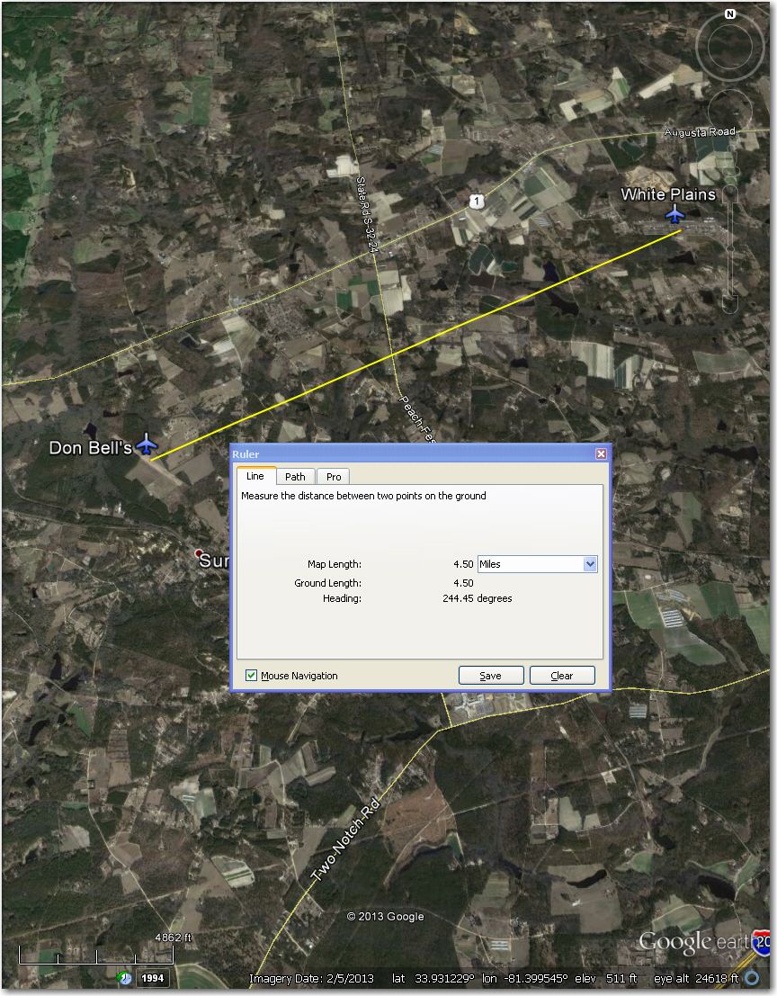
Don Bells, 4.5 mi SW of White Plains Airpark
Williamsport Airstrip – Waypoint symbol is about 0.8 mi east of the actual airstrip.
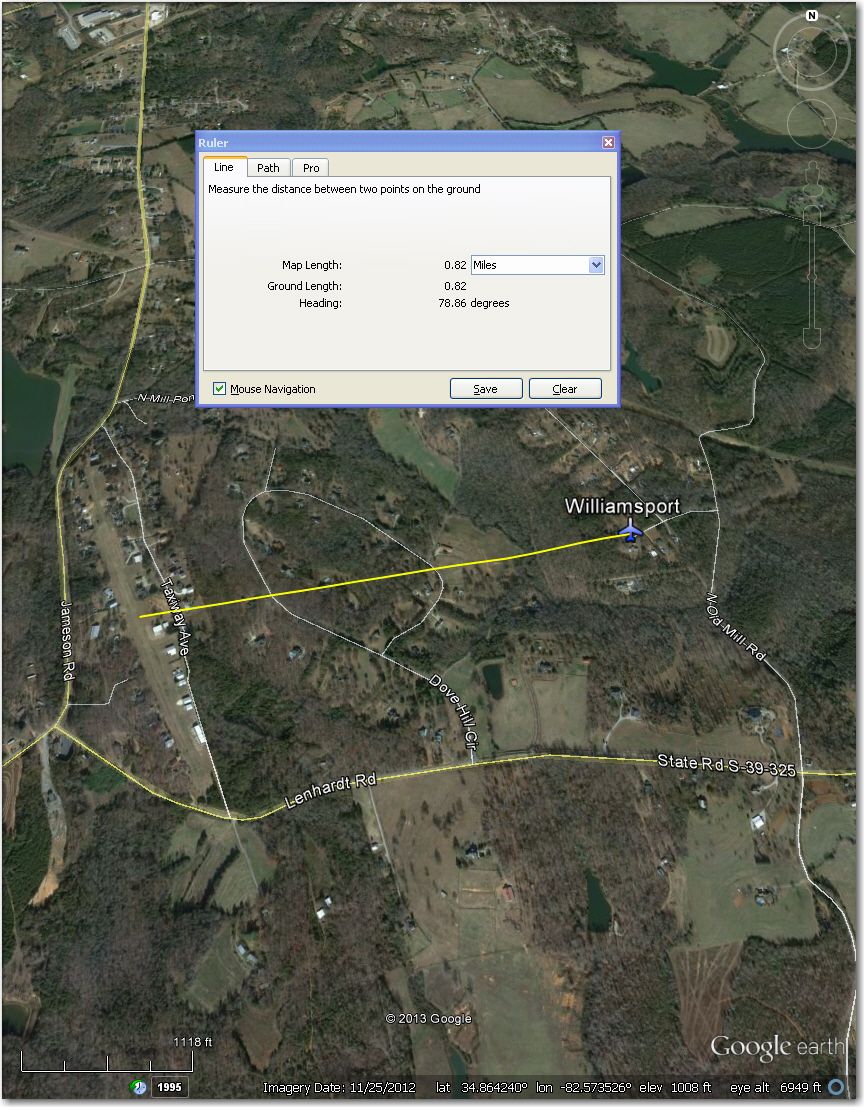
The waypoint symbol is about 0.8 mi east of the actual airport


3 comments for “Perry (Wagener, SC) Airstrip Review, Part I”