As part of my 12-step crash recovery program, I have taken a solemn vow to never go to another soaring site without first having done a thorough Google Earth review of all the airports/airstrips in that site’s waypoint database. Never again will I arrive at an ‘airstrip’ waypoint only to discover that it can’t be found or has been abandoned for years/decades!
This is my review of the Eagleville, TN waypoint database from John Leibacher’s wonderful Worldwide Soaring Turnpoint Exchange. As part of this great service, John provides a .KMZ file that displays all the waypoints in Google Earth. When I review a soaring site, I look at *all* waypoints with a ‘landable’ coding, but I only report the ones that I find missing, abandoned, or otherwise problematic (i.e. not wide enough for my 18-meter ship). If you don’t find a reference and/or image for a particular airstrip in this review, then you can safely assume that I didn’t find anything scary about it, and would be willing to land my glider there. Of course, this is all based on Google Earth images that can be as much as 2 years old, so your mileage may vary!
Frank Paynter (TA)
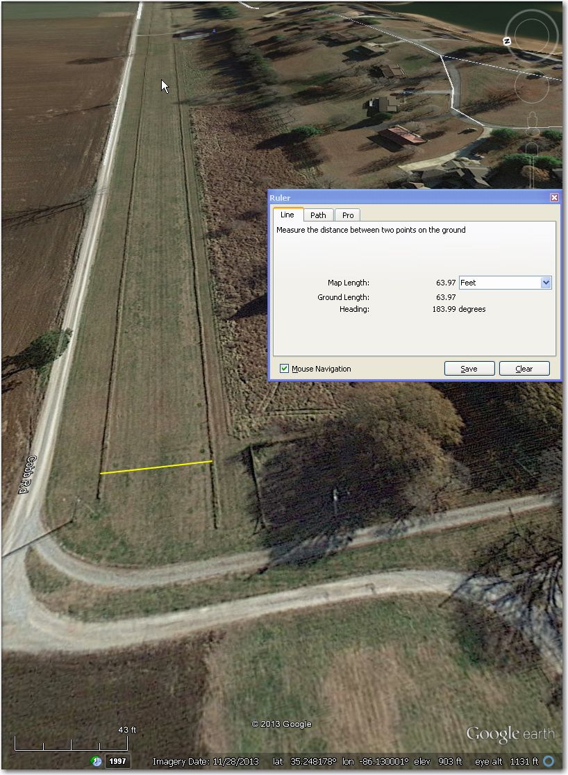
#3 Amacher Strip: Looks abandoned on a 11/28/2013 GE image
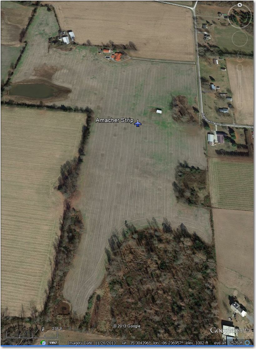
#3 Amacher Airstrip – looks abandoned
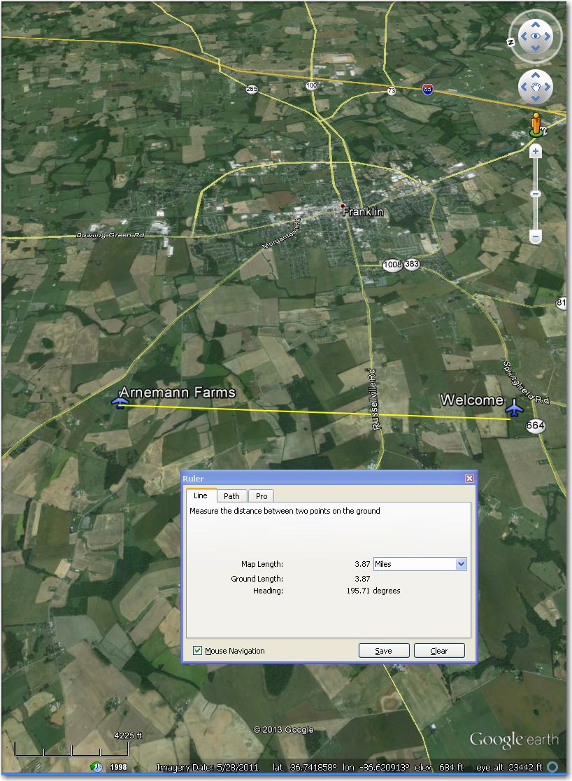
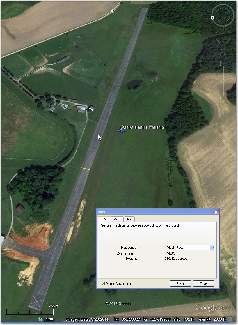
Arnemann Farms: 5/28/2011 GE image shows ‘X’s at each end – but runway still looks clear. ‘Welcome’ airstrip 4 mi east might be better bet.
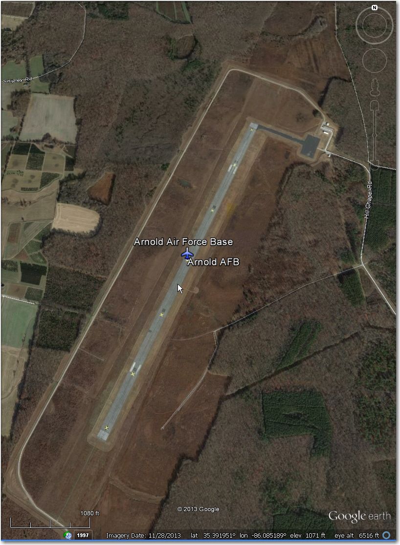
Arnold AFB: Runway ‘X’d out – might be an ‘interesting’ retrieve!
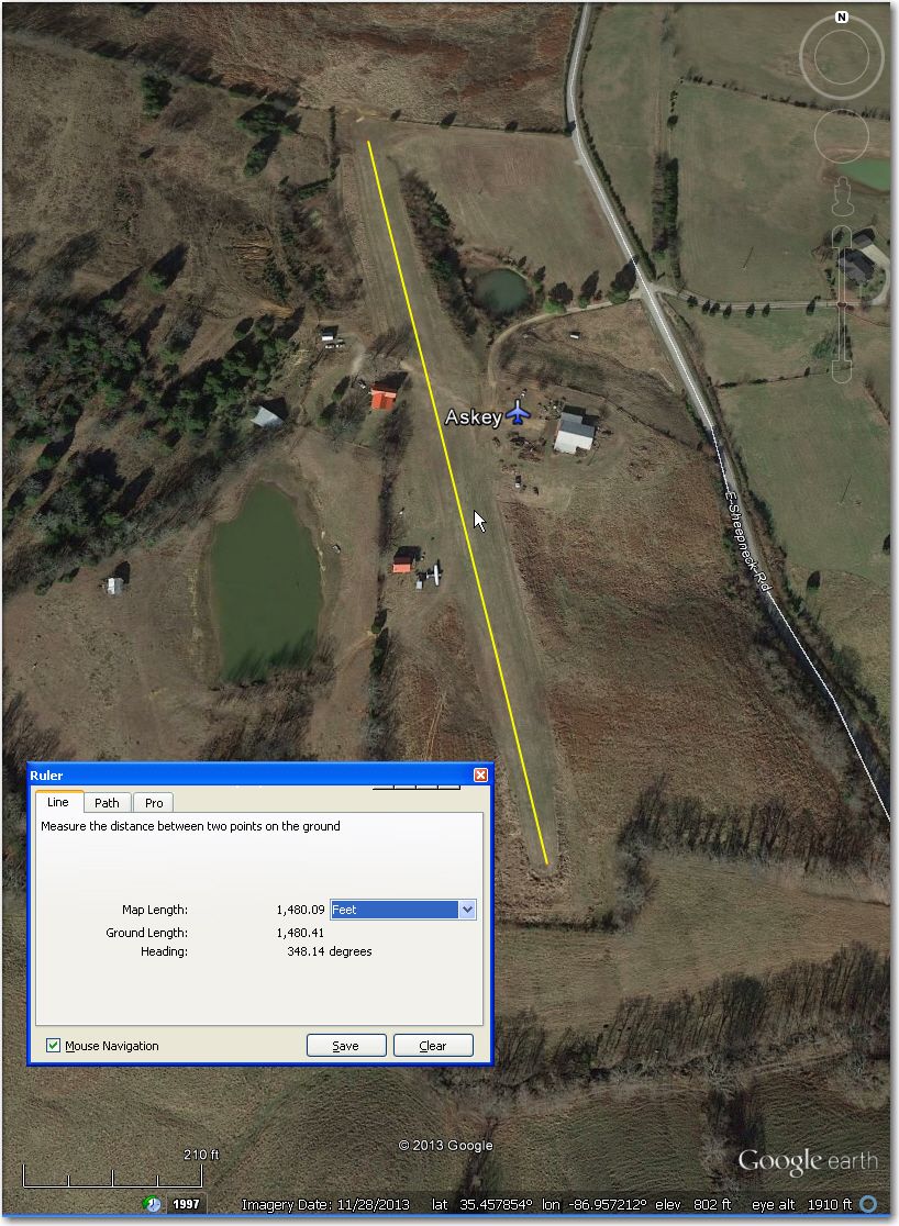
Askey Airstrip: Short, but plenty wide enough. Placed on top of a hill, so expect some slope on approach. This is a good one to keep in the database, as there aren’t many other landing options in the area.
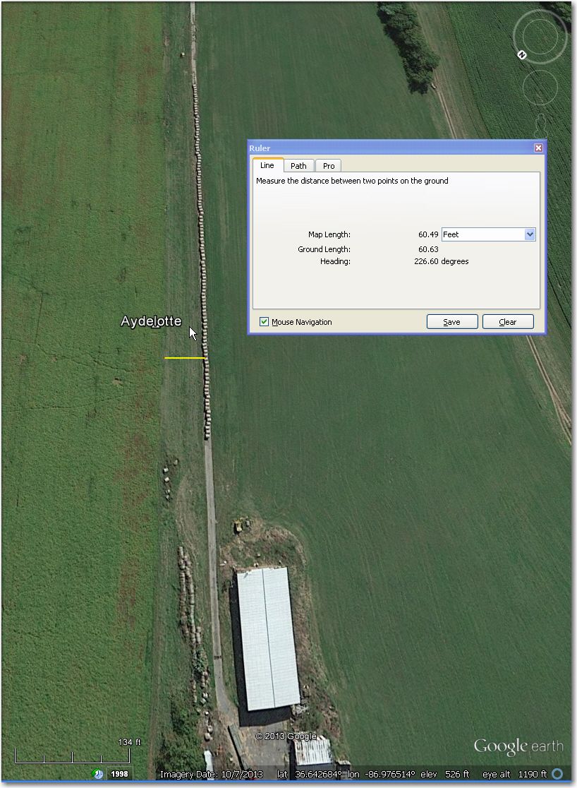
Aydelotte: Abandoned and unusable – hay bales stacked alongside previous runway area
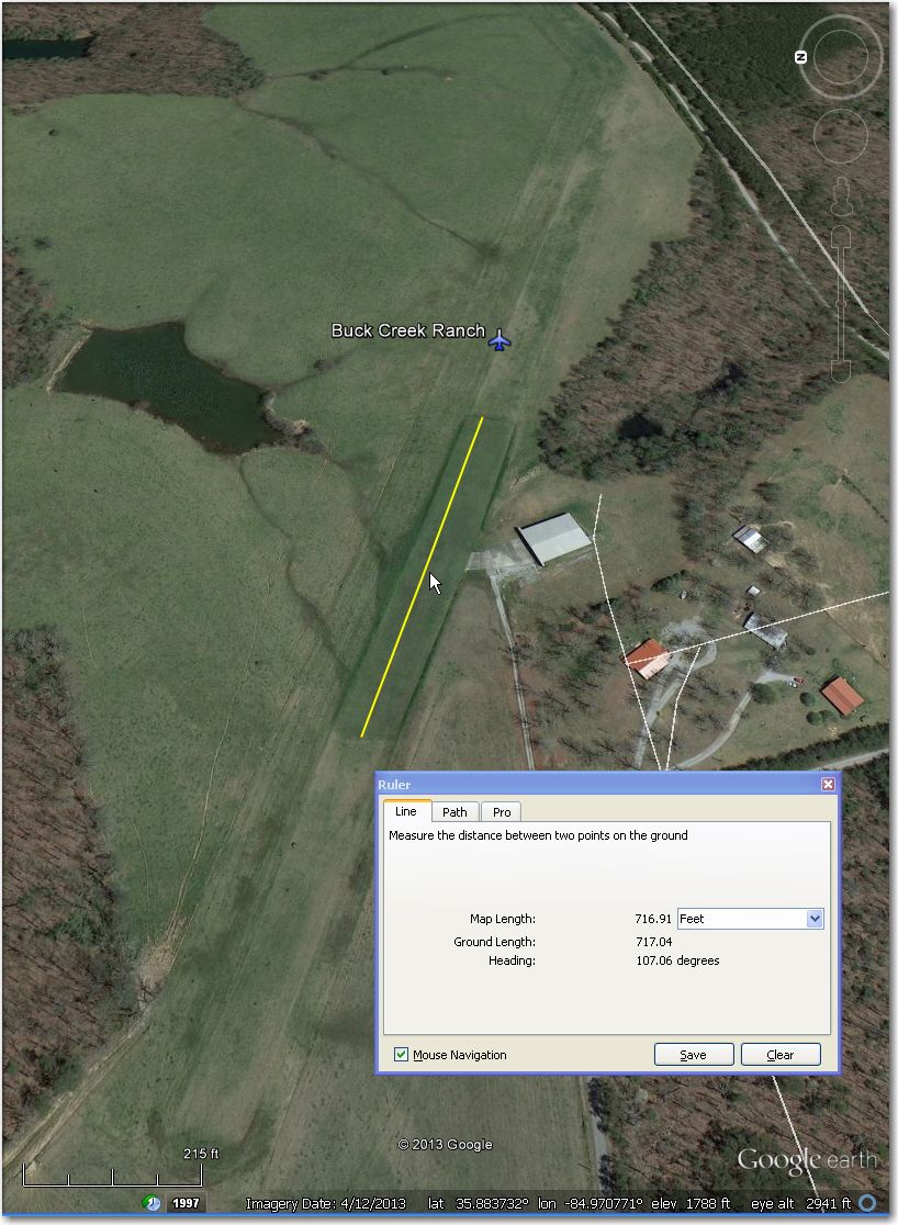
Buck Creek Ranch Airstrip: Only the center 700’ or so has been mowed recently. Plenty wide enough though
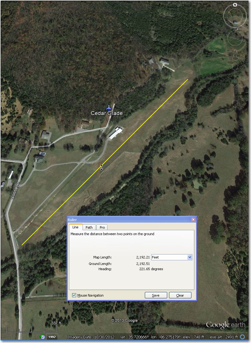
Cedar Glade: OK in length and width, but might be hard to find from the air
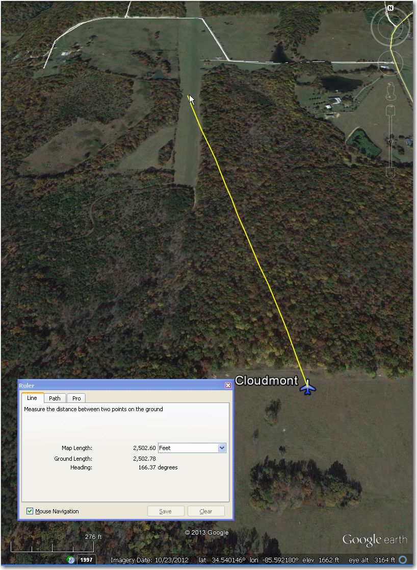
Cloudmont Airstrip: Airport is about 0.5 miles NNW of waypoint symbol. Actual airstrip location is (34.540146, -85.592180)
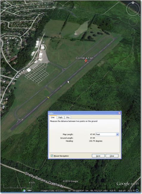
Cornelia Fort: Looks nice and well maintained, but runway is ‘X’d out. Retrieve issues there?
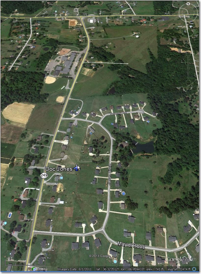
Doc Jones Airstrip: Obviously long gone – now a housing development
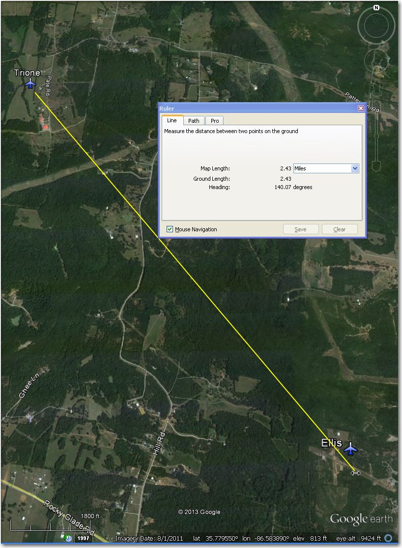
Ellis Airstrip: Either it is still under construction, or abandoned as of 8/1/2011. Trione 2.5 miles NW might be a better bet.
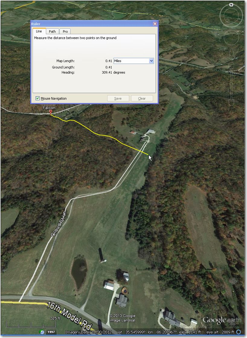
Falcon Airstrip: Waypoint symbol is about 0.4 miles NW of airstrip. Strip itself looks a bit hilly, but otherwise OK.
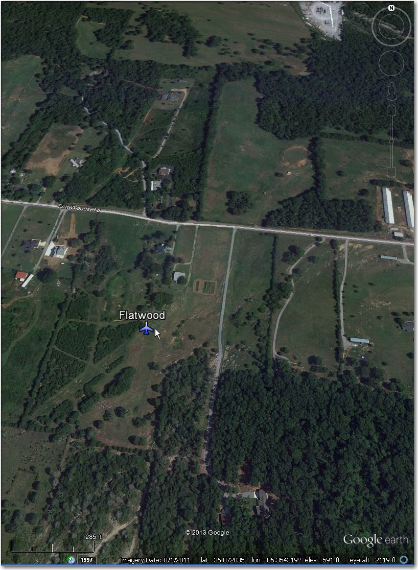
Flatwood Airstrip: Long since abandoned.
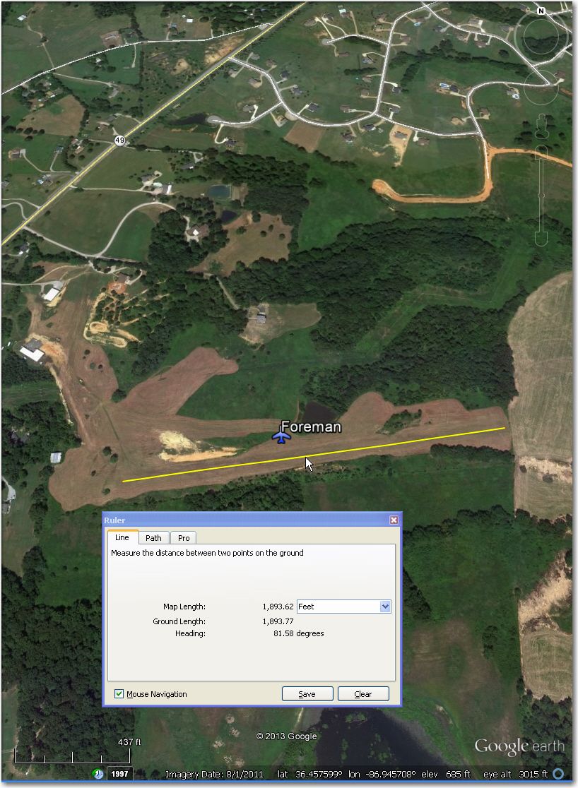
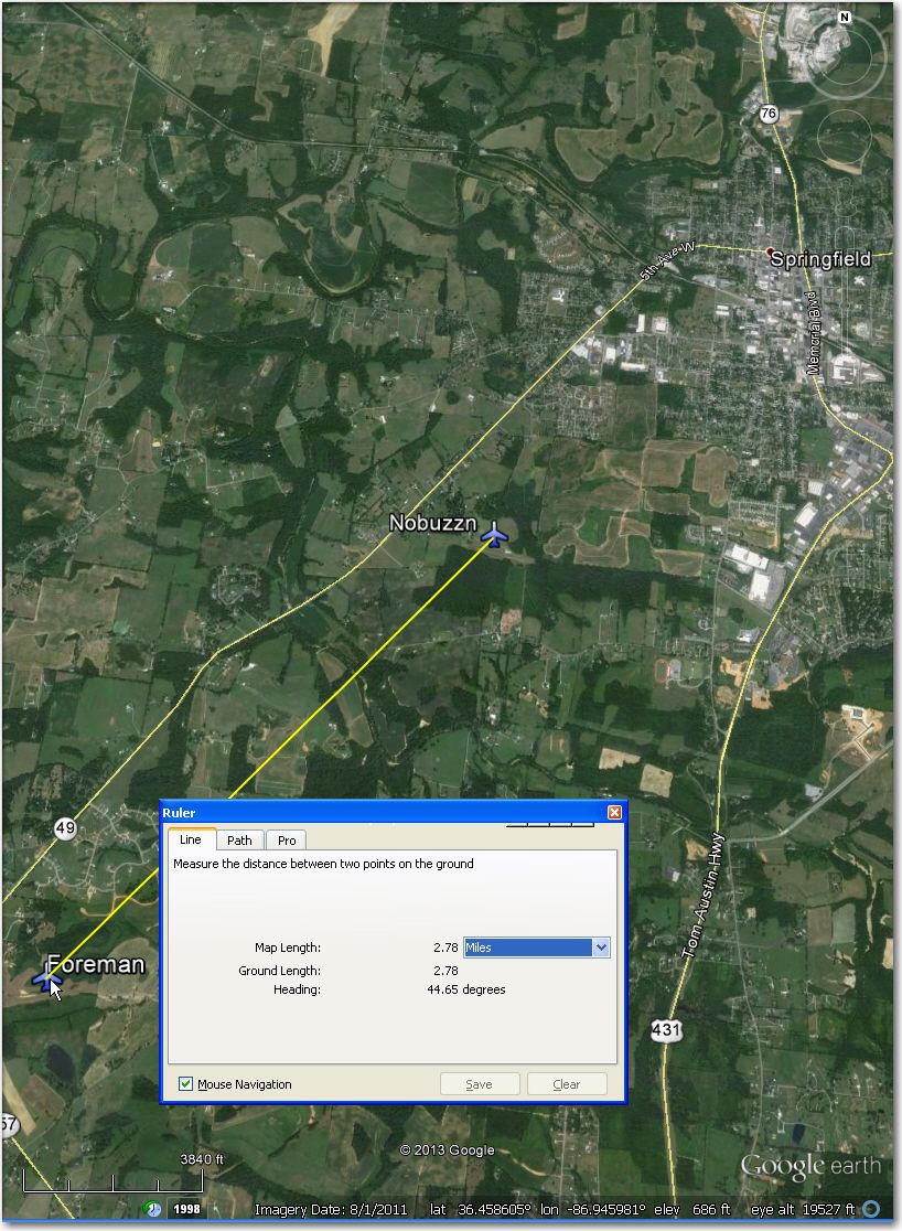
Foreman Airstrip: Looks to be under construction in this August, 2011 GE image. Might be better off at ‘Nobuzzn’ Airstrip 2.8 miles NE.
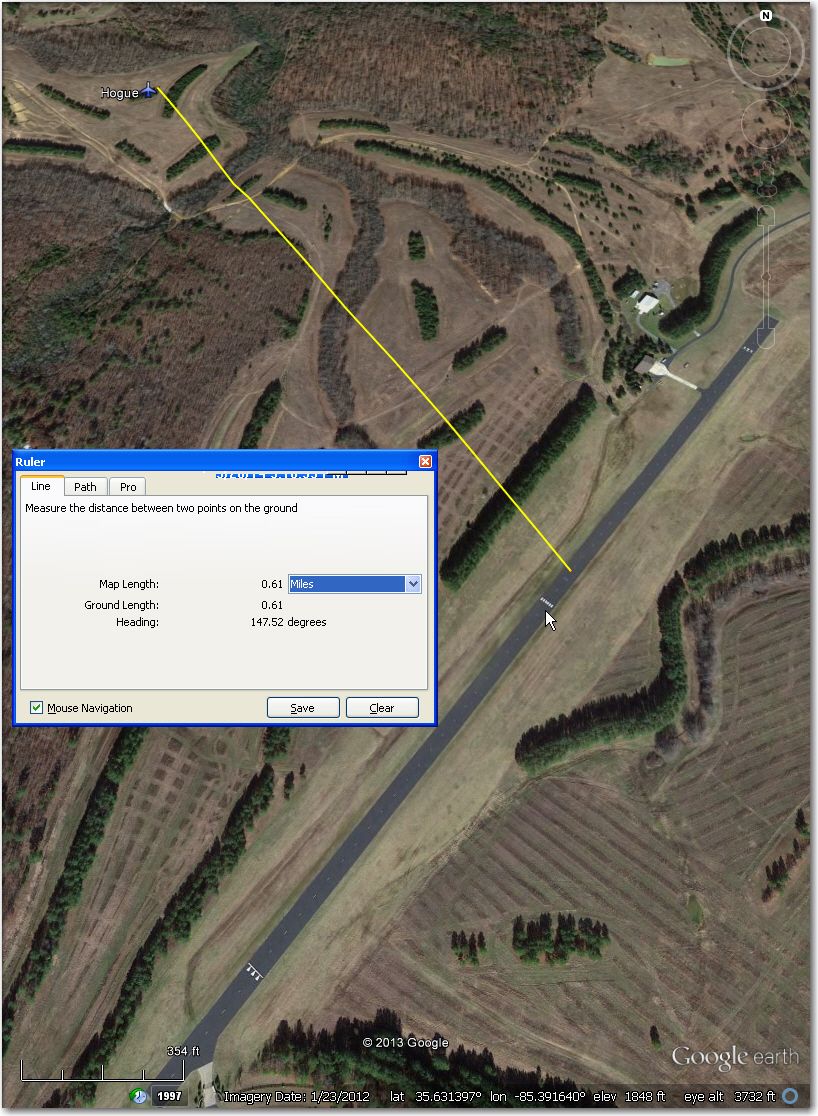
Hogue Airstrip: Waypoint symbol is about 0.61 miles to the NW.
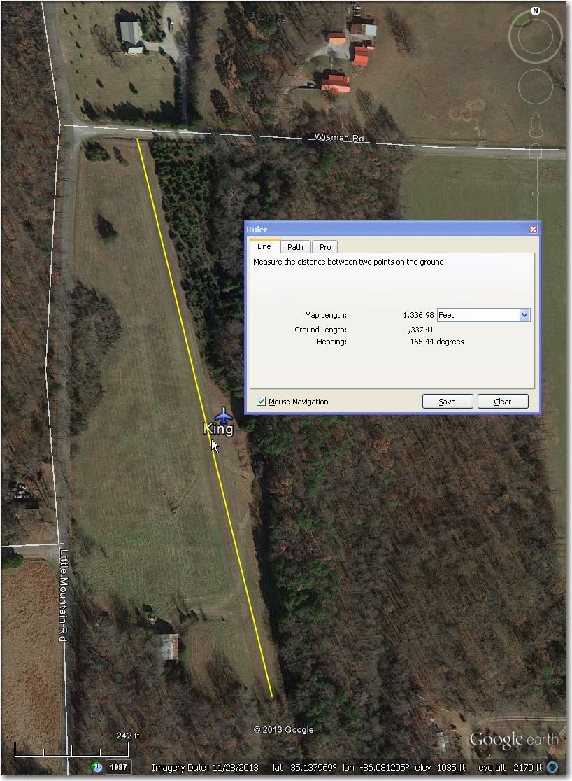
King Airstrip: Very short (1300’), with obstacles on both ends, and not overly wide, either. Better be ‘on your game’ for this one!
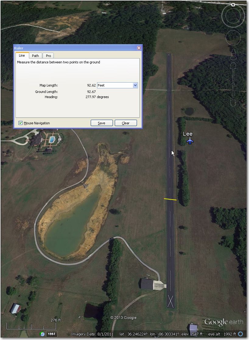
Lee Airstrip: Beautiful paved strip, but ‘X’d out. Should be OK, but…
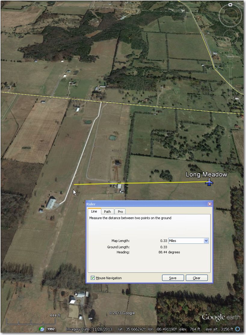
Long Meadow: Waypoint symbol is about 0.33 mi E of airport. Strip itself looks good, but might be hard to find with the displaced symbol.
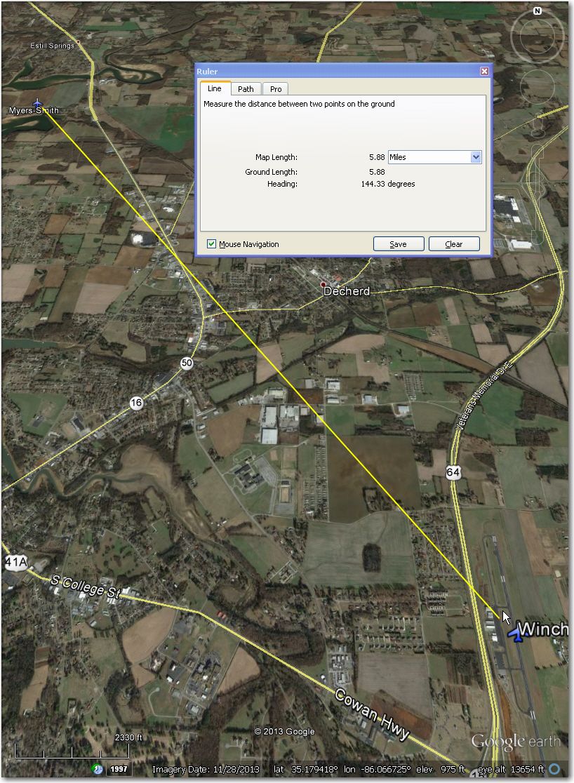
Myers-Smith Airstrip: Beautiful strip, but may be bordered by fences approximately 62’ apart. If so, would be extremely marginal for 18m, and pretty tight for even 15m ships. Winchester Airport 6 mi SE might be a better bet.
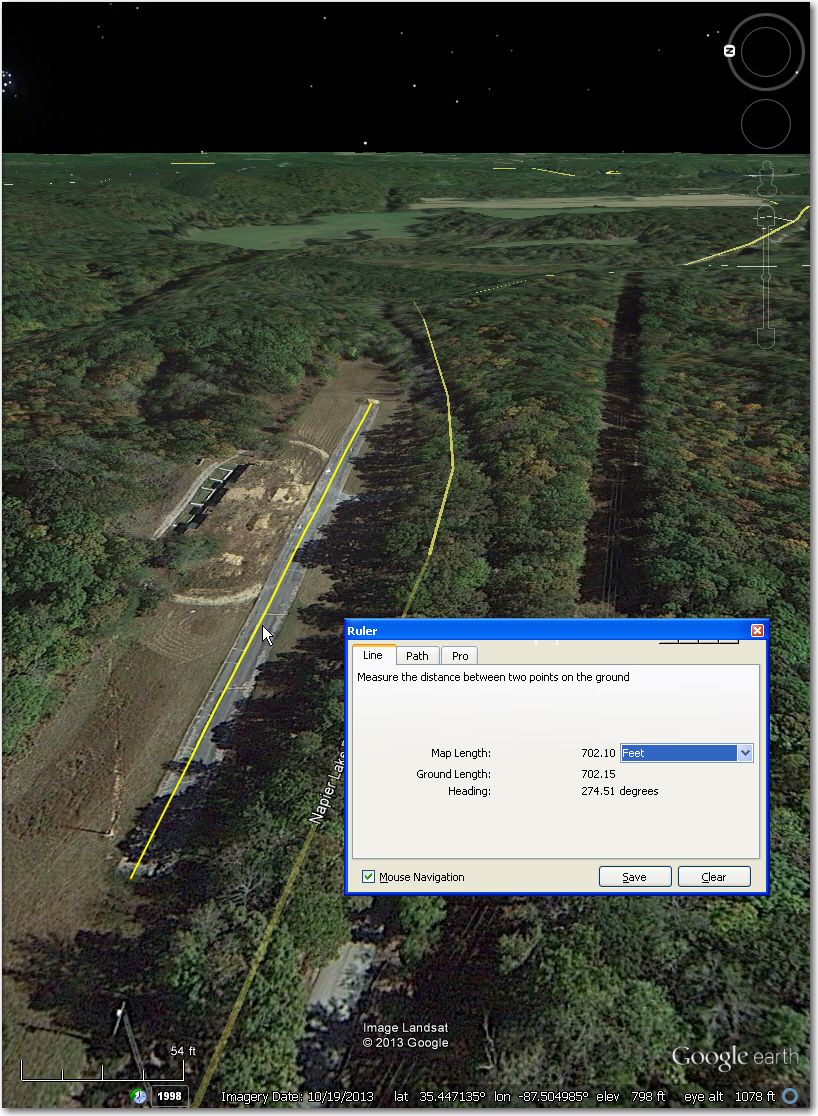
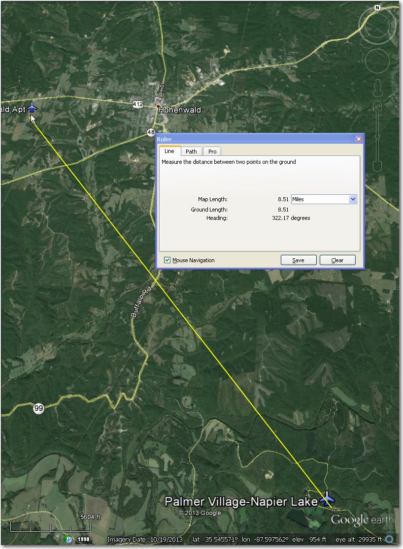
Palmer Village-Napier: WAY too short (700’), with visible power lines across south end – run away!! Much better off at Hohenwald Airport 8.5 mi NW.
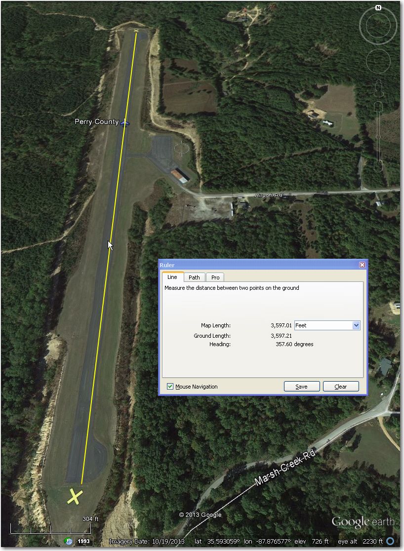
Perry County: Perfectly good looking airport in the middle of unlandable terrain, but has ‘X’s on runway in this October 2013 GE image.
Pleasant Grove: Another beautiful airstrip with a problem. This one has obvious landing lights spaced less than 50’ apart, each 200’ along the runway. May be able to land in the grass on the north side of the runway proper.
Ragsdale Rd Airstrip: October 2012 GE image clearly shows cattle or horses grazing on the strip. Might be better off at Warren County 14 NNE.


3 comments for “Eagleville, TN Airstrip Review”