Behind the scenes of Dan Gudgel’s weather briefings at the Uvalde Pre-Worlds, Walt Rogers (WX) is doing careful analysis of the numerical model outputs to extract the most useful information of the soaring day.
Two relatively new numerical models, although not fully operational, are providing excellent output and forecasts of thunderstorm convection. TheRapid Refresh (RR) has been running behind the scenes for several years and is now nearly ready to replace the RUC by October 2011. Developers at NOAA’s GSD Labs claim it’s equal or better than the RUC. The High Resolution Rapid Refresh (HRRR) cover the entire U.S. (CONUS) at 4km resolution and runs hourly. It is initialized every hour by the Rapid Refresh model.
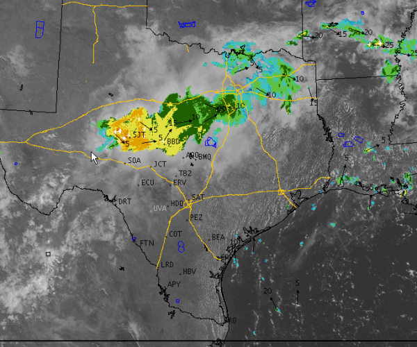
As I write this around 11 am Saturday morning, a large mesoscale complex of showers and thunderstorms extends from the San Angelo (SJT) area to the SW outskirts of the Dallas Metroplex.
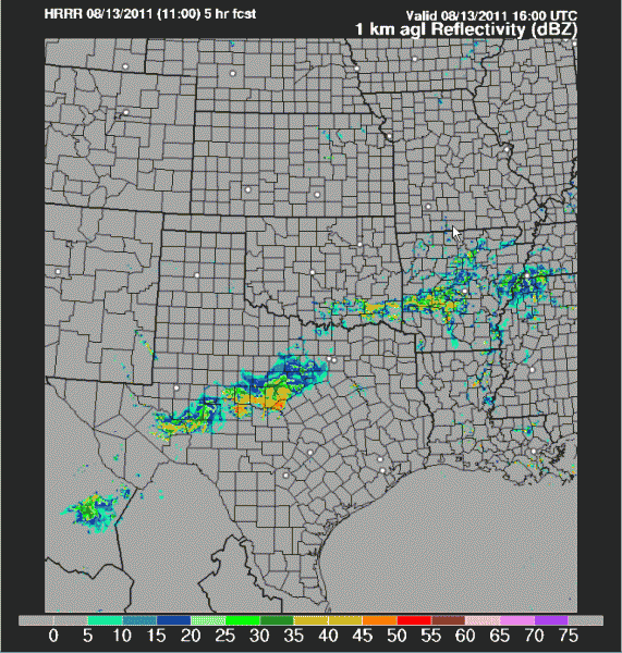
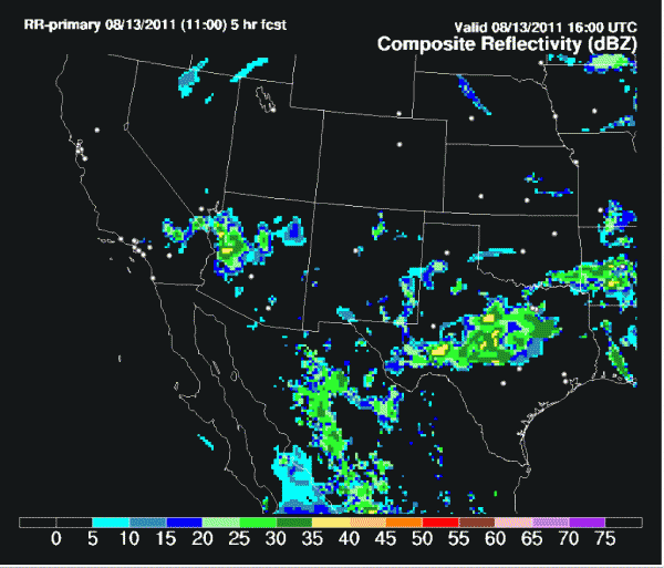
Both the RR and the HRRR show this system slowly progressing southward and dissipating by late afternoon before reaching the Uvalde and San Antonio area (HRRR). If you believe the RR, some of the showers may hold together and reach San Antonio or north edge of Uvalde. The HRRR has most of the activity dissipating before reaching the plains south of the Hill country.
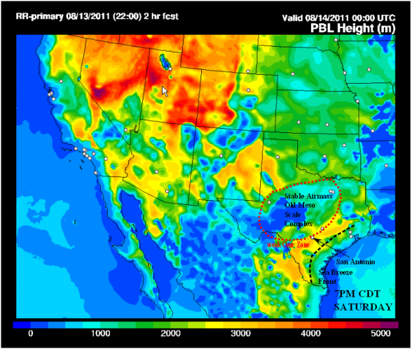
Planetary Boundary Layer (PBL) heights (Thermal Heights in meters AGL) are depicted in this graphic from the Rapid Refresh.
A large region of “dead thermal areas” can be seen in blue shades across Central Texas near the thunderstorm complex. Note the yellow “good soaring” areas south and southeast of Uvalde. The sea breeze front can be seen pushing inland from the Gulf coast.
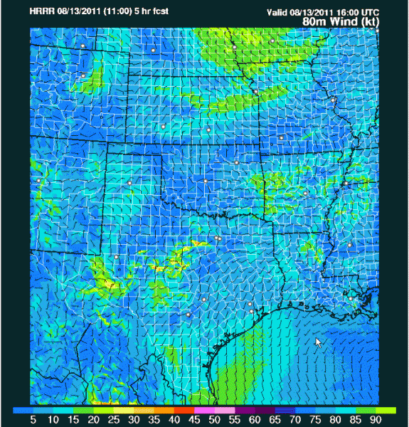
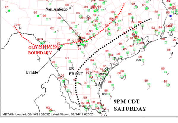
Outflow boundary winds are readily visible here from the HRRR model 80 meter winds (The wind power industry really likes to have this level!). The edge of the outflow boundary from the north is just reaching Uvalde and San Antonio by around 5pm CDT. Note the sea breeze front inland from the Gulf Coast.
The future of soaring forecasting will inevitably require examination of many model solutions (ensembles) to give a range of probability of various forecasts. Already, the Severe Weather forecasting community is using ensembles of 10 models.
You can examine outputs from both the Rapid Refresh and HRRR model here:
http://rapidrefresh.noaa.gov/R
http://rapidrefresh.noaa.gov/h
Walter Rogers
Weather Support Team – Pre-Worlds Uvalde

