Editors’ Note: We’re pleased to publish this story of a long late winter flight by Tony Condon. Less than two weeks before this flight, Tony was recognized at the 2014 SSA Awards Banquet as one of four winners of the 2013 Henry Combs Perpetual Trophy. Tony was the 2013 Henry Combs award winner in the Central U.S. division.
Over several decades, Henry Combs made a very long series of straight distance flights from Crystalaire, California in his venerable Libelle. He would take off from Crystalaire, fly as far as possible, and land. The Combs Trophy is awarded annually to the pilot in the East, West, and Central U.S. who makes the most straight out diamond distance flights in his or her zone.
Congratulations on your award, Tony, and best wishes for a continued safe and successful soaring season this year!
————————————————————————-
“Spring, Go South.” KSA members have been saying that for decades. Since well before Jim LeSeuer wrote his article “Distance in the Spring” in the March 1967 Soaring, pilots in Kansas have been watching spring cold fronts pass, watch the weather behind them closely, and occasionally chase one towards the Gulf of Mexico. Bernie Mohr followed just such a front on his flight in his modified BG-12 on April 2, 1971 from Newton, KS to Osceola, AR, a flight of 436 miles that stood as the Kansas State Record for over 40 years. Tonk Mills described a post cold front flight in the Fall in his September 1989 Soaring article, “November Flight,” when he flew 265 miles in four hours.
In my early days of Cross Country soaring in my Cherokee II I was often looking for a cold front to chase. While almost all my flights in the Cherokee were downwind dashes, none of them that I remember were post frontal, and my best distance flown in Iowa was about 100 miles. After moving to Kansas my flights got longer but that elusive cold front just hadn’t worked out. Steve Leonard, Andrew Peters, and I would spend each spring analyzing the upcoming fronts and then watching them go by while viewing weather satellite pictures from our desks at work. It seems that these fronts tend to happen Monday through Friday.
Since I have been liberated from desk duty for the time being, I had one roadblock out of the way to attempt a flight. The week before the flight I had noticed strong north winds forecast for the Talihina, OK area on Wednesday and hoped that it would be reasonable to get a tow plane there for a long day of ridge soaring. After John Wells gave an excellent presentation on Saturday night about soaring weather, I realized that that cold front on Wednesday just might bring good thermal conditions. I contacted John on Saturday night to get his thoughts on the weather. On Sunday I asked him if he’d like to chase me. The forecast indicated that the soaring would definitely be good and with a due north wind. I started looking at routes down towards Dallas and further on and started working on getting everything ready for a potential flight.
On Monday, I arranged with John and KC to chase. It was a big relief to have a good experienced crew available, and well in advance of the flight. Leah and I went down to Wellington after work to assemble the glider, our Standard Cirrus “Kate”, and I hoped to change the tires on the trailer and do some other work. We got the glider assembled and in the hangar and then spent the rest of the evening repairing the lights on the trailer. The forecasts still all looked good although without as many clouds as I would’ve liked.
KC and John, “Kate Ground”
On Tuesday morning, Steve sent an email out about the weather. It looked pretty good for a “go south” flight and it was good for me to know that his opinion on the weather matched mine. I returned to Wellington and with help from my partner, Rafael Soldan, we repacked the bearings on the trailer and put new tires on it. I also did as much prep work on the glider as possible so that I could minimize the number of preflight tasks required on Wednesday. The cold front arrived in the early afternoon with wind gusts in Wichita recorded at 53 mph. I was sure glad the glider had already been assembled and was safe and sound in a hangar. The forecast updates were showing a more northwesterly wind and I was starting to wonder about the possibility of soaring to the Talihina area and using the ridges there to extend my distance. On Tuesday night, Randy Teel posted a wind forecast on the Talhina Soaring Facebook group and wished that he wasn’t busy with airline simulator training that week. I mentioned I was hoping to fly there from Kansas and he recommended a turnpoint to join the west end of the ridges, near Daisy, OK. I had never flown that far west on the ridges there and his information and shared experience was important in bolstering my confidence in the route.
On Tuesday night I confirmed with John and KC that we would meet at my house at 9 AM to head for Wellington. KC had a lot of confidence in me as he said he would pack an extra pair of clothes in case we ended up at the Gulf of Mexico. Optimism—I like it. I spent the rest of the night getting batteries charged, looking at forecasts, finding maps and developing a task for the day. I decided that a launch at noon would be about right and set a task from Wellington to Cochrane Ranch airport near Daisy, OK and then to the Three Sticks monument on the Kiamichi Ridge and then to Texarkana, TX. Total distance was 360 miles. I figured 6 hrs at 60 mph would be a spectacular flight for March 12th, but decided to declare big or go home. Since I have never flown south of the ridges I also spent some time looking at the route between Three Sticks and Texarkana. There are a lot of trees down there, but an airport at De Queen, Arkansas was about halfway, which made me feel better.
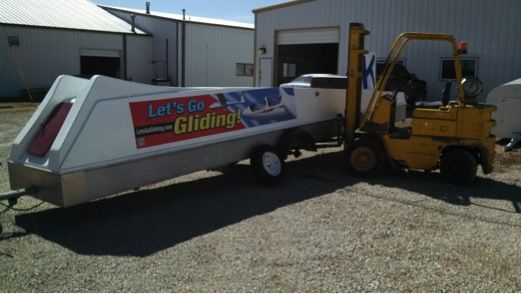
Some work required to be ready to fly
On Wednesday morning I made a quick check of the forecasts. Everything looked the same, the sounding still showed that noon would be a good takeoff time and the forecasts still showed clouds until Interstate 40 with a slight chance of clouds after that. Further east into Arkansas the clouds might extend further south, so I felt that my plan of cutting east on the ridges was a good plan. As we drove towards Wellington, the first flush of low altitude cumulus arrived. The mood in the car was pretty high. It didn’t take long to get the glider ready. Rafael asked me to bring the towplane over and after some searching we found the plane and discovered that its battery was dead. No fear though, Air Plains had a cable for jump starting. Whew! I pulled the glider out about 11:30 AM and could see the first cumulus wisps on the horizon. Good timing. Mike Logback texted me at 11:45 AM to let me know that there were cu in McPherson, northwest of Wichita. KC and John got the towplane started and I launched at 12:14 PM, just as the first cu wisps were arriving over Wellington. Perfect timing.
I found lift immediately off tow, went through my start line, and told Kate Ground to head out. They had just finished hooking up the trailer and were on their way. I tiptoed very carefully at first, taking any lift going up and waiting for the cloud field to develop in front of me. I had had several flights in the Cherokee where I pushed out too hard to start and spent the rest of the afternoon watching a beautiful soaring day go by. I was not going to repeat that mistake! By the time I crossed the Oklahoma border the sky looked much better and I was usually between 4,000 and 5,000 feet. About an hour and a half into the flight I got the first really good climb, 4.3 knots to nearly cloudbase at 6,700 feet.
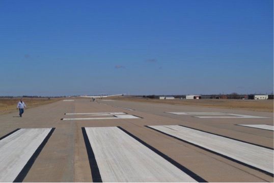
Liftoff. Note Cu wisps.
The clouds were not streeting so I couldn’t take advantage of long straight runs. I was still flying pretty carefully, as I’ve had a lot of experience trying to dig out from low spots on windy days in torn up thermals, and I preferred not to add to that experience. The 20 mph wind was blowing right down my course line so I figured even a weak thermal was still allowing me to make good progress on course and was worth taking.
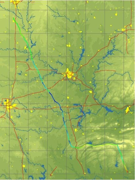
I passed Interstate 40 west of Henryetta as the clouds started to thin. Bases had been rising and the clouds had been getting thinner and thinner. Beyond I-40 there were just a few faint wisps or haze domes and solid blue beyond. I was initially inclined to turn more east and follow the clouds, but out in the distance to the east the clouds didn’t really look a lot better. There had been a series of large fires with more on course in the blue and I was confident I could find lift in the blue. So I stuck with the task. Shortly after that I had my last radio communication with my crew. A few climbs from fires allowed me enough altitude to make it to McAlester. Nearing McAlester I saw no more fires but blundered into a good climb that gave me enough altitude to make the turnpoint. Alright! Shortly thereafter, I found a 4.7 knot climb that got me back up over 7,000 feet with plenty of margin to get to the turnpoint and get down on the ridge.
I joined the ridge east of Daisy. With the strong surface wind it was not a challenge to maintain over 1,000 feet above the ridgetop. I passed by Sardis Lake as the ridge 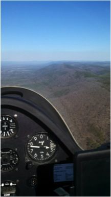 turned east and took three turns that averaged 6.5 knots, which made the gap at Clayton no sweat. I joined up with the familiar Kiamichi Ridge and ran east to Three Sticks. The ridge leg was a piece of cake and gave me plenty of time to game plan for the last leg of the flight. Ideally I wanted to get a really tall climb right at the turnpoint, at least get high enough to make De Queen and then hope to find another few climbs to make Texarkana. There were still thermals coming off the ridge so I hoped that the day still had something left.
The plan worked partially. I found a good thermal right at the turnpoint and took it to 6,400 feet, which wasn’t quite enough to make De Queen. However the thermal was dead, so I set out. I soon found another climb, which was very weak but was going up, so I held on as long as I could. I gained 1,300 feet and drifted five miles and my Oudie now said I could make De Queen at over 1,000 AGL. I set out and found a spectacular river of sink in the blue and the margin started to disappear. Landable fields were few and far between, but there were a few and I was pretty happy to find some zero sink about seven miles away from the airport at 1,500 AGL. I didn’t gain much altitude but drifted a mile-and-a-half and was in a much better place. The last few miles presented no problems and I was happy to land at the airport in De Queen, even if the runway was straight across the wind. Task distance worked out to 318 miles in 5.5 hours. A good day!
The airport was equipped with a nice leather recliner, so I relaxed and started to catch up on several texts and emails that I had received during the flight. Word had gotten out thanks to my friends notifying the world on rec.aviation.soaring, Facebook, and by email, and several people had been following along on the SSA Sailplane Tracker. I contacted my crew and they were about two hours behind in Talihina after having some trouble finding a good route through the ridges in SE Oklahoma. They arrived shortly after sunset, the local Sheriff’s Deputy let them in the airport, and we were on the road a little after 9 PM. We arrived back in Wichita at 4 AM and I was wide awake riding the high of a great flight for at least another hour.

Greetings from the airport at DeQueen, Arkansas!
http://www.onlinecontest.org/olc-2.0/gliding/flightinfo.html?dsId=3486851


1 comment for “Spring … Go South!”