Yesterday was a rain day at the Seminole Gliderport (SGP), so John Mittell (BZ) and I spent some quality time touring possible landing fields in preparation for the upcoming 2014 Seniors contest.
Although the SGP soaring area is pretty benign in general, the last few miles coming into SGP can be ‘interesting’ (especially from the west!) if you find yourself in a marginal final glide situation. From the south and north there are airports around 10-12 miles away, but the landing options in the last 3-5 miles are somewhat dicey. Also, here in the middle of Florida’s cattle country, many fields contain cattle (a potentially bad thing) and most fields are fenced with locked gates (another potentially bad thing). Cutting locks is considered a serious felony under Florida law (a VERY bad thing!), so retrieves can be a real adventure.
After spending some time in Google Earth, poring over possible landing fields and recording their coordinates, we had a list of half a dozen or so possibilities, so off we went in my big red F-150 pickup to play Florida ‘cracker’ on the backroads and byways. At one point we found ourselves deep in the pine forests on barely navigable and muddy back roads, and I would swear I could hear banjos playing in the background!
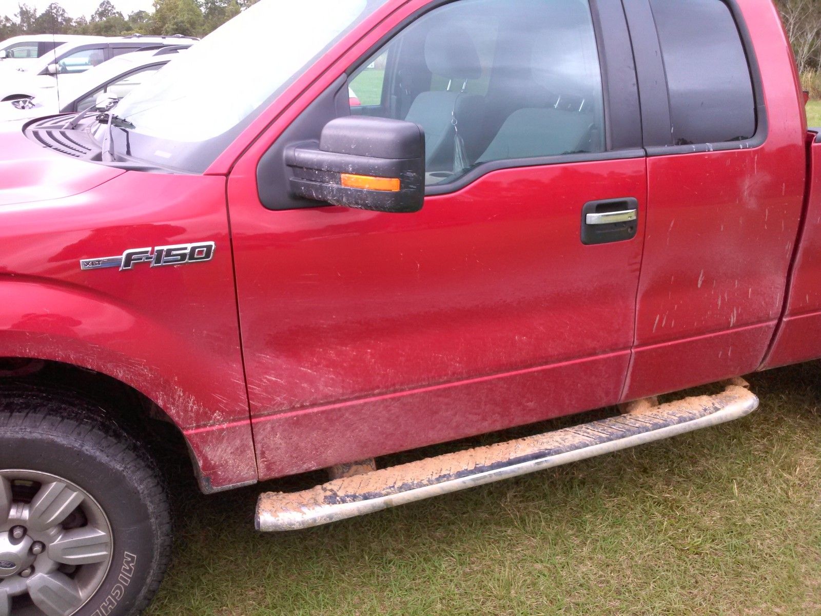
TA Crew After Florida Backroads
South Abort Fields:
Coming from the south, the last good landing site is about 13 miles away at Flanders airport. To get home from there you need about 3000′ msl, maybe more like 3500-3800′ msl if you want to get home above the min finish altitude of 700′ agl at 1 mile. On a weak day it may not be possible to get to that altitude, so you may be forced to either land at Flanders or take a chance on finding some additional lift on the way home. There is an airstrip at the Frazier quarry, but it is fairly far off course to the east. We found a good field south and west of Frazier, about halfway between Flanders and SGP that looked like a good anchor point for south arrivals, and we dubbed this ‘AS2 Van Fleet, as shown in the following Google Earth screenshots.
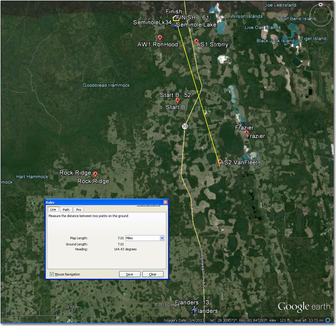
The Van Fleet Rd field location, about halfway between Flanders at the bottom of the photo and SGP at the top

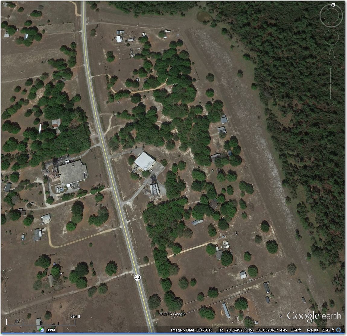
Aerial view of the Van Fleet Rd field, at the corner of Van Fleet Rd and ‘Crash Creek’ Rd.
The field is located at the corner of Van Fleet Road and ‘Crash Creek’ Rd (I kid you not!), and appears to be every bit as smooth and flat as SGP itself. It also does not appear to be fenced for cattle – a great plus. The gate off Van Fleet controls a long driveway to a house at the far north end, and the gate itself appeared to be unlocked – a *big* plus! This one is a keeper!
We also inspected a field right on rt 33 at the two microwave towers and at about the same distance out as the Van Fleet field. We have both actually landed at this field in years past, and although it looks a bit narrow, and has some ruts from heavy truck traffic, it is (or was last year at least) perfectly usable. We checked the access gate at the north end of the field, and it is still unlocked (yay!)
Note two microwave towers (one on each side of Rt 33). Field is oriented N/S on right side of photo, access is via gate off Rt 33 at north end
We also closely inspected a close-in field that has been recently converted from grazing land to a crop field (looks like strawberries or something similar). The good news is that the previous fencing has been removed, so access is no longer an issue. The bad news is that it has been heavily furrowed in an east-west direction, so landings would have to take that into account. Also, irrigation drip-line hoses have been strung along the furrows with 3-4″ diameter fabric cross hoses feeding the drip lines, and a power line now runs from the south side to the center of the field. Although this sounds ‘gnarly’, the field is still perfectly suitable as an abort field as long as the landing is conducted along the furrows, Its location (about 1.3 miles southeast of SGP) might make it a literal ‘life-saver’ at some point.
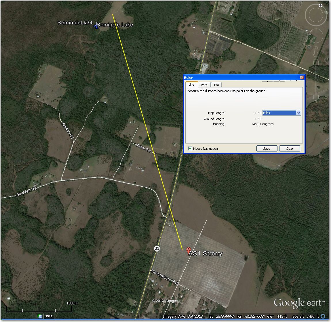
Strawberry Field about 1.5 miles southeast of SGP
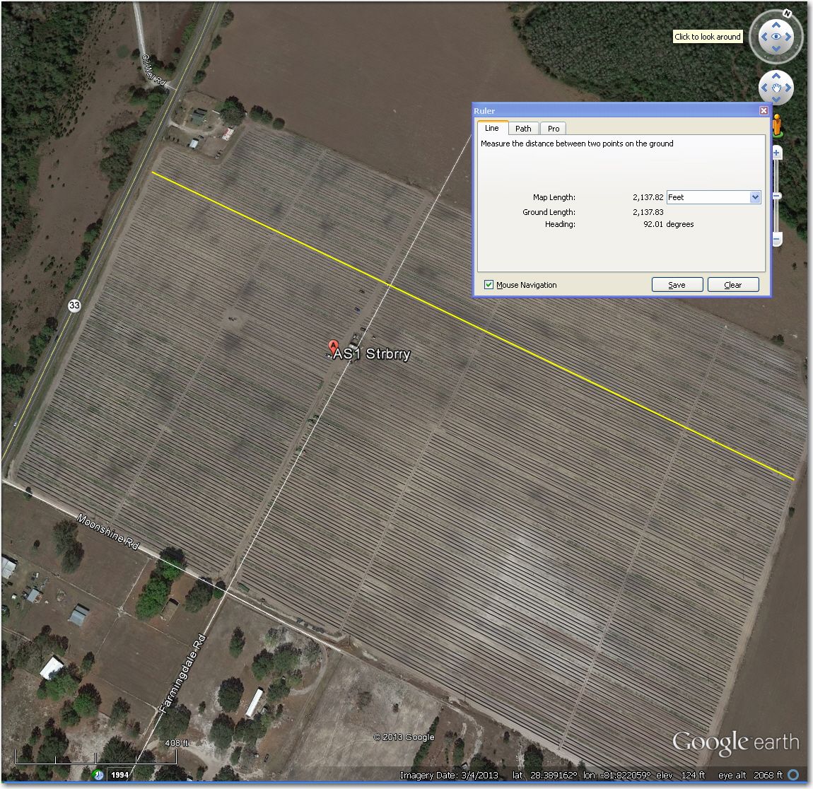
‘Strawberry Field’ about 1.5 miles southeast of SGP. Best landing lane is along the yellow line
North Abort Fields:
Coming in from the north, there are a fair number of decent fields along rt 33 between Osborne airstrip (about 10 miles out) and SGP itself, so the challenge is to find fields that don’t contain cattle and that don’t have locked gates. We wound up with three very good candidates, as shown below.
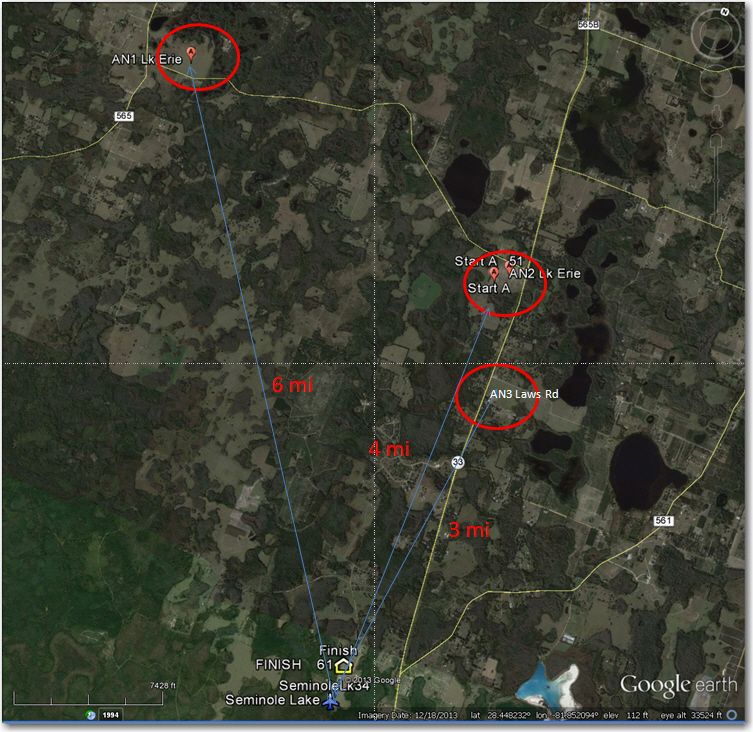
Three good field alternatives on the way in to SGP from the north
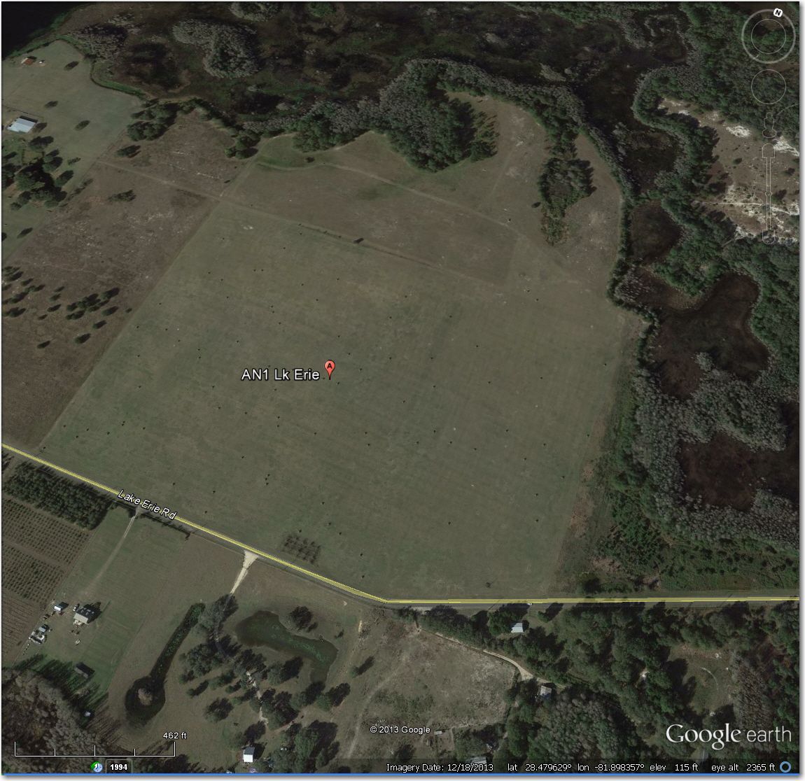
AN1 Erie Lake. Some of the hay bales shown in Google Earth are still there, but physical inspection showed plenty of space for landing
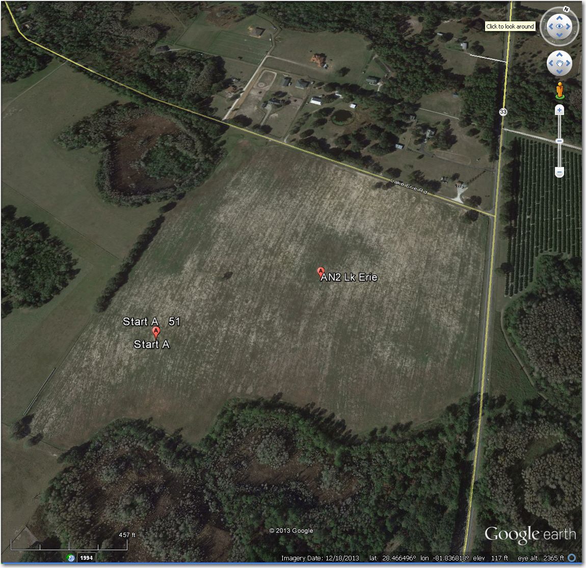
AN2 East Lake Erie Rd. No cattle, plenty of room for landing, open gate
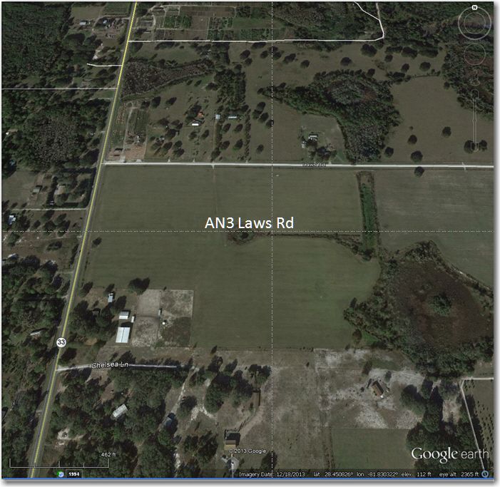
AN3 Laws Road. No cattle, plenty of room, open gate
West Abort Fields
Sad to say, but there really aren’t many choices for abort fields coming in from the west. Fortunately, tasking at the Seniors rarely has gliders coming home from due west – generally it is from the north, northwest (over Fender and AN1-West Lake Erie) or from the southwest over Burnwood and Rock Ridge. Rock Ridge airstrip is about 8 miles southwest of SGP, and while there are some open fields just to the east of the line between Rock Ridge and SGP, there aren’t any roads in this area. If you land in one of these fields, expect to be there a while while your crew figures out how to get a trailer to you. We did find one field just over the treeline to the west of SGP (one with an actual road and an open gate), figuring that it might come in handy on a marginal final glide that started going bad after the point of no return. The field we found is pretty short, but do-able even for 18m at 1000′ diagonal.
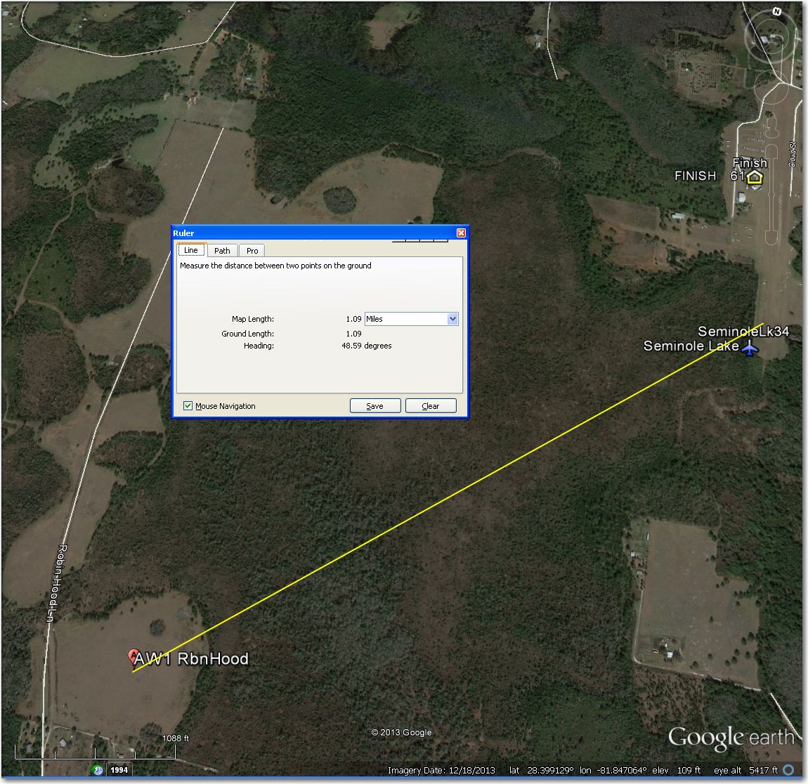
AW1 – Robin Hood Lane. Short, but do-able. Only 1 mile from SGP, but could be a life-saver
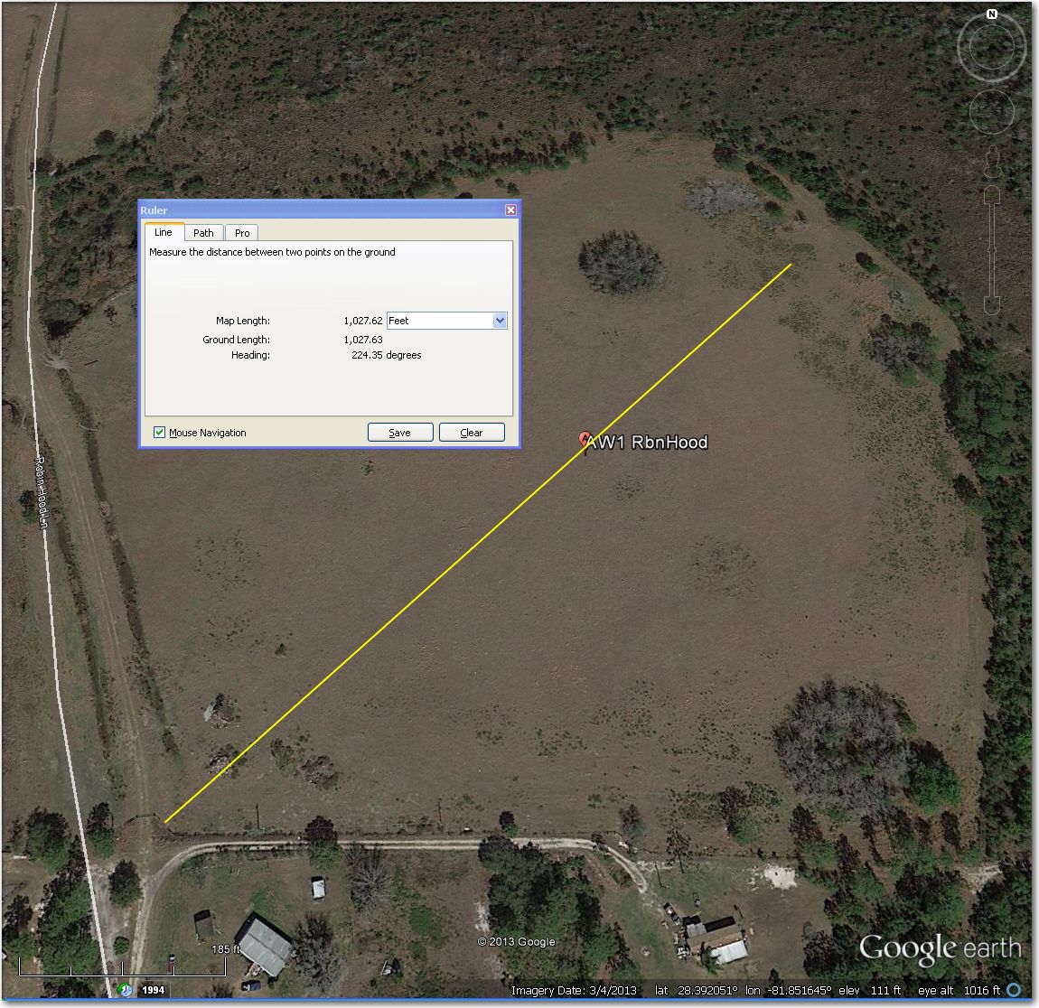
AW1 – Robin Hood Ln. Short at about 1000′ but after this is only trees for the next 1 mile
Hopefully all we did was occupy an otherwise dull, rainy day with some interesting traipsing through the Florida countryside, and we won’t ever need the information. However, knowing there are pre-inspected fields along our path between the last good airstrip and home could make the difference between an agonizing (and stupid) final glide, and one that might be marginal from the point of view of completing the task, but not from the point of view of safety.
Frank (TA)


1 comment for “Landing Field Safari at Seminole”