Updates from Walt
Here’s Gordon’s April 13th announcement of their intentions:
“On Sunday, April 14th I will be attempting a downwind distance record attempt in a Duo Discus glider, an unmotorized, unpressurized, and unheated aircraft, launching from Minden NV (KMEV) located 30 miles south of Reno, Nevada. I will be flying along the jet stream utilizing mountain wave conditions, climbing to altitudes of up to 28,000 feet. My copilot is Hugh Bennett. We’ll be aiming for an area east of the Rocky Mountains, our goal being Garden City, Kansas, a flight of roughly 1030 miles (1658 km). A lot of variables exist since what we’re attempting is weather driven. Currently the lower level winds near the ridge tops in Nevada and western Utah are of concern since they’re forecast to be light. All other weather related items look promising. Ridge top winds are necessary to trigger the mountain wave. Hopefully we’ll have enough to generate wave strong enough to keep us high. Our goal is to launch before sunrise [0623 PDT (UTC-7) or 1523 CET] and fly into the late afternoon/evening hours if the weather allows us. You can track our flight on Flight Aware at the link below the Flight Aware screenshot.
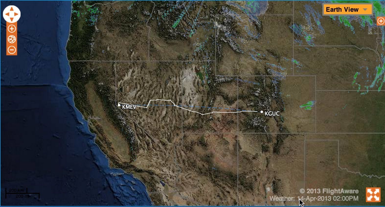
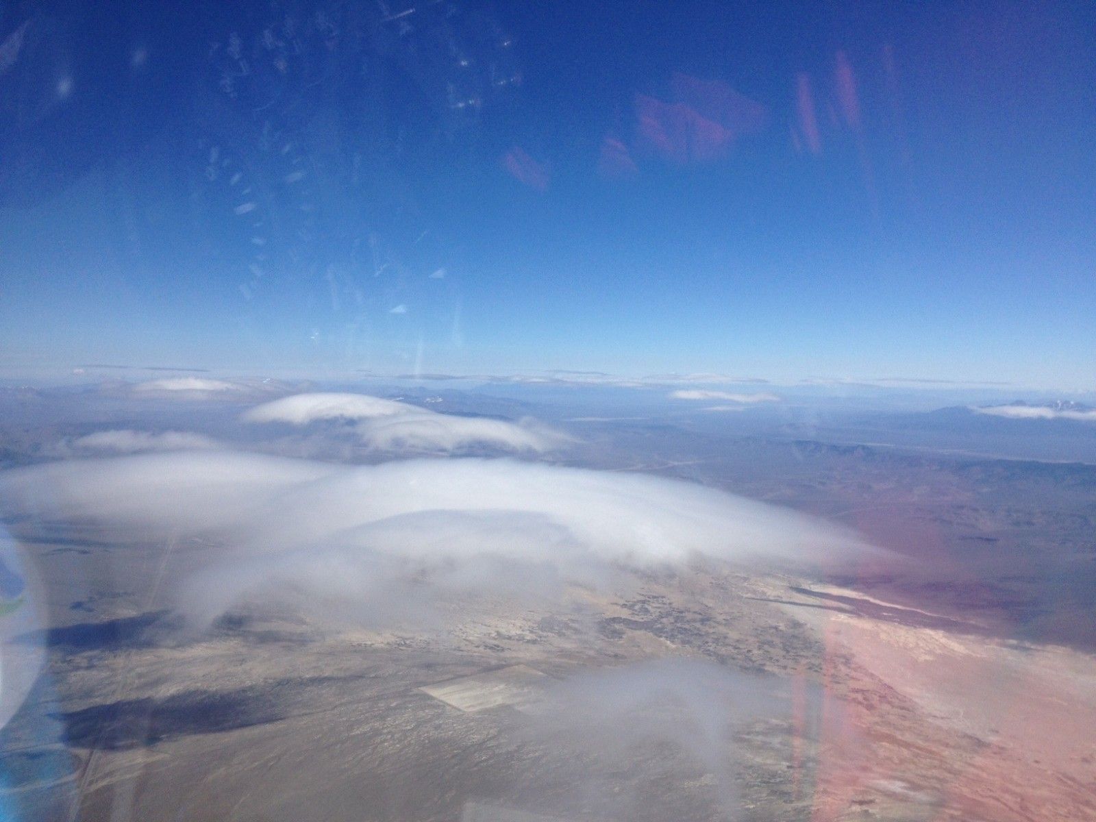
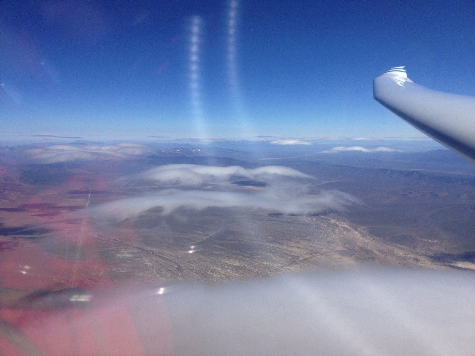
Flight path from start to finish
Click here to follow Gordo with Flight Aware
Walt’s updates follow in reverse chronological order.
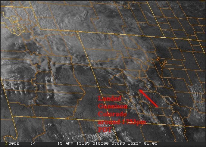
1751 PDT
“Going in to land at Gunnison, Colorado – based on Denver ARTCC Ops Manager – 1751pm PDT
“Distance achieved: 691 sm approximately from Release Point to Gunnison, CO
“Gordon’s crew is Michael Mitton. I talked with him about 45 minutes ago; he was practically to Salt Lake City. He hasn’t made plans for where he’s stopping tonight. Guess he could drive straight through … I’d stop for a night’s sleep myself.”
“Congratulations Gordon for a magnificent show.”
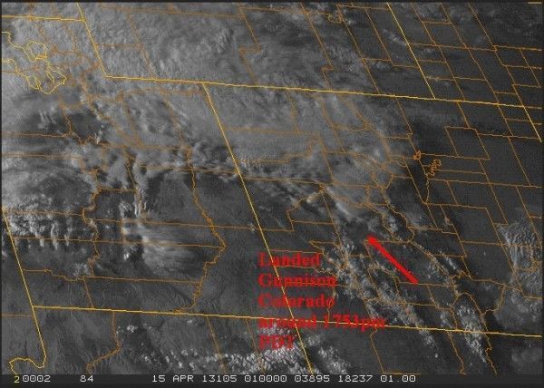
- Final visible GOES image showing landing point at Gunnison, Colorado
“Here are three graphics showing end of day winds aloft.”
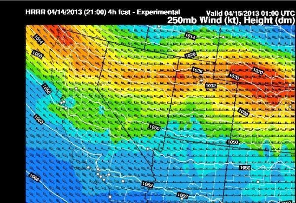
- End of Day Winds Aloft – 250mb

- End of Day Winds Aloft – 500mb
- End of Day Winds Aloft – 700mb
1706 PDT
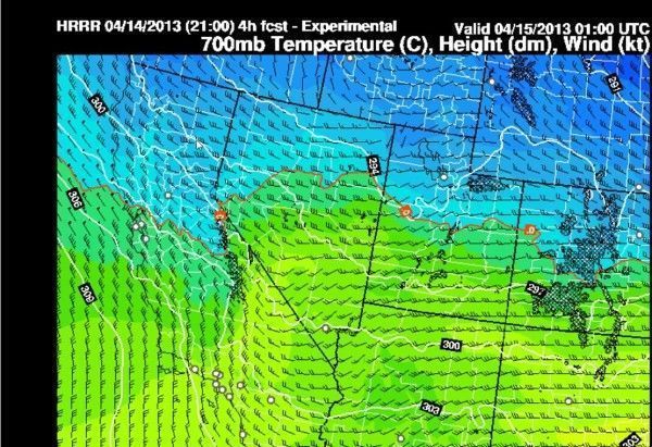
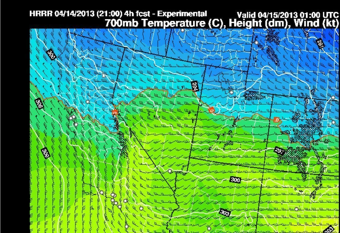
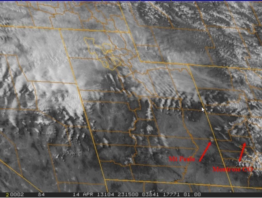
“20 miles E of Mt Pease climbing 1-2kts at 20,000 msl…
“Gordon did not get any lift over or downwind of Mt Pease. Now, west of Montrose he has final glide made to Gunnison CO. Looking for one more good climb to cross the Continental Divide. Alternatives flying due east after Gunnison: Salida, Canon City and Pueblo CO.”
1638 PDT
“Pointing out Mt Peale where Gordon is headed. He is probably within 10-15nm west of this peak now… 1638 PDT.
“Montrose CO is in the long valley to the east.
“If he can climb of the NW-SE mountain range bounding the west side of Montrose, then the question is how long before making a run across the Continental Divide… over Gunnison Salida to the north end of the Sangre De Cristos.”

1607 PDT
“Gordo called 1607 PDT just after top of climb 27,500 msl – heading downwind 180 kt groundspeed.
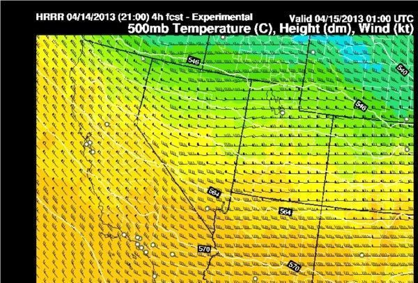
“At 1607 PDT he had just left TOC at 27,500 msl. Now, little less than 100 nm to Mt Waas or Mt Peale, a conical mountain about 48 nm SW of Grand Junction, Colorado. He should easily cross into the next mountain range downwind of Mt Peale that is along the valley of Montrose, Colorado.”
1606 PDT
“Reported 23,000 msl climbing 6kt 15 miles NE of Wayne’s Wonderland.
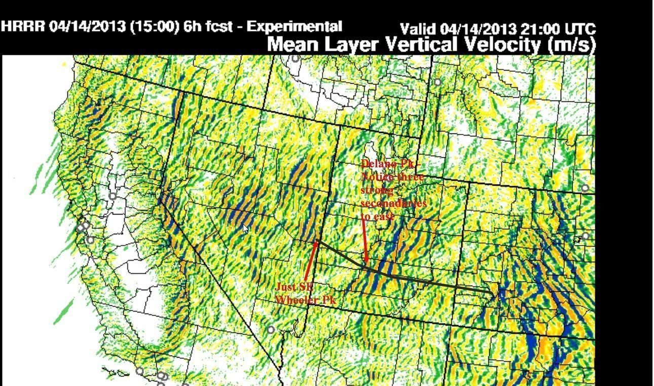
“Gordon has a good climb exactly where I guided him to with the lennie. He is planning on taking this to 28,000 msl which is the max ATC permitted altitude (38°30′, 111° 20′).
“It’s 100 nm to the next conical mountain, Mt Waas (11,000 msl) HRRR model updraft graphic shows a conical bow wave mountain wave structure. If he makes it to 28,000, he should make it there with at least 15,000 msl. That puts him within easy range of Grand Junction and Montrose Colorado. At that point, the BIG DECISION has to be made whether to cross the Continental Divide.
“Mike Mitton, his crew, is having dinner on I-80 near the Nevada-Utah border about an hour out of Salt Lake City.”
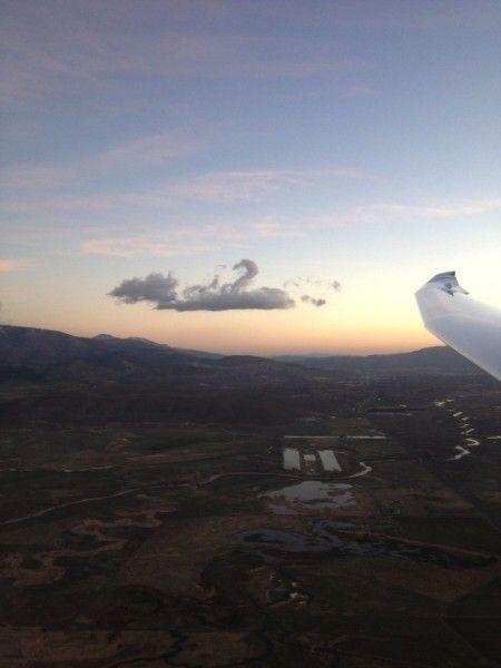
1446 PDT
“Beautiful photo of Delano Peak while he is climbing.
“I gave Gordo the coordinates to the next lennie … 38 29min N 111 28min W. This is about 45-50 nm due east.
“I noticed in my logs that some of my time line entries may be off. Don’t sweat the inconsistencies. This report is accurate from a call at 1446pm PDT.”
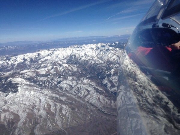
- Gordon’s photo of Delano Peak at 1446 PDT

1437 PDT
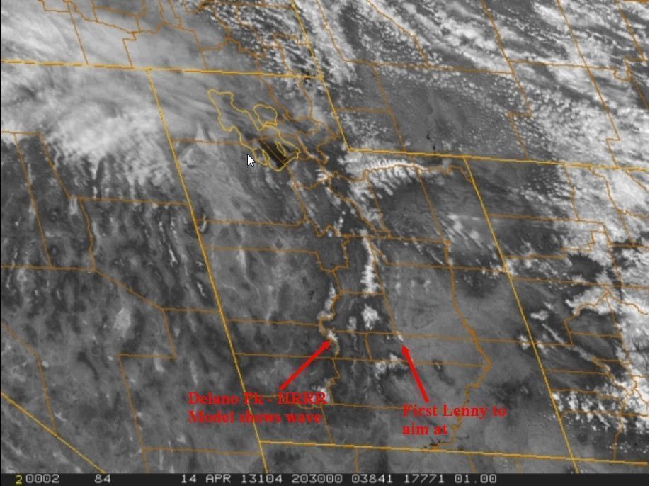
“This photo shows where Gordo is aimed at … as of this writing 1437 PDT… according to Flightaware.com (10min delay) he is almost at Delano Peak. Notice the next lennie downwind, the first to aim at…
1440 PDT
“Gordo called at 1440 PDT over Delano Pk. Hopefully God will give him a 5-10kt climb up to 28,000 msl if not from this ridge … another in the next 10-30 mi. It’s only 50 nm from Delano Peak to the next lennie just downwind of Hens Hale Peak. Somewhere in there must be a good fast climb!”
1434 PDT
“SPOT has died; he changed batteries and fiddled to no avail. Use FlightAware.com N55LK.”
1425 PDT
“Gordo decided to be conservative and make sure he stays high before reach the first mountains of the Wasatch range (Delano Peak). Flight Computer calculated winds 275 @50kts.
“He is in good shape to reach some strong wave trains on the Wasatch. I think he’ll make it across Utah after hopefully getting really high… 28,000 msl. Then glide into Western Colorado around the Montrose area. This is all my speculation.
“Gordo says the wind mills below him are not turning… he wants to stay high!”
1424 PDT
“FINALLY 6 kt on vario – around 1230 PDT – Eventually climbed to 25,000 SE of ELY”
1358 PDT
“Gordon has climbed high again and is cruising downwind IAS 50 kts ground speed 160kts (glide computer wind 288 72kts; RAP Model winds 290 75 kts). He should have enough to easily make Beaver, Utah and will probably be high enough to get over Delano Peak, which is 11,300 msl.”
1326 PDT
HRRR 21Z (2pm PDT) Updraft graphic
1319 PDT
“Gordon will be turning downwind again from 21,000+ toward the lee of Wheeler Peak. The climb there should get him high enough to make a run for the mountains in the Wasatch Range. I’m recommending turning toward Delano Peak (38 23min N 112 23min W which is 1130 msl. Making it to the Wasatch Range is essential for further progress of this flight.
“There are at least three strong mountain wave trains in the Wasatch; the lee of Delano Peak is the first. Getting high there (ATC limits him to 28,000 msl) will allow continued flight into Western Colorado.”
1225 PDT
“Gordon is heading a bit to the south toward the north end of the Egan Range. His FlightAware track is working since he reactivated the ATC flight plan with the FAA. The SPOT is still not working… last update 1054 PDT. He’s fiddled with batteries and stuff…”
1106 PDT
“Gordon is finally climbing a little better 3-4kts through 18,000msl. It’s been painfully slow. His coordinates at this time are: 39 21min N 116 27min W”
1145 PDT
“Gordon called AT 1145AM. Not looking so good… down to 15,000msl 26W ELY. I suggested a “Sweet Spot” in lee of the Egan Range is 24nm S of ELY. North end of Egan Range is about 10SSW ELY.
“UPDATE… Gordon called 1158am at 15,000msl. Heading to lee of north end of Egan Range. Gordon had to cancel with ATC, so the FlightAware track will stop updating. Use the SPOT tracks. He is seeing some rotor cu in the lee of the Egan Range. Heading there…”
1035 PDT
“Gordon slid north in the lee of the Toyabe range and found a little better lift or “Sweet Spot” and reported to be climbing at 3-4kts. Altitude 16,500 msl. Second call update at 1034 PDT; very slow 2kt climb 17,500 msl.”
1004 PDT
“Gordon called at 1004 pdt. He’s only finding 2-3kts in lee of Arc Dome Pk close to Toyabe Dome Pk. Plan is to move north along lee of Toyabe range and find the “Sweet Spot” for some stronger moutain wave lift.”
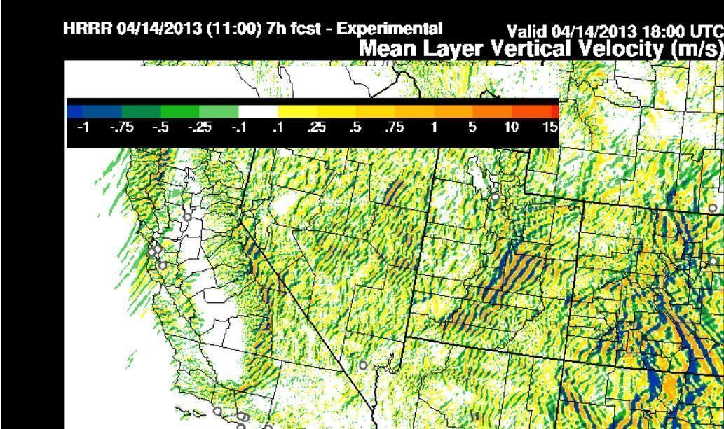
0942 PDT
“The HRRR Model stands for NOAAs experimental High Resolution Rapid Refresh. It’s a 3 km resolution model that shows mountain lee waves. Take a look at:
http://rapidrefresh.noaa.gov/HRRR/Welcome.cgi
“Select under DOMAIN: SW
“Select the latest time in the pull down menu at the top
“I’m looking at loops of either MAX UPDRAFTS or MEAN WEL (mean vertical velocity). You can browse and experiment with the many graphic output images from this model.
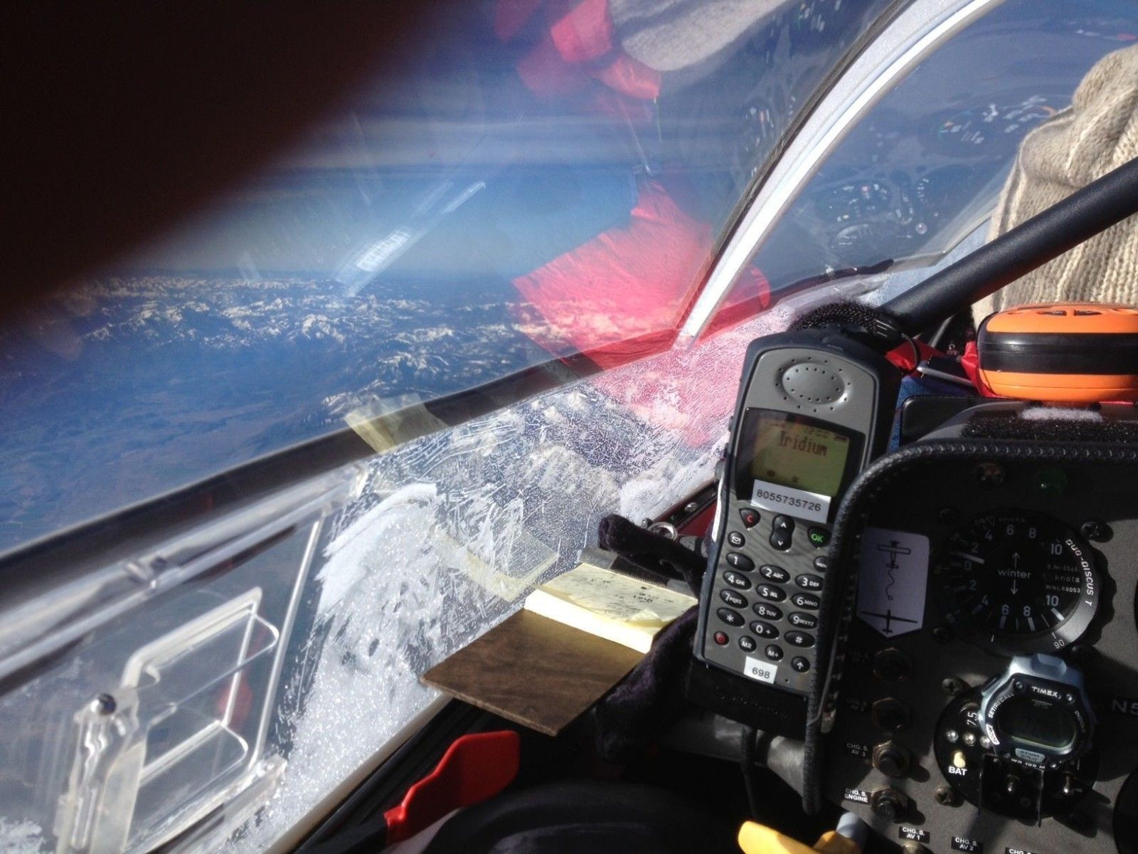
“Nice photo taken at 0807 PDT near Carson City, Nevada …”

- Downwind Record Flight – Cockpit View at 0807 PDT
0922 PDT
“Gordon called at 0922 and reported smooth steady 2 kts descent as he glides downwind at around 132 kt ground speed. He is 15 NM west of Arc Dome Peak and should make it to small looking rotor clouds in the lee of the mountains. Best lift appears to be about 8 nm downwind of the peak at 38°45′ N 117°11′ E.
“The graphic attached of the HRRR model shows the mountain waves. First circle is lee of Arc Dome Peak; second red circle lee of Wheeler Peak 36nm SE Ely, Nevada; third circle strong wave lee of Utah Wasatch Range 25 ENE of Salina, Utah – 12 NM dowwind of Mary’s Nipple Peak.
“All is going very well…”
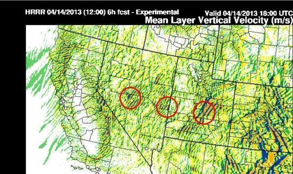
- Downwind Record Flight – HRRR 0931 PDT

0802 PDT
“This HRRR model graphic shows Vertical Velocity and the beautiful mountain wave trains that will be worked on his flight toward Utah/Colorado. Gordo’s next stop is 122NM to the Toyabe Range – Arc Dome Pk”
0801 PDT
“Downwind Glider Record Attempt – 0801am Flight Aware – shows 23,700msl – Here at HRRR Model Graphic”
0755 PDT – Satellite Images
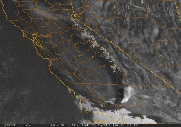
- 20130414_1451_VIS1FAT.GIF

0748 PDT
“Gordo called at 745 am – 22,500 msl up at 3kts – Getting ready to head out.”
0625 PDT
“The HRRR Model valid 13Z (6am PDT) shows 1.5-3 m/s lift (Light blue) in the Carson Valley. Downwind 122NM the Toyabe range and further downwind (see red circles) show a little better lift.
“Water Vapor show the slight darkening. This is a result of drying and downdrafts in the MW … just another indicator that things are working!
“Gordo reported at 6:09 am PDT just before takeoff weak rotor clouds to the north in Washoe Valley. The wave is working weakly but should give him a slow climb.”
Photos just after takeoff…
- Cockpit view of Minden just after takeoff


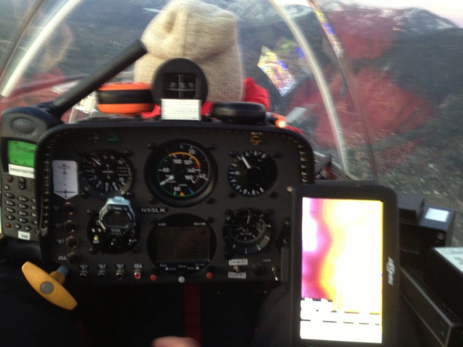
- Gordon’s backseat view of Hugh’s hat
0603 PDT
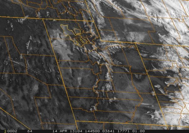
“Water Vapor Imagery showing darkening bands indicating Mountain Wave (MW)

Water Vapor Imagery showing darkening bands indicating Mountain Wave (MW)
http://sat.wrh.noaa.gov/satellite/alternative.php?wfo=rev&area=west&type=wv&size=2
“Above is an animation of the image and there is a hint of darkening near Wheeler Pk (to the east of red arrow). Also, just the slightest hint in the Carson Valley near Minden, although one has to animate it fast to see it.”
0555 PDT
“Gordo may not see this before takeoff, but I will talk to him just before around 1300 to 1330Z (6-630am).
“The HRRR model updrafts shows 1.5-3 m/s wave near Minden, 122NM downwind at the Toyabe Range (a little stronger lift).
“In discussion with Gordo at 1205Z we both agreed it may be a bit slow starting and finding lift in wave. He would like to get as high as possible. Looks to me like he needs about 22,000 to have a shot at the Toyabe range.
“Winds at 13,800 310/47kt; 18,000 303/54kt; 24,000 298/58kts”


2 comments for “Get Sunday’s Record Flight Updates Here!”