After months of planning, Dan Reagan and I completed a flight from Caesar Creek Soaring Club to Blairstown New Jersey on April 20, 2013. Preparations for the flight included thorough research of the entire route. We used Google Earth to verify if many of the points in the database were landable. We developed Go – NoGo weather criteria for each segment of the flight. We did have a lot of moisture on the ground at CCSC, which made for lower cloud bases (4000 MSL) and had light 10 knot winds to start. As the flight progressed east the cloud bases increased to 7000 MSL and winds increased to 20-25 knots.
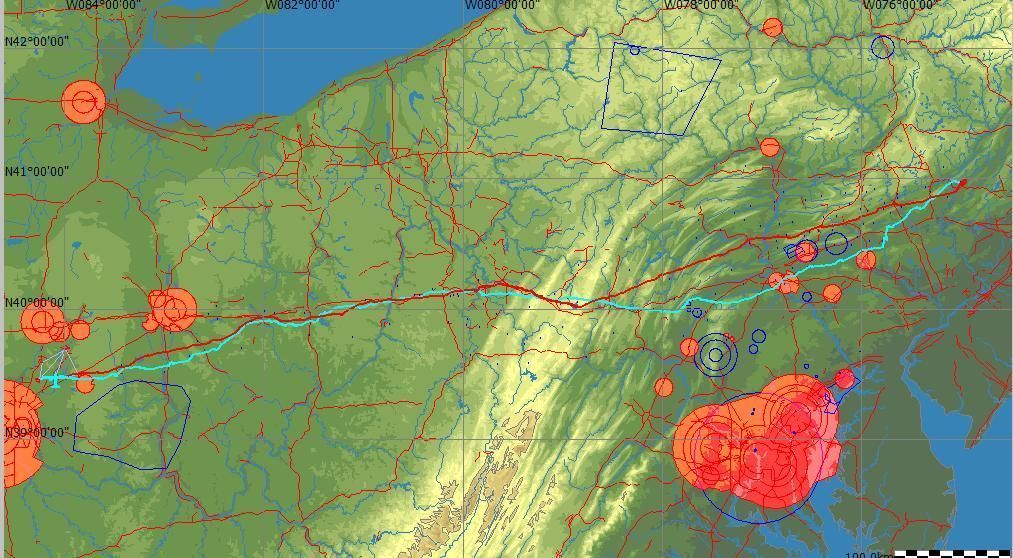
The path of the flight followed Interstate 70 in Ohio. We crossed the Ohio River at Wheeling, West Virginia. Dan had a low point near Latrobe PA and I had a low point near Somerset PA. Dan stayed north and I stayed further south for the rest of the trip.
I completed the 493 mile (789 km) flight in a little over 7 hours and Dan completed in slightly under 8 hours. There were many fellow club members following us on SPOT tracker. Several of the Blairstown Club members were made aware of our progress and were there to greet us.
Editors’ Note: Click here to see Dan’s OLC claim and here for John’s flight.

Dan Reagan and John Lubon


2 comments for “Dan Reagan and John Lubon Soar from Ohio to New Jersey”